LYFE IN TOW

A year of life on the road

  • BLOG
  • ABOUT
    • THIS JOURNEY
    • WHY THE Y
    • ME, AS A PROFESSIONAL
  • CONTACT
  • PARK PHOTOS
    • Shenandoah National Park
    • Mammoth Cave National Park
    • Great Smoky Mountains National Park
    • Congaree National Park
    • Everglades National Park
    • Biscayne National Park
    • Dry Tortugas National Park
    • Hot Springs National Park
    • Big Bend National Park
    • Guadalupe Mountains National Park
    • Carlsbad Caverns National Park
    • Channel Islands National Park
    • Pinnacles National Park
    • Sequoia & Kings Canyon National Parks
    • Yosemite National Park
    • Lassen Volcanic National Park
    • Redwood National & State Parks
    • Crater Lake National Park
    • Olympic National Park
    • Mount Rainier National Park
    • North Cascades National Park
    • Glacier National Park
    • Grand Teton National Park
    • Yellowstone National Park
    • Zion National Park
    • Bryce Canyon National Park
    • Capitol Reef National Park
    • Black Canyon of the Gunnison National Park
    • Great Sand Dunes National Park
    • Mesa Verde National Park
    • Arches National Park
    • Canyonlands National Park
    • Petrified Forest National Park
    • Saguaro National Park
    • Death Valley National Park
    • Grand Canyon National Park
  • BOOKS
IMG_6788.jpg

#30: Yosemite National Park

July 10, 2020 by Sarah Williams in National Parks

“It is by far the grandest of all the special temples of Nature I was ever permitted to enter.”

- John Muir

Oh, Yosemite. I will begin by stating that this park experience was slightly different from previous park visits (for many reasons). Every park requires some planning: where to stay, what hikes to do, how to handle Addie if she cannot hike with me, how many days we need, etc. However, the visit to Yosemite required some additional planning.

Because of COVID, and given the Yosemite’s popularity, visitors were required to reserve an entrance date online at recreation.gov. Luckily, I learned of this early enough (thanks, Chris!) to get a reservation around the time I wanted to go. However, it did take some thinking ahead. Again because of COVID, most of the campgrounds at Yosemite were closed. The ones operating were booked entirely (probably last year!).

Knowing that I wanted to experience some substantial hikes at Yosemite, and couldn’t bring Addie along on them, I decided to splurge to do this park right. I scrounged around and found a small hotel two miles outside the West entrance. This way, I could leave Addie in the air-conditioned room while I indulged in some epic hikes.

It’s a big park, and I needed to make the most of my 3-4 days there.

IMG_1843.jpg

Day 1:

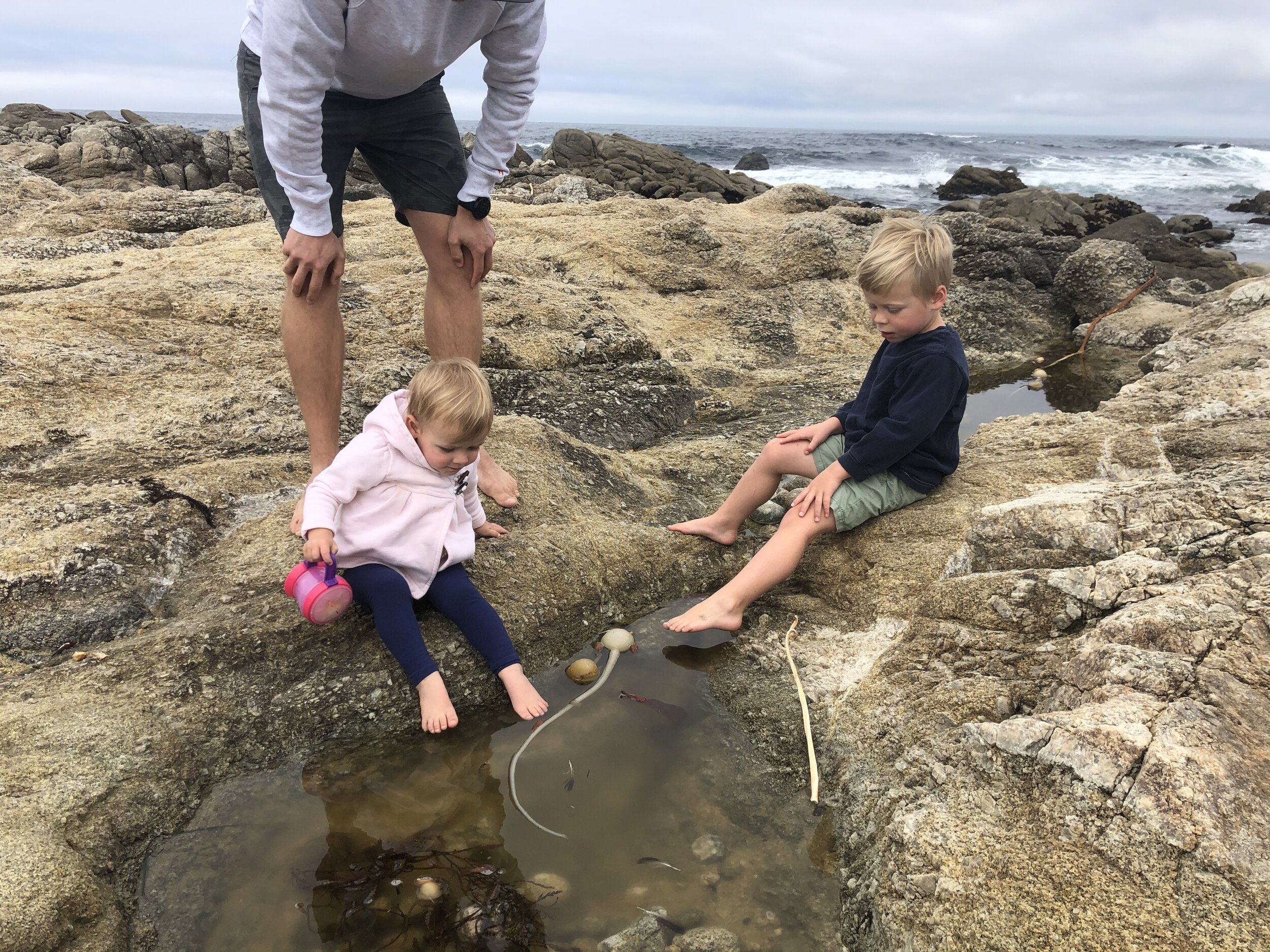
We first arrived in the area around 3 pm. After hotel check-in, Addie and I ventured into the park to get the lay of the land. We walked to Mirror Lake (well, Mirror Pond, because Addie couldn’t go past that), popped into the visitor center, and got our bearings in Yosemite Valley - which is the “main” area of the park and I’d guess the most visited.

IMG_0029.jpg
IMG_0674.jpg
IMG_0164.jpg
IMG_0481.jpg
IMG_0736.jpg
IMG_4557.jpg
IMG_6724.jpg
IMG_6656.jpg
IMG_0029.jpg IMG_0674.jpg IMG_0164.jpg IMG_0481.jpg IMG_0736.jpg IMG_4557.jpg IMG_6724.jpg IMG_6656.jpg

I cannot even put into words the feeling I had when I first caught a glimpse of El Capitan. I was awestruck. I’ve watched countless movies on the rock climbing culture of which “El Cap” is a cornerstone. Not only is this rock wall massive, but there is so much history, adventure, and energy around it. I stood there dazed, looking up, thinking about all the climbers who’ve tackled this beast and how Alex Honnold recently free soloed it. Incredible.

Did you know that geologists have been puzzled about how the granite cliffs of Half Dome and El Capitan were formed? They think the granite of the walls solidified over five miles underground. Then, rock eroded to reveal what we see today.

Day 2:

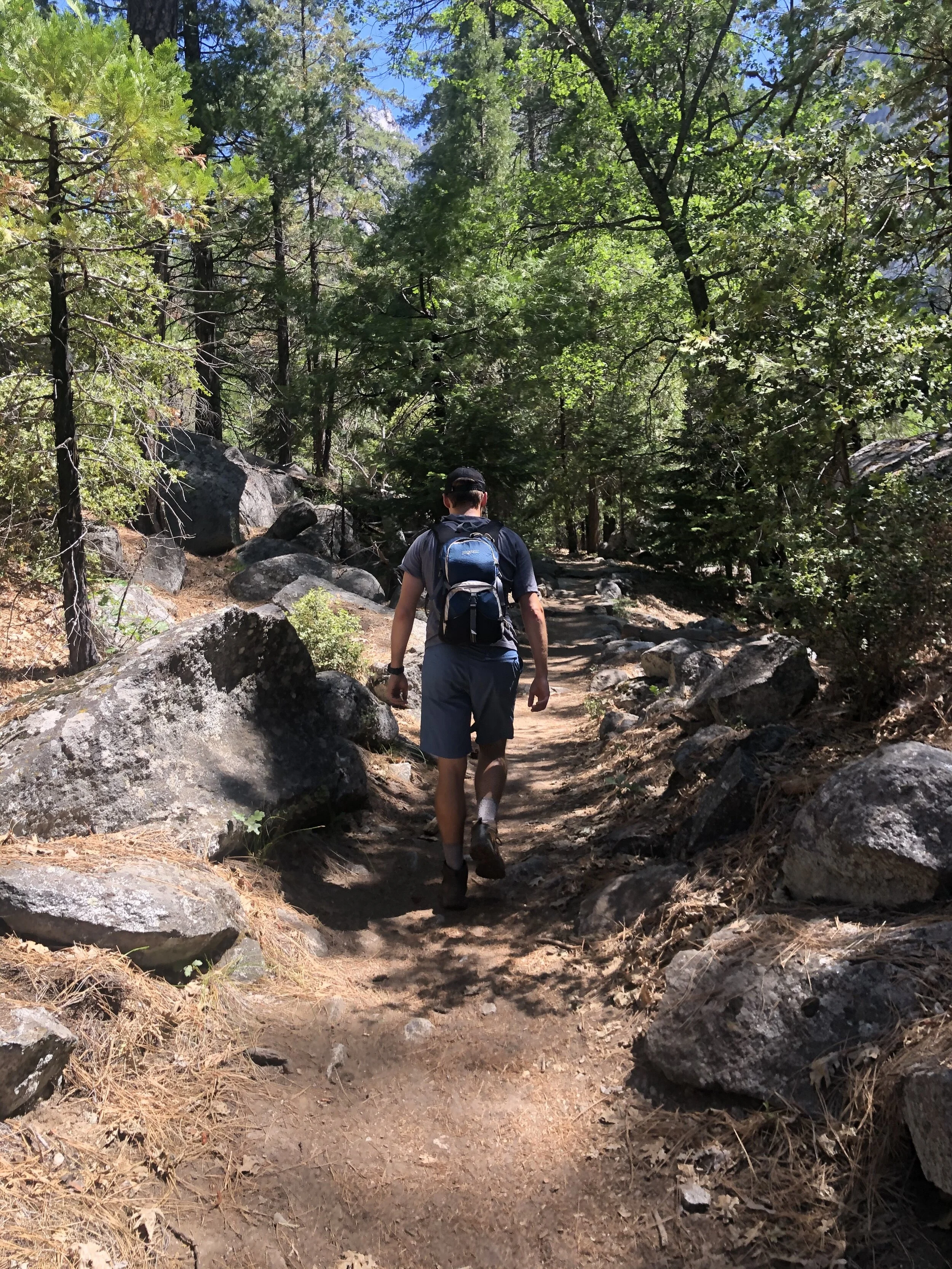
My plan for the first full day was to get up early, get into the park before the crowds, and hike Vernal and Nevada Falls via the Mist Trail. This 9-mile trail afforded me close views of both Vernal Falls and Nevada Falls, and the valley. I started around 7 am - the air was crisp, and the views were stunning. The falls even kept me a little “misty” when I got up close to them. I took a longer route back via the John Muir Trail - at the time I went, this was required due to COVID. The park employees deemed it best if people didn’t go up and down the same route.

IMG_0516.jpg
IMG_0951.jpg
IMG_1131.jpg
IMG_1258.jpg
IMG_2573.jpg
IMG_3306.jpg
IMG_3308.jpg
IMG_4706.jpg
IMG_4847.jpg
IMG_4938.jpg
IMG_6968.jpg
IMG_7062.jpg
IMG_0516.jpg IMG_0951.jpg IMG_1131.jpg IMG_1258.jpg IMG_2573.jpg IMG_3306.jpg IMG_3308.jpg IMG_4706.jpg IMG_4847.jpg IMG_4938.jpg IMG_6968.jpg IMG_7062.jpg

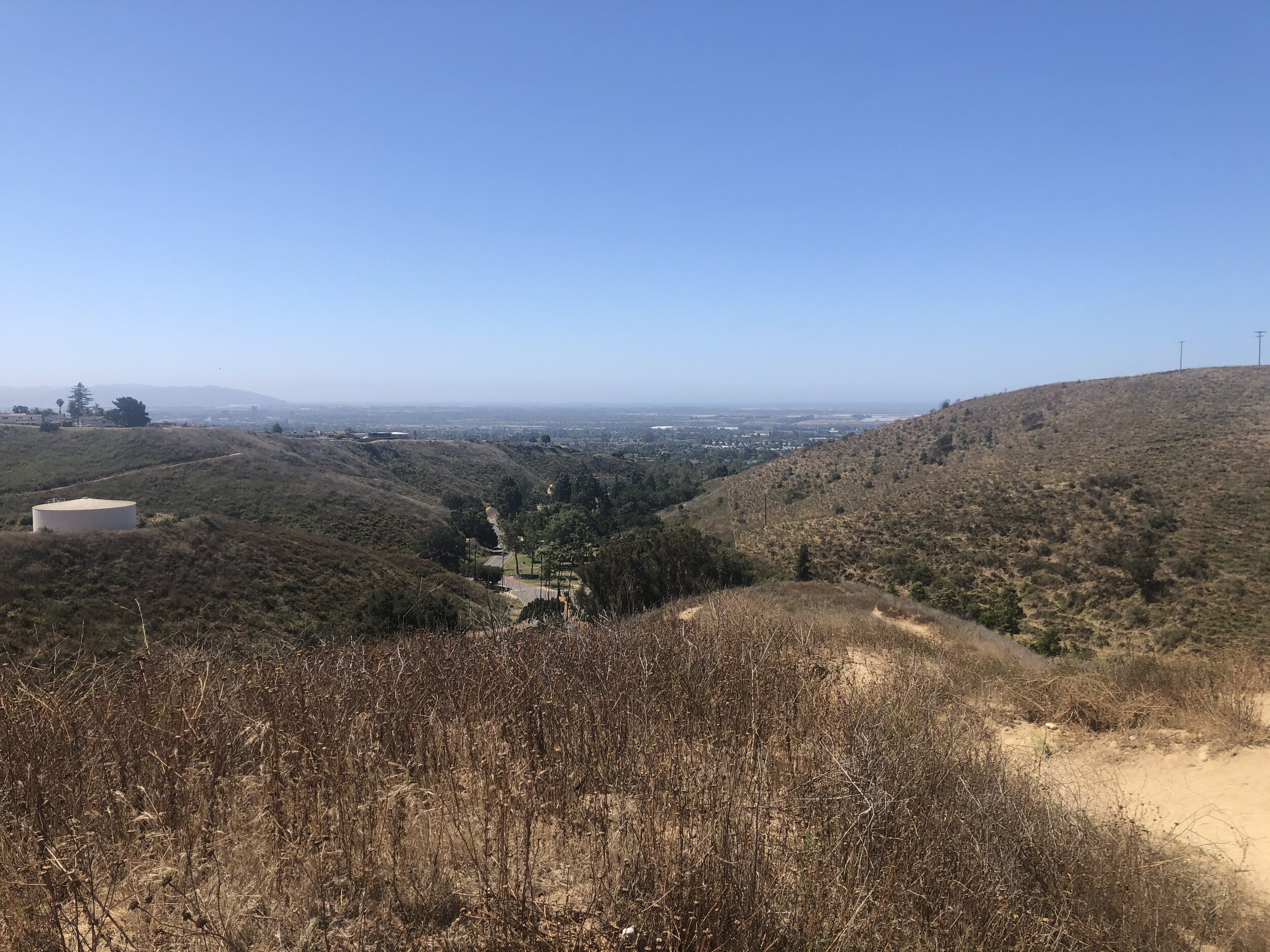
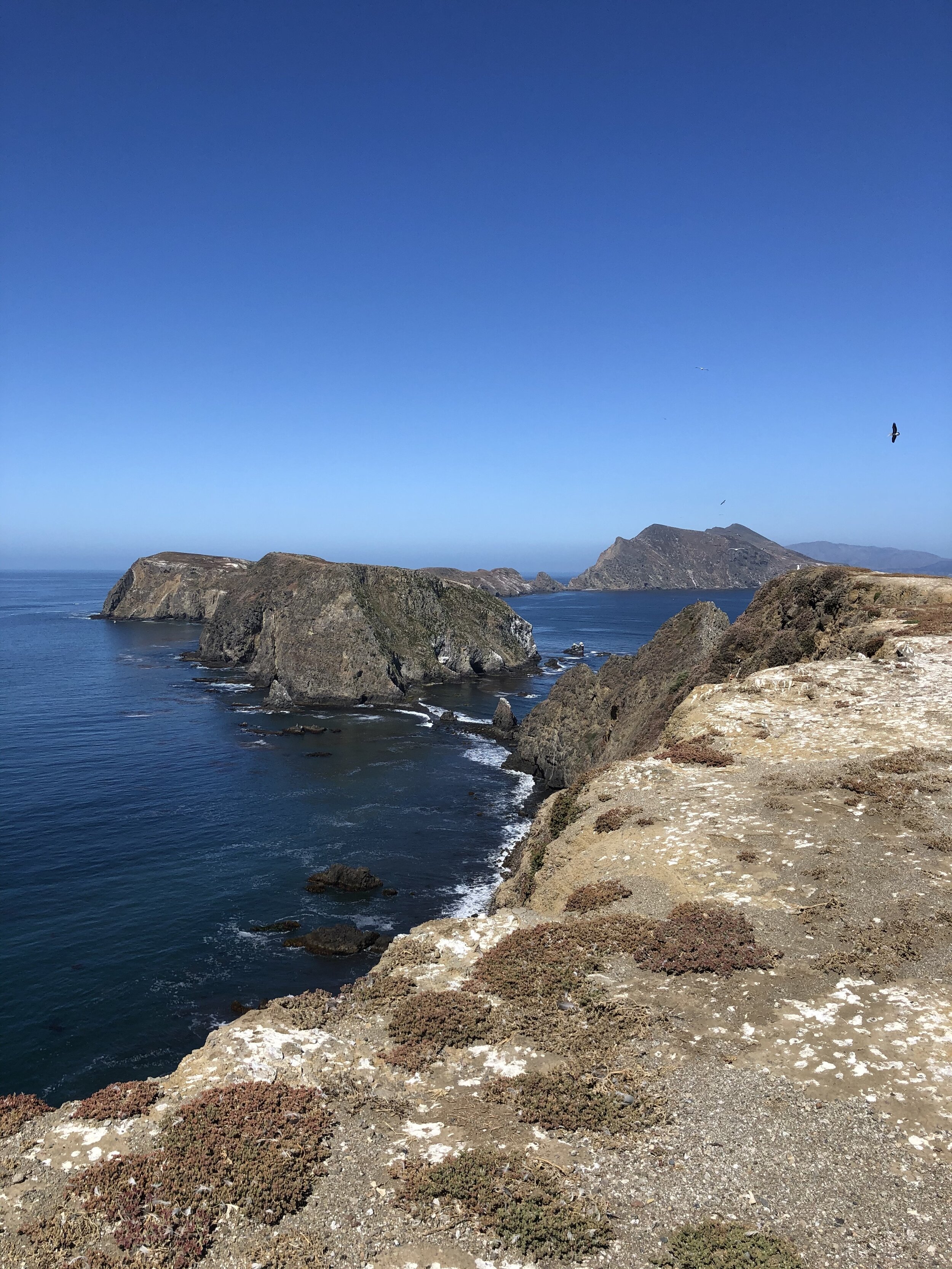
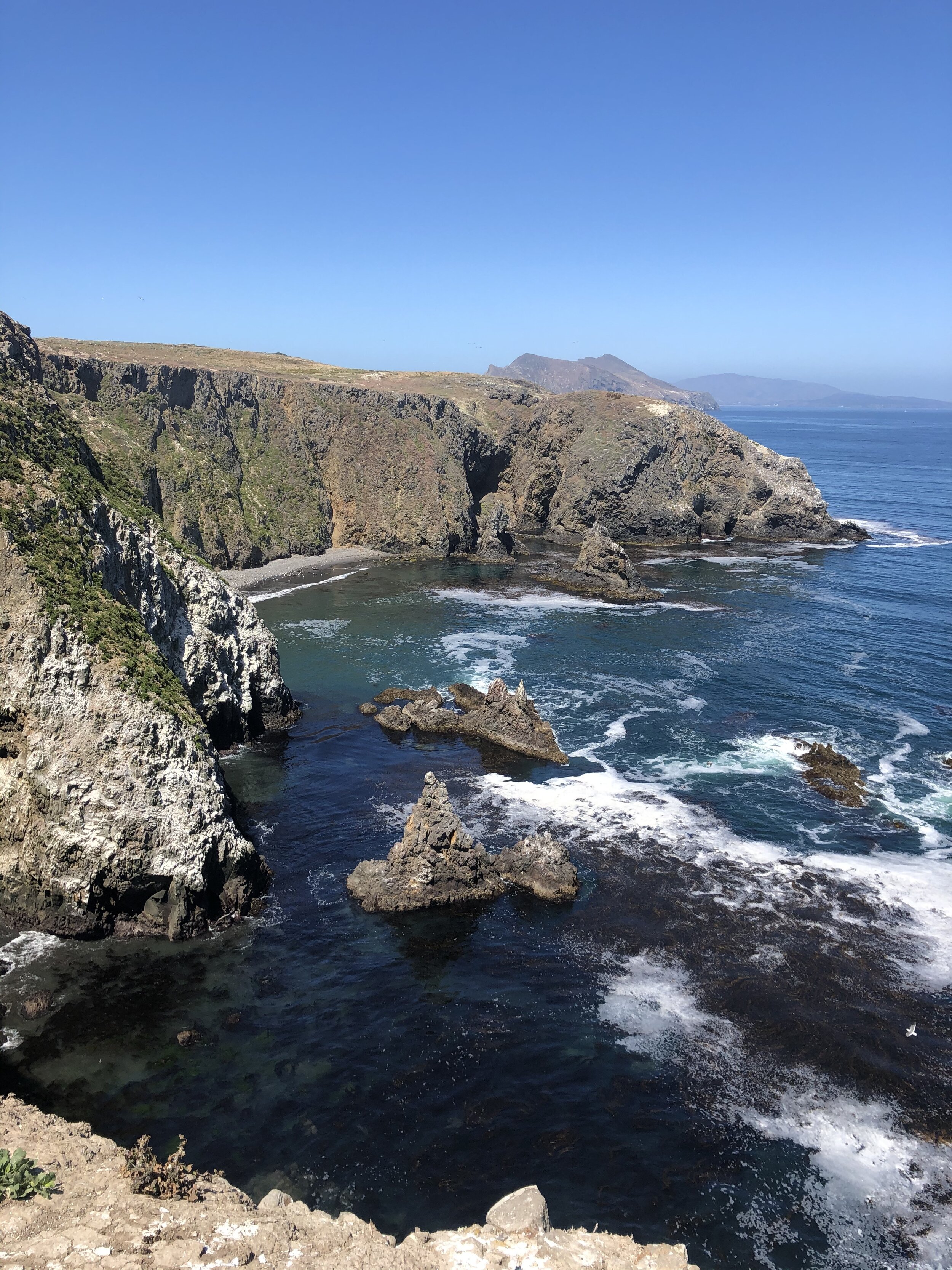
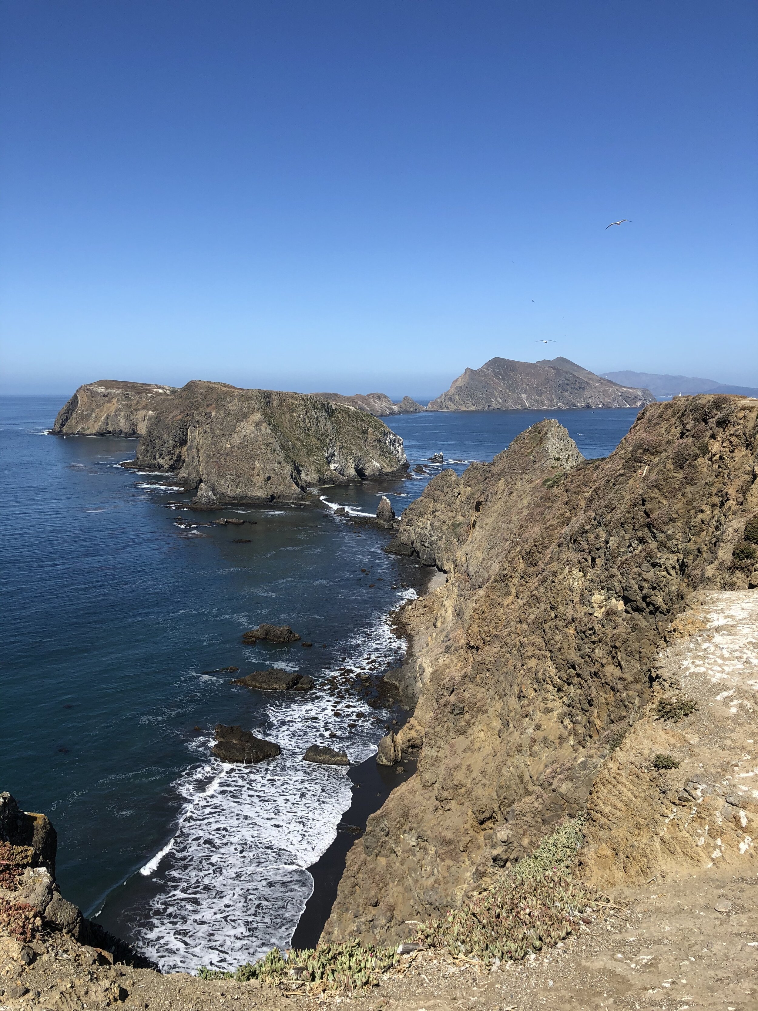
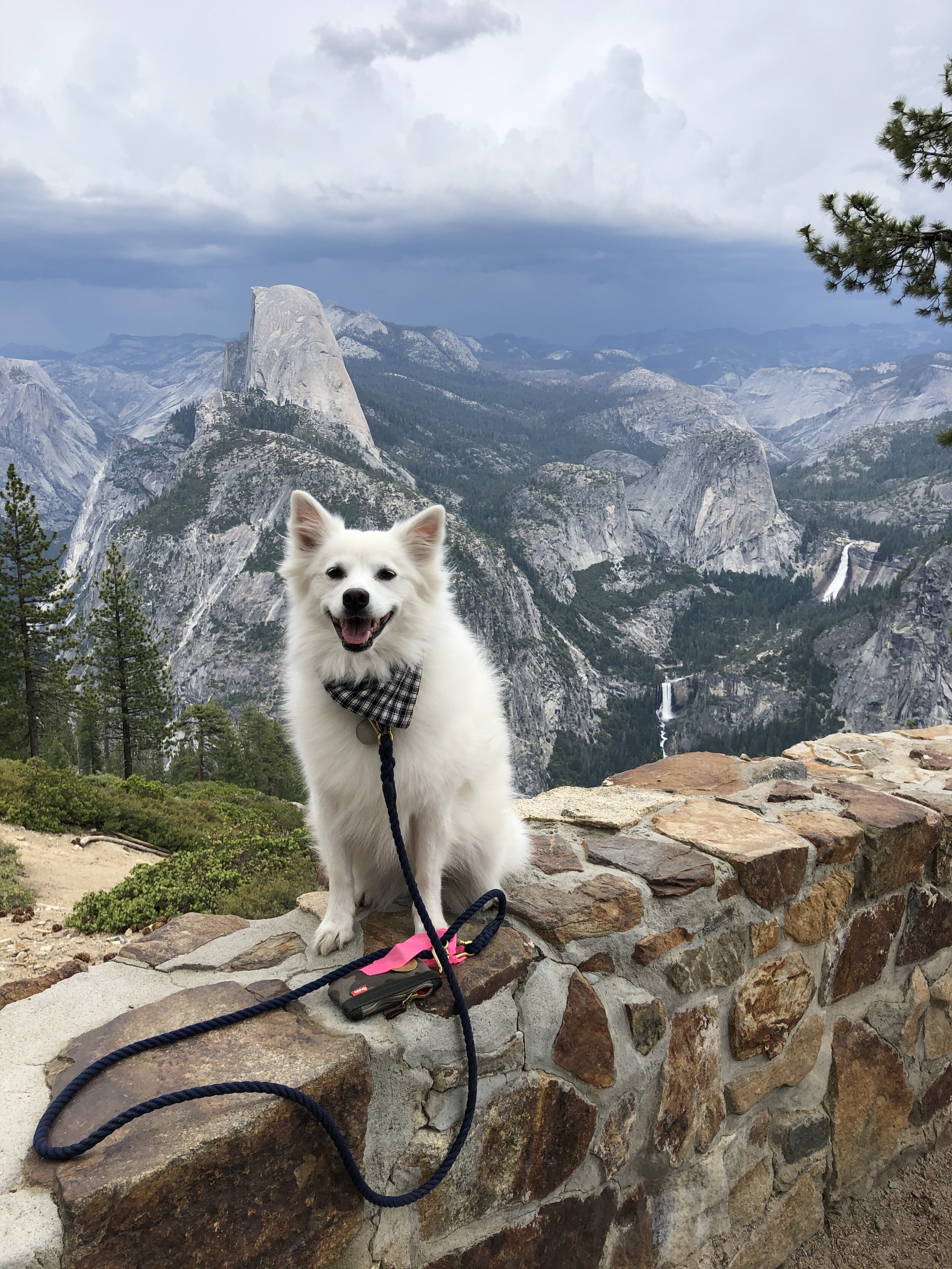
When I returned to the hotel room, Addie had been a very good girl. She and I took a nap before heading back into the park to drive up to Glacier Point. From here, I got a clear view of Half Dome - one of my favorite landmarks of Yosemite (Fun Fact: Half Dome is the inspiration behind The North Face logo). These are some views from Glacier Point.

IMG_0785.jpg
IMG_0919.jpg
IMG_1858.jpg
IMG_2536.jpg
IMG_3147.jpg
IMG_4230.jpg
IMG_6526.jpg
IMG_8367.jpg
IMG_0785.jpg IMG_0919.jpg IMG_1858.jpg IMG_2536.jpg IMG_3147.jpg IMG_4230.jpg IMG_6526.jpg IMG_8367.jpg

On the way back from Glacier Point, we stopped at the Tunnel View viewing area. The view from this location is arguably the most epic view from the entire park. However, I argue that Glacier Point may be.

IMG_0865.jpg
IMG_1332.jpg
IMG_2122.jpg
IMG_7068.jpg
IMG_8507.jpg
IMG_0865.jpg IMG_1332.jpg IMG_2122.jpg IMG_7068.jpg IMG_8507.jpg

Day 3:

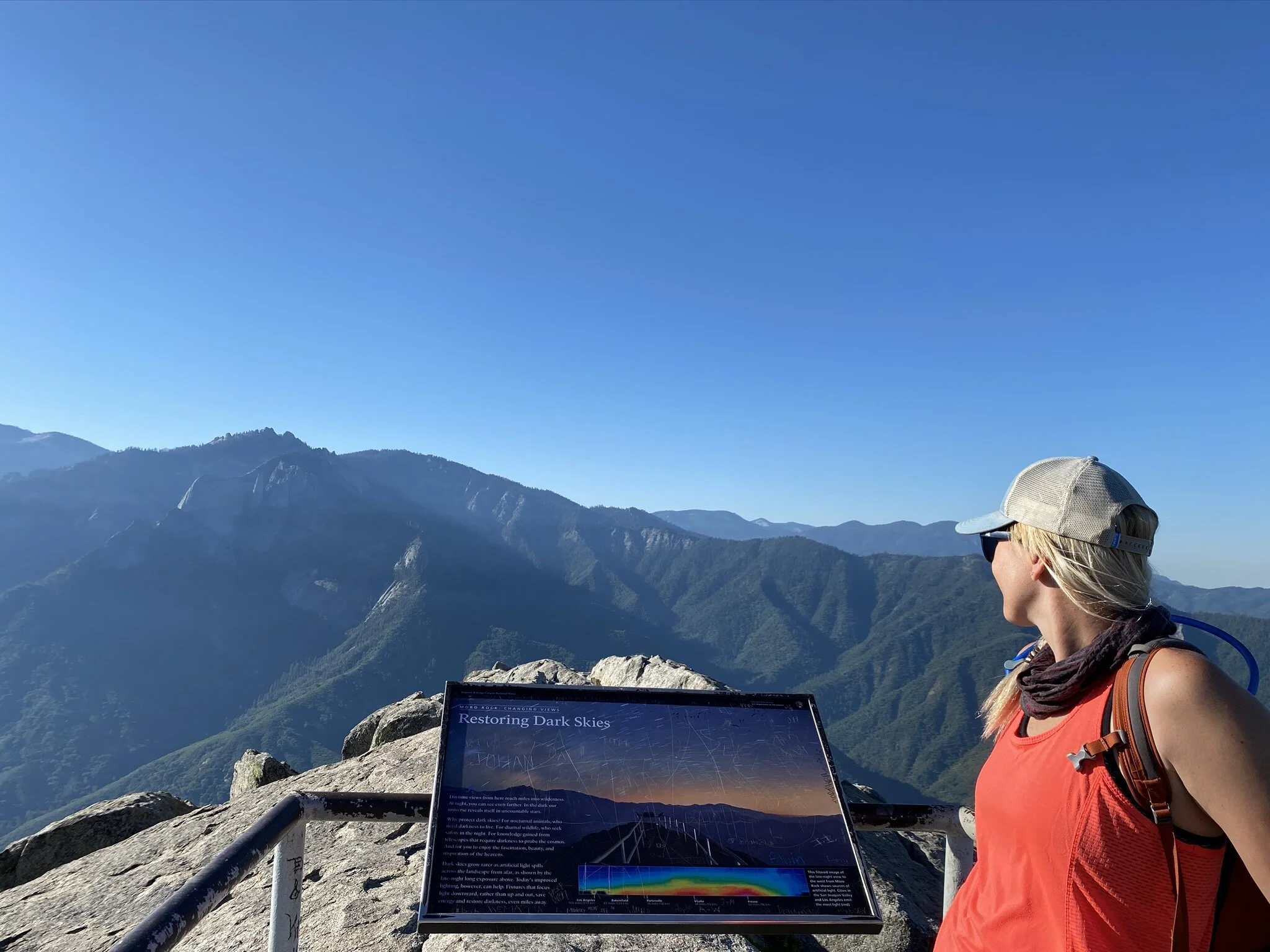
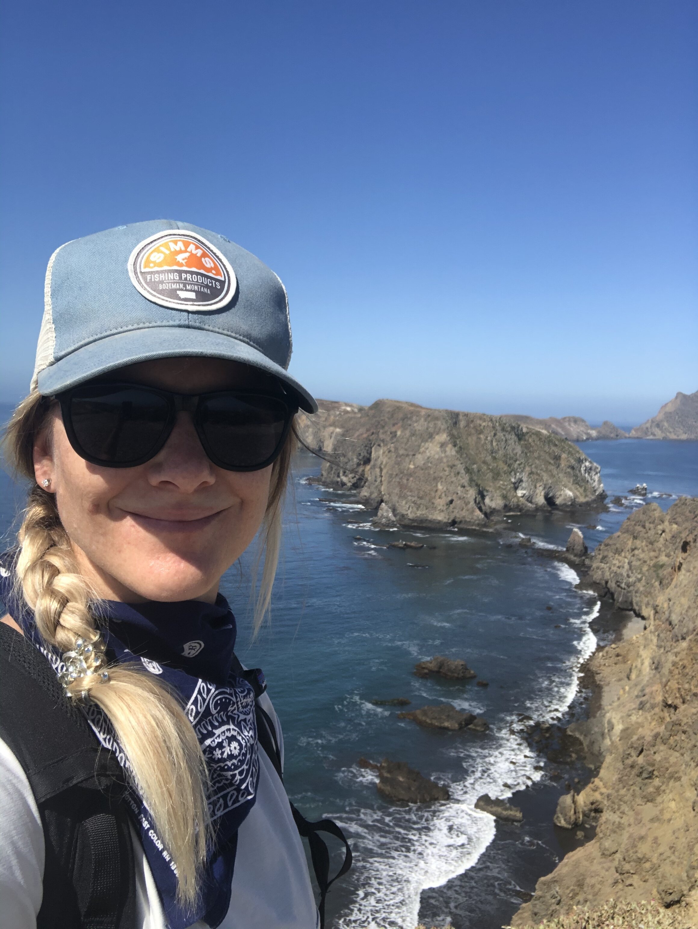
Once again, I got my butt up early to beat the crowds and get to the Four Mile trailhead as early as I could. This trail is a well-known one at Yosemite and is over 3,600 feet in elevation gain. I knew it was going to be a tough one. The way up was mostly switchbacks, but the views were insane. Glacier Point is the “destination” of this trail. Even though I drove up to Glacier Point the previous day, I reveled in my accomplishment to get there by hiking and explored the area a bit more while there. 

I included all my Glacier Point photos in the first photos of Day 2. In the last picture of this collection below, I am pointing to the falls that I hiked on Day 2. 

IMG_4736.jpg
IMG_4828.jpg
IMG_3513.jpg
IMG_6883.jpg
IMG_4736.jpg IMG_4828.jpg IMG_3513.jpg IMG_6883.jpg

In the afternoon, after our nap, Addie and I drove to the other side of the park to get our classic park sign photo. After all, unless we have a picture with the sign, we didn’t technically go to Yosemite. :)

IMG_4084.jpg

Day 4:

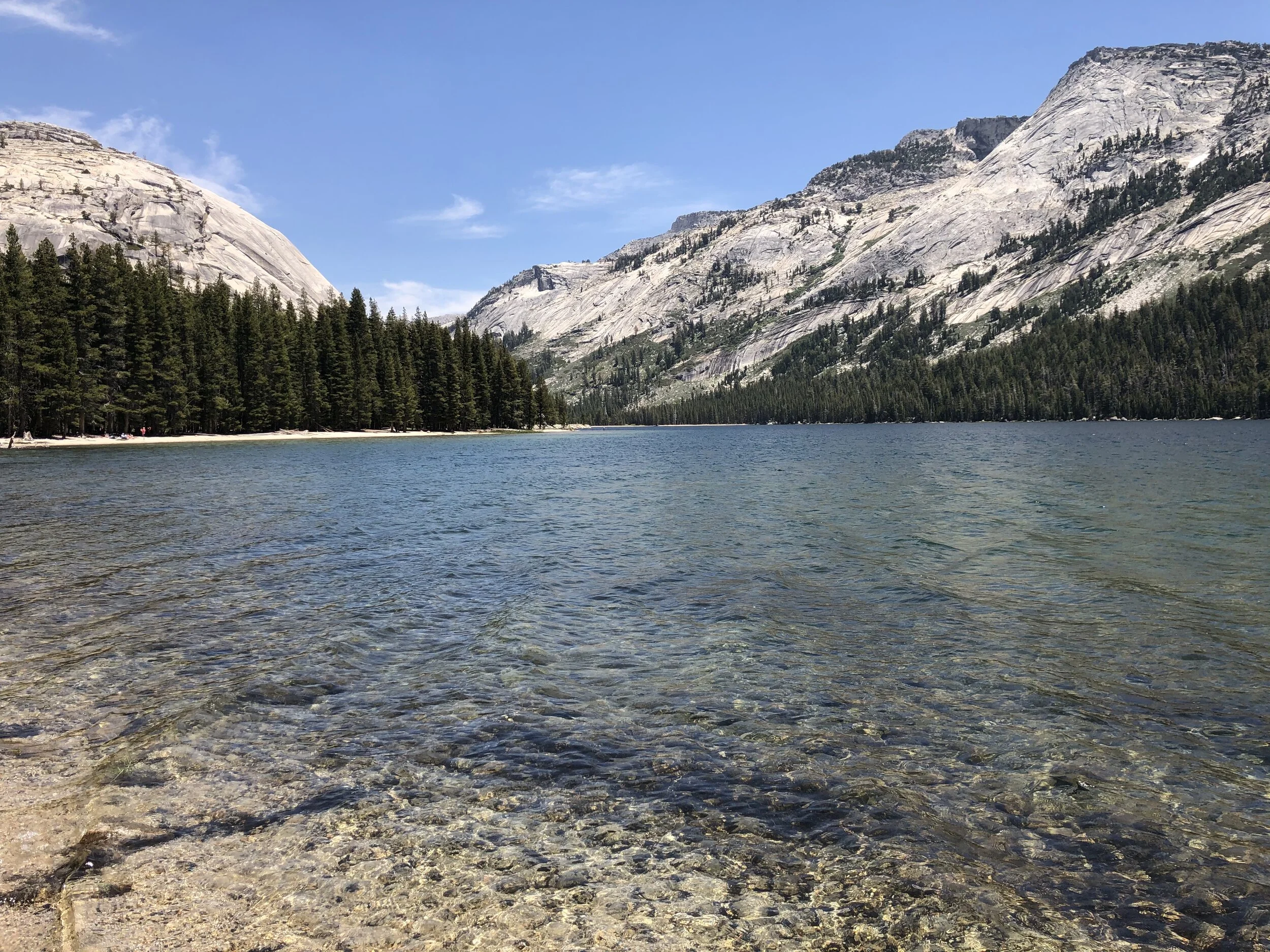
Day 4 was our last day at Yosemite. On the way out of the park, we took the morning to check out the Tuolumne area, the northeast corner of the park. This way out of the park dumps you right onto US-395, where we continued our exploration of the eastern side of the Sierras (see post #26).

This section of the park you don’t often hear much about. I’m pleased that we concluded our time at Yosemite with this area. Full of meadows and lakes, this landscape is much different from what you find in the valley or in the more mountainous regions.

IMG_0710.jpg
IMG_2146.jpg
IMG_4114-1.jpg
IMG_4781.jpg
IMG_4878.jpg
IMG_5204.jpg
IMG_7250.jpg
IMG_8638.jpg
IMG_0710.jpg IMG_2146.jpg IMG_4114-1.jpg IMG_4781.jpg IMG_4878.jpg IMG_5204.jpg IMG_7250.jpg IMG_8638.jpg

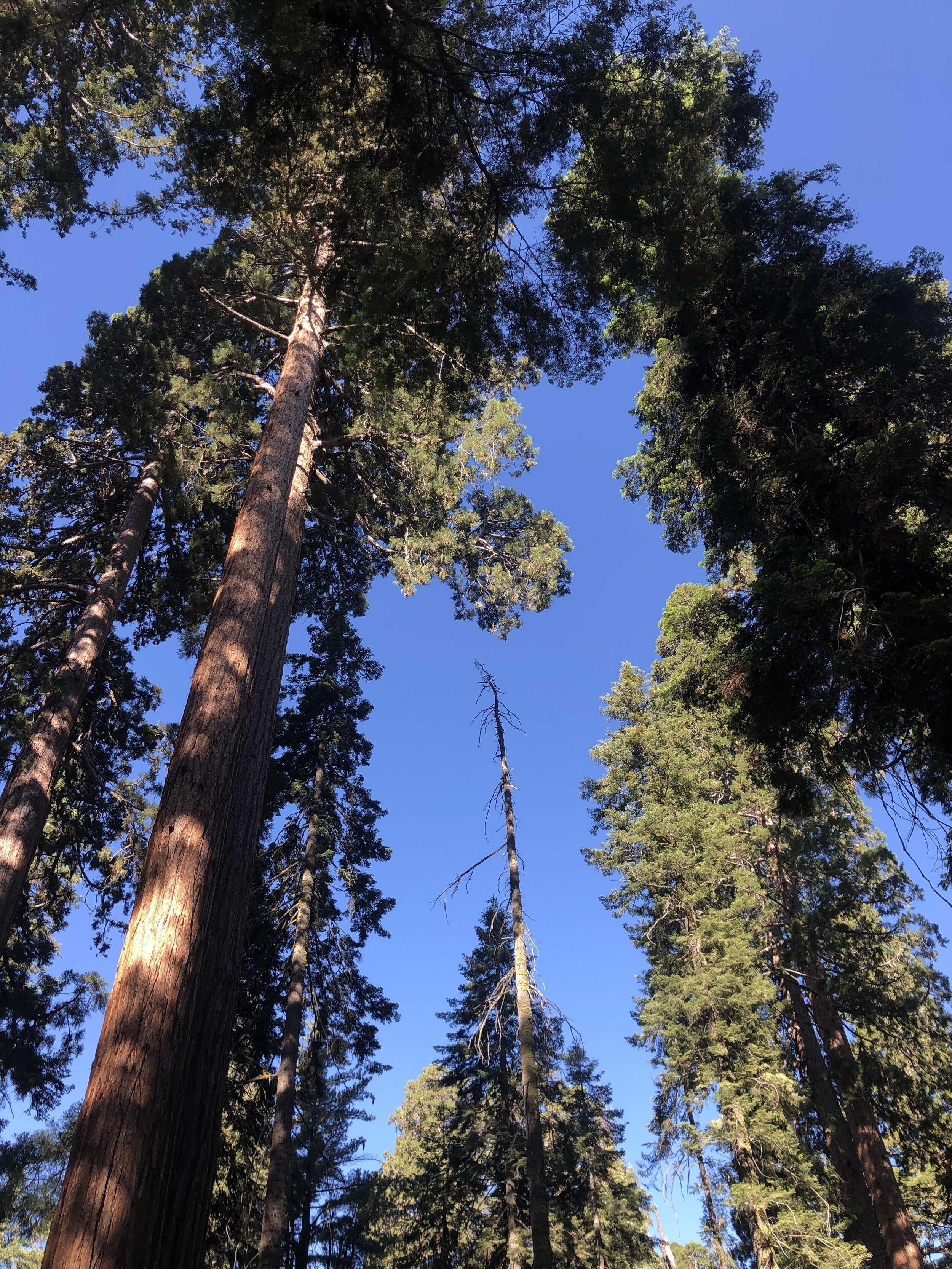
The one area that we did not explore was the Sequoia Groves. I got my fill of Sequoias at Sequoia National Park, so I didn’t feel inclined. 

Although COVID presented some challenges with my visit to Yosemite, I think I lucked out. Without the reservation system, I’m afraid the park would have been too crowded, and therefore a lot less enjoyable. I found my experience to be very manageable and, in turn, that much more memorable. 

Yosemite did not disappoint. Unless, of course, you are the person who said this (if you don’t already, follow @subparparks - hilarious art highlighting negative reviews of national parks!):

Screen Shot 2020-10-07 at 8.02.24 PM.png


July 10, 2020 /Sarah Williams
yosemite, el capitan, half dome, hiking, yosemite valley, subpar parks, tuolumne area
National Parks
Comment
IMG_0063+2.jpg

#29: Monterey and Sequoia & Kings Canyon National Parks

July 09, 2020 by Sarah Williams in Along the Way, National Parks

Before taking the weekend to camp and visit Sequoia and Kings Canyon National parks, I spent about a week with my friends Chris and Allison and their family in Sunnyvale, CA. Chris and I met in business school (pretty much day 1) in Ohio, but he now has a killer job at Google. I may have mentioned this before, but getting the chance to spend time with my friends and their kids is remarkable. I got the opportunity to fold into their lives, spend some QT with Allison, and get to know their children. And the kids LOVE Addie, so it was a win-win.

We had a lovely day in Monterey (hey, that rhymes!). We drove the famous 17-mile drive through Pebble Beach and had lunch in Carmel-by-the-Sea. We stopped in the afternoon for a little beach time for the kids. I loved Carmel-by-the-Sea.

IMG_8730.JPG
IMG_5191.jpg
IMG_9439.jpg
IMG_6744.jpg
IMG_6919.jpg
IMG_9566.jpg
IMG_3465.jpg
IMG_8730.JPG IMG_5191.jpg IMG_9439.jpg IMG_6744.jpg IMG_6919.jpg IMG_9566.jpg IMG_3465.jpg

Visiting Sequoia and Kings Canyon National Parks was a treat; for a few different reasons:

1) My friend Chris joined me visiting these two sister parks.

2) I didn’t do any research on these parks (Chris did…), so I had no expectations going in.

In short, often, low expectations equals pleasant surprises.

Because campgrounds are few and far between (see my previous post), we made campground reservations in the Sequoia National Forest, but each night at a different campground, due to availability - one night at Upper Stoney Creek Campground, and the other at Princess Campground. Not staying in the same campground meant we were towing the Airstream around with us for most of the weekend.

Per Chris’s park research, I learned that Sequoia trees are the largest (by volume) globally. With a depth of 8,200 feet, Kings Canyon is one of the deepest canyons in the United States. These parks also host two of the largest (by volume) trees in the world: General Sherman and General Lee. The General Sherman Tree IS the largest in the world (275 feet tall and over 36 feet in diameter at the base), and the General Lee Tree is the second largest of the Sequoias in the Grant Grove section of the park, and 11th largest in the world.

We started by visiting Grant Grove, which is home to the General Lee Tree. We were blown away not only by the size of that tree, but also by all the other trees in the area. The bases of these trees were massive!

IMG_6465.jpg
IMG_7653.jpg
IMG_4735.jpg
IMG_0163.JPG
IMG_0139.JPG
IMG_0128.JPG
IMG_0044.jpg
IMG_6465.jpg IMG_7653.jpg IMG_4735.jpg IMG_0163.JPG IMG_0139.JPG IMG_0128.JPG IMG_0044.jpg

The trees were enormous - but the views driving through the park were equally as impressive. Chris and I took turns driving. I have to say; it was nice to be in the passenger seat for a change. I got to look out the window at the sights without having to pay attention to the road.

IMG_0135.JPG
IMG_6784.jpg
IMG_7723.jpg
IMG_0135.JPG IMG_6784.jpg IMG_7723.jpg

Chris and I did the perfect nine-mile hike. I hate to admit it, but we took Addie with us, despite it being against the rules. The path seemed “less traveled,” so I took the risk. The trail was called Mist Falls, and it snaked through lush greenery, riverbanks, and at the end was a beautiful waterfall. 

IMG_8178.jpg
IMG_9782.jpg
IMG_9874.jpg
IMG_7723.jpg
IMG_4986.jpg
IMG_2001.jpg
IMG_0355.jpg
IMG_0023.JPG
IMG_0031.JPG
IMG_0091.JPG
IMG_0099.JPG
IMG_0110.JPG
IMG_8178.jpg IMG_9782.jpg IMG_9874.jpg IMG_7723.jpg IMG_4986.jpg IMG_2001.jpg IMG_0355.jpg IMG_0023.JPG IMG_0031.JPG IMG_0091.JPG IMG_0099.JPG IMG_0110.JPG

The last day in the parks, we hiked up Moro Rock. From the top, our vantage point afforded us views of both parks - nearly in entirety. We also couldn’t leave without driving through the tunnel log.

IMG_0078.JPG
IMG_9468.jpg
IMG_0121.JPG
IMG_0126.JPG
IMG_0141.JPG
IMG_0078.JPG IMG_9468.jpg IMG_0121.JPG IMG_0126.JPG IMG_0141.JPG

Lastly, here are a few shots of us with the National Park signs. After Addie and I got a photo next to the Sequoia sign, she insisted on being in Chris’s picture as well. She ran up to him as he was standing next to it!

These sister parks were stunning and although I had now expectation for them, they blew me away.

IMG_0066 3.JPG
IMG_0085 3.JPG
IMG_0094.JPG

It’s funny. Many people I meet ask me what my favorite park is so far. It’s not a simple answer. Being a favorite depends on so many factors: the weather, where I’m camping, if Addie is with me or not, if I have a special treat like a friend joining me, how crowded the park is, the ease on navigating the park, etc. It’s way more about the experience in its entirety that makes it a favorite or not. I’d say these parks were definitely a favorite.

July 09, 2020 /Sarah Williams
sequoia tree, sequoia and kings canyon national park, kings canyon, camping, monterey, carmel-by-the-sea, national parks, Airstream, sequoia national forest, general sherman tree, general lee tree, grant grove, Moro rock, tunnel log
Along the Way, National Parks
1 Comment
IMG_8272.jpg

#28: Truckin' Up the California Coast (& Pinnacles National Park)

July 08, 2020 by Sarah Williams in National Parks, Along the Way

Leaving Ventura, the only plan I had was to camp at Pinnacles National Park that very night. I had made a reservation for two nights at the Pinnacles campground, but one night was forfeited since I extended my time in Ventura by a day when I found out Channel Islands National Park was open (see previous post #27). Unfortunately, this happens sometimes, and I do a quick cost-benefit analysis in my mind to decide what to do. In this case, I was more than willing to sacrifice a night at Pinnacles to visit Channel Islands.

It was going to be a long day of driving up the coast - not only was it nearly a four-hour drive to my next destination but also there were a lot of little places I wanted to check out along the way. You may be thinking, “Why did she only give herself a day to go from Ventura to Pinnacles?” (see map below), but I had a tough time finding camping spots along the coast.

Screen Shot 2020-09-21 at 11.51.25 AM.png

I want to note: from here on out on my journey, there are a few things to keep in mind to understand some of the decisions I make:

1) It’s summer, so it’s busy everywhere. You need to take what you can get if you don’t want to plan too far in advance.

2) COVID thing #1. More people are embracing this “nomad” lifestyle and/or choosing to vacation via RV (no one wants to stay in a hotel) to do “outdoor” stuff (outdoor activity is the only option).

3) COVID thing #2: Fewer places/campgrounds are open. I’ve seen parks that have closed every other site to practice social distancing. Some parks have closed entire campgrounds and/or don’t offer camping at all.

4) COVID thing #3: Tours, buses, and organized activities are either not running or not running at full capacity.

More people are out there, and fewer things are open/running. So, if this adventure wasn’t challenging enough, it’s even way more challenging now. But, I keep my head up and put things in perspective: I’m out here doing this, and I’m healthy.

My first stop on this route was Pismo Beach. And by stop, I mean merely a halt. A couple I had met a few weeks earlier had mentioned a cinnamon roll place that I couldn’t resist.

IMG_8231.jpg

It. Was. Delicious. The next two photos were taken about 2 minutes apart. The gooey deliciousness did not last long.

IMG_8232.jpg
IMG_8234.jpg

After a gluttonous five minutes, I hit the road for San Luis Obispo (“SLO” as Californians call it). I couldn’t tell you what, exactly, there was to see in this little town, but since I had heard about it and was going to be close to it, I wanted to check it out.

I was able to park the car and Airstream easily, and Addie and I walked around. I don’t have anything crazy to report on this town. It was quaint, the people were friendly, and the weather was fantastic. There is an array of different types of shops and lots of touristy things to buy. Maybe it’s the retail ingrained in me, but I love exploring different kinds of shops and seeing all of the creativity people put into their small businesses.

The next place I wanted to see was Big Sur. But first, some roadside stops along the way. Around every corner, I wanted to stop as the views were so breathtaking. I think my favorite part was the elephant seals, though. Hehe.

IMG_8246.jpg
IMG_8247.jpg
IMG_8258.jpg
IMG_8249.jpg
IMG_8260.jpg
IMG_8253.jpg
IMG_8263.jpg
IMG_8255.jpg
IMG_8264.jpg
IMG_8268.jpg
IMG_8270.jpg
IMG_8271.jpg
IMG_8246.jpg IMG_8247.jpg IMG_8258.jpg IMG_8249.jpg IMG_8260.jpg IMG_8253.jpg IMG_8263.jpg IMG_8255.jpg IMG_8264.jpg IMG_8268.jpg IMG_8270.jpg IMG_8271.jpg

When I got to Big Sur, I admit I was somewhat confused. I noticed how the forest butted right up to the coastal cliffs, but I didn’t know what, specifically, to look for. According to the Big Sur Chamber of Commerce, “Big Sur refers to that 90-mile stretch of rugged and awesomely beautiful coastline between Carmel to the north and San Simeon (Hearst Castle) to the south.” Pfeiffer Big Sur State Park is a beautiful park in this area, but I couldn’t camp there due to limited availability. So, technically I went to Big Sur, but I didn’t explore Big Sur. Next time.

And speaking of Hearst Castle, it was closed due to COVID. Once again, next time.

I arrived to Pinnacles National Park around sundown. There is one campground at this park, and it’s accessible only from the east side of the park. There is no through road in this park, meaning you can’t get through the park by driving. Given that I had never heard of this park, and my long day, I neglected to do any research on this park beforehand. If I did, I would have known to enter from the east side of the park. However, I pulled up to the west entrance. I had no service and couldn’t figure out where to go. So, I drove back out where I had service (about 25 minutes), googled the park map, and came to the realization that the campground is on the other side.  

I drove about an hour around the park to the east entrance, and by the time I arrived at the campground, it was dark. Backing into my spot in the pitch black was, well, interesting, but I got it done.

I was disappointed when I went to explore Pinnacles the following morning. The road in the park next to the campground was closed off to vehicles. Many people biked to trailheads, but A) I don’t have a bike with me, and B) I have Addie. We decided to walk on the road, and we “hiked” for about five miles. Addie wasn’t allowed on any of the hiking trails, so we turned around and went back to the campground. Although I spoke to a ranger that morning, I’m still not entirely sure what the park is known for. Alas, we went.

IMG_8274.jpg
IMG_8276.jpg
IMG_8282.jpg
IMG_8285.jpg
IMG_8287.jpg
IMG_8288.jpg
IMG_8274.jpg IMG_8276.jpg IMG_8282.jpg IMG_8285.jpg IMG_8287.jpg IMG_8288.jpg

We packed up and headed north to visit friends in Silicon Valley. On the way, I couldn’t resist stopping in Gilroy - known as the Garlic Capital of the World - at “The Garlic Shoppe.” I love garlic and spent way too much money in there to admit. With garlic breath, we got back in the car for the last stretch to Sunnyvale.

IMG_3980-1.jpg
July 08, 2020 /Sarah Williams
California coast, San Luis Obispo, Airstream, Gilroy, Pinnacles National park, camping, covid-19, Pismo beach], big sur, Hearst Castle
National Parks, Along the Way
Comment
IMG_4641.jpg

#27: Back to the Coast (& Channel Islands National Park)

July 07, 2020 by Sarah Williams in National Parks

I didn’t take the most efficient route through California, as there was some backtracking. However, this often happens when: A) You are meeting people in specific places at specific times, and B) When people you meet along the way recommend new places to check out. The above is just another example of how a detailed, rigid plan only takes you so far (for me on this trip and for all of us in life!).

From Lone Pine, I headed down south on 395 to then head west to the coast. My next destination was Ventura. From there, I would take day trips to Ojai and Santa Barbara.

Screen+Shot+2020-09-11+at+8.40.58+PM.jpg

I booked a “cushy” RV park in Ventura called Waypoint. It was the only place to stay near the city – and it was right downtown somewhat along the water. The coolest part about it was that they only allowed vintage trailers and Airstreams. I fit right in. Plus, they had heavenly showers.

Ventura

Ventura is a California surfer, hippie town with a little grit to it. It reminded me a bit of Santa Cruz. After having a nice, long, hot shower, Addie and I walked around the downtown area, popping into shops. VERY dog-friendly city, which I love.

The following day I quickly hit up the local Saturday morning farmers market. Dogs were not allowed, but a nice gentleman at the entrance offered to watch Addie while I scoped it out.

IMG_3205.jpg

Shortly afterward, I met up with a friend, Katie, from business school who lives in Ventura. After business school, she took a job at Patagonia, headquartered there. We took the dogs for a hike/walk in a nearby park and caught up after lost time. After Katie gave me some “organic” avocados and oranges from trees in her backyard, Addie and I hit the road to visit Ojai and Santa Barbara.

IMG_0259 2.jpg
IMG_7375.jpg

Little sidebar: Since COVID began, the national parks closed to visitors. At this time (mid-June), I was continually checking to see which parks were opening up and when. Channel Islands National Park (off the coast of the Ventura area) was closed every time I checked because visitors take a ferry to get to the islands. I had come to terms with the fact that I would not visit the Channel Islands. BUT (big "but" here), while hiking with Katie, she mentioned that her friends were going to the Channel Islands that weekend. It was then I learned that it was open!

I quickly arranged for another night at Waypoint and snagged a ferry reservation for the next morning. This change of plans pushed my timeline back one day, but it worked out for the best (more to come on why).

Okay, back to Ojai…

I had heard lovely things about Ojai – and that there was not much to do there, but I still wanted to see it for myself.

Ojai is beautiful. It’s a small town set in a valley and a little desert-y. The little downtown hosts galleries, new-age boutiques, and cafes, and the surrounding areas are home to ranches and nature trails. It’s a very spiritual place where many escape to find peace, wellness, and sanctuary. You can immediately tell by the vibe there - very Zen.

Because Ojai was a stop en route to Santa Barbara, I grabbed a coffee in a coffee shop and perused the town just a bit. I hit up a famous bookstore called Bart’s Books, but they didn’t let dogs inside. Boo.

IMG_8261.jpg

I went to Santa Barbara and took it all in. Addie and I walked around a ton – on the main drag and then by the water. I have been to Santa Barbara a few times in the past, but I love it so much that I wanted to say hello. Honestly, not much to highlight from this particular visit.

Channel Islands National Park

The next morning I had an 8 am ferry to Anacapa Island via a company called Island Packers. Channel Islands National Park consists of five different islands. Anacapa is the smallest island and arguably the most picturesque. It's almost like the "classic" of the Channel Islands, so I chose to visit it.

What I didn't realize when choosing that particular island was that it is one of the most massive nesting places for the Western Gull. And at the time I visited, it was nesting SEASON. Gulls were EVERYWHERE. To the point where I had to flail my arms around with every step, so they didn't attack me. I walked over multiple dead gulls - including chicks. It's nature, so I love it, but I was ready to go when the time came.

Anacapa is also home to the largest brown pelican rookery in the United States. These guys congregated into one area of the island, and it was undeniable where they were. It didn't smell nice where they lived…

It was beautiful, though. I had a clear day, and the views were incredible. I also saw sea lions. After a short boat ride back to the harbor, and a 15-minute drive, I was in Ventura again. Katie and I walked the boardwalk with the dogs and wrapped up my weekend with some shrimp tacos on the pier.

IMG_0606.jpg
IMG_0059.jpg
IMG_7802.jpg
IMG_0308.jpg
IMG_0186.jpg
IMG_1953.jpg
IMG_2979.jpg
IMG_1494.jpg
IMG_7186.jpg
IMG_5378.jpg
IMG_3405.jpg
IMG_5344.jpg
IMG_3425.jpg
IMG_3980.jpg
IMG_6406.jpg
IMG_4054.jpg
IMG_4349.jpg
IMG_3053.jpg
IMG_7671.jpg
IMG_8942.jpg
IMG_6069.jpg
IMG_8193.jpg
IMG_9695.jpg
IMG_6341.jpg
IMG_2682.jpg
IMG_8193.jpg
IMG_7671.jpg
IMG_0606.jpg IMG_0059.jpg IMG_7802.jpg IMG_0308.jpg IMG_0186.jpg IMG_1953.jpg IMG_2979.jpg IMG_1494.jpg IMG_7186.jpg IMG_5378.jpg IMG_3405.jpg IMG_5344.jpg IMG_3425.jpg IMG_3980.jpg IMG_6406.jpg IMG_4054.jpg IMG_4349.jpg IMG_3053.jpg IMG_7671.jpg IMG_8942.jpg IMG_6069.jpg IMG_8193.jpg IMG_9695.jpg IMG_6341.jpg IMG_2682.jpg IMG_8193.jpg IMG_7671.jpg

Are you wondering where Addie was when I went to Anacapa Island? Katie helped me out with that. She and her dog sitter split the time and watched Addie for me. It was a treat to have someone I knew and trusted to stay with her while I explored a place she couldn’t go with me. Thanks, Katie!

July 07, 2020 /Sarah Williams
Anacapa Island, Channel Islands National Park, Ventura, California, Ojai, Santa Barbara, Western Gull, brown pelican
National Parks
Comment
Screen+Shot+2020-05-05+at+2.39.46+PM.jpg

#20: White Sands National Park

May 05, 2020 by Sarah Williams in National Parks

I was really excited to visit this park. This is one of those places you see the photos of and you can’t imagine what it’s like in actuality. I mean, white sand dunes in the south of New Mexico? So strange. But so incredible.

This portion of my trip was my first boondocking experience. This term is used in the RV community and it means to camp out on public land with no water or electric hookups. No reservations are needed because it’s public land, not necessarily “managed” as a campground would be. You basically just park and stay. There are numerous apps and websites such as Campendium, Recreation.gov, and iOverlander (to name a few) that enable travelers to find these free places to camp. Usually, they’re public lands, parks, or government properties - sometimes even business parking lots that allow RV’rs to spend the night.

I found a place to camp outside Las Cruces, NM. White Sands National Park was about an hour’s drive from there. Since I wasn’t too familiar with boondocking and didn’t feel comfortable leaving my Airstream unattended, I towed it along with me to the park. I’d just find another place to boondock that night. NOTE: at this point, I am MUCH more comfortable “winging it” and not necessarily knowing where I’d be spending the night on any given day. In my first few months of traveling, this was NOT the case! See, I’m getting comfortable with being uncomfortable. 😀

Sunset from my boondocking spot near Las Cruces, NM.

Sunset from my boondocking spot near Las Cruces, NM.

The park’s visitor center was at the start of the white gypsum sand dunes. You sort-of drive into the dunes. The cool thing about this park is that there are minimal actual trails. You can just park your car on the park road wherever you want and start exploring anywhere. Addie and I randomly parked in a few different places where it didn’t look like many other people were. I took off my shoes and we were off into the dunes.

A few cool things about the sand here:

  • It’s super fine.

  • It’s not little rocks like beach sand; it’s gypsum.

  • It’s not hot. The day we went was super sunny, but the sand was cool (not like at the beach when the sand can get so hot you have to leave your sandals on).

Although Addie wasn’t supposed to be off-leash, I let her off for a bit. She is so much easier off the leash and with all the open space, I wanted her to be able to run. Of course, she decided to go to the bathroom immediately, so I was walking around with a poop bag the whole time (worth it).

IMG_6933.jpg
IMG_6927.jpg
IMG_6934.jpg
IMG_6936.jpg
IMG_6937.jpg
IMG_6941.jpg
IMG_6942.jpg
IMG_6965.JPG
IMG_6971.JPG
IMG_6988.jpg
IMG_6980.jpg
IMG_6990.jpg
IMG_6983.jpg
IMG_6991.jpg
IMG_6992.jpg
IMG_6994.jpg
IMG_7001.jpg
IMG_6933.jpg IMG_6927.jpg IMG_6934.jpg IMG_6936.jpg IMG_6937.jpg IMG_6941.jpg IMG_6942.jpg IMG_6965.JPG IMG_6971.JPG IMG_6988.jpg IMG_6980.jpg IMG_6990.jpg IMG_6983.jpg IMG_6991.jpg IMG_6992.jpg IMG_6994.jpg IMG_7001.jpg

There was an option to sled on the dunes. Park visitors could rent or buy sleds at the visitor center. I did not do this and avoided people who were. I just felt that this landscape is better enjoyed walking and taking it all in, rather than sledding on it.

We stayed for a few hours. We might have stayed longer and relaxed a bit if it weren’t so windy. This park was one of the coolest I’ve been to yet. Not only was it beautiful, but it was so unusual. You never expect to see gorgeous white sand while NOT on a beach. Come to think of it, the sand was very similar to the sand on the Gulf Shore of Florida. Can you tell the difference?

Screen Shot 2020-05-05 at 2.32.40 PM.png

After a fun-filled visit to White Sands National Park, Addie and I departed late afternoon and headed back to Las Cruces to find a place to stay for the night. More to come in my next post about the rest of New Mexico!

May 05, 2020 /Sarah Williams
White Sands National Park, gypsum, boondocking, BLM land, national parks, dogs, New Mexico, Sunset, sledding, sand dune, Las Cruces
National Parks
2 Comments
  • Newer
  • Older

@lyfeintow