#50: Petroglyphs & Canyons
There was more to see in Utah, but I deemed it time to head to Colorado. My "planned" route had gotten off track a while ago, so going off-track a little more wouldn't hurt. I sound like my mom when I say this, but I wanted to catch the Colorado Rocky Mountains' foliage. To do so, I needed to get going promptly.
The next national park I wanted to visit was Black Canyon of the Gunnison outside Montrose, CO. The drive from Salt Lake City was almost six hours, and because I didn't hit the road from SLC until later in the day, I'd stop somewhere on the way.
The first RV park I found appeared booked online. But I swung by there anyway because sometimes, when you show up, you get lucky. I didn't get lucky - it was filled. There was another park nearby in Helper, UT. It didn't look great, but it was just a stopover. It offered water and electric hookups, which was helpful.
I was only planning to stay for one night, but things changed (as they often do). I started chatting with the owner, and she recommended a few local things worth checking out. My ears perked up when she mentioned petroglyphs. I was also intrigued because the petroglyph location she mentioned was not very well-known. I love finding hidden gems. This one was called Nine-Mile Canyon.
I decided to book a second night and take the full day to explore my newly-learned-about attraction. I stopped by the historic town of Helper, before making my way to Nine-Mile Canyon.


I couldn’t put an address into Google Maps to find Nine-Mile Canyon because, well, there isn’t one. There also wasn’t a visitor center or anything like that. I had to navigate myself and figure it out. The RV park lady gave me a paper listing out mile-markers along the canyon road and what to find at each. That was all I had, but I found this map after following the verbal directions to the canyon entrance.
Addie and I were off on an adventure. I reset my odometer at the start to ensure I was on-par with the mile-markers on the "ditto." At first, the petroglyphs were tough to spot, but I got good at it as I got farther into the canyon. It was like a fun game spotting all the rock drawings. Some were right off the road, and some were viewable after a quick hike.
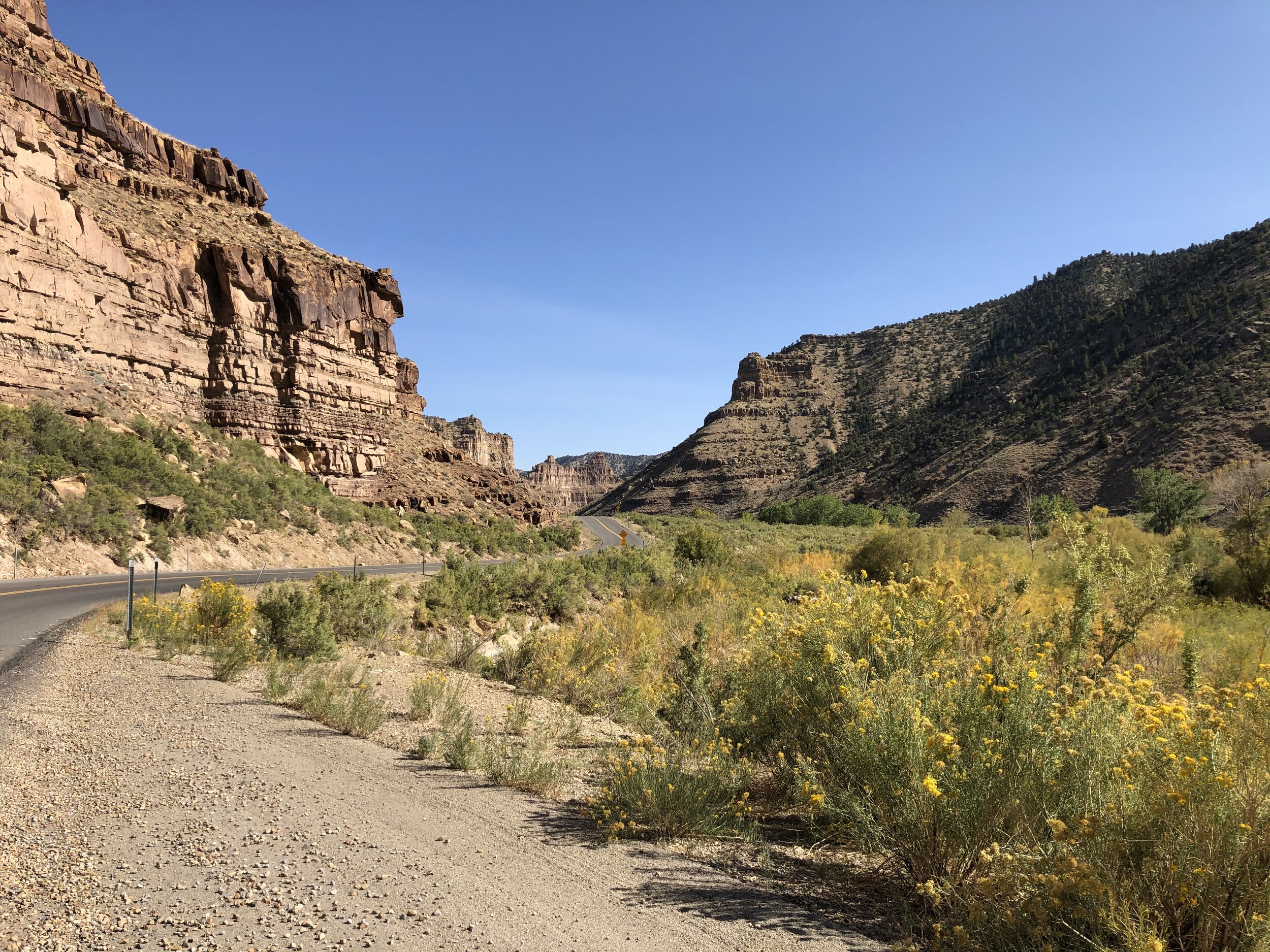


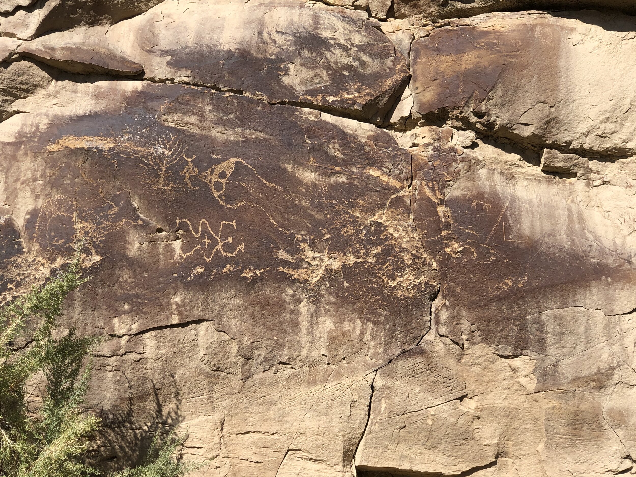


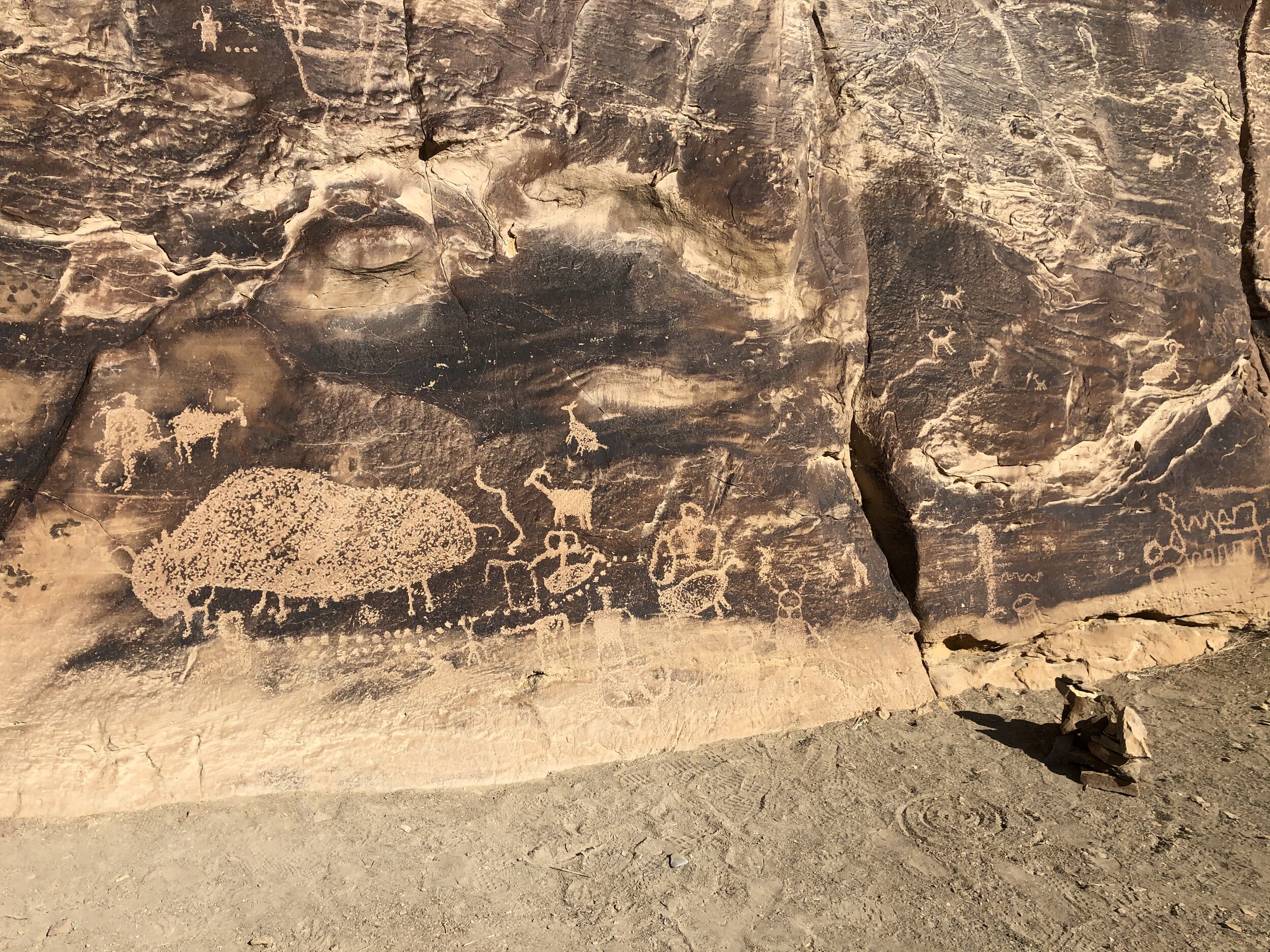


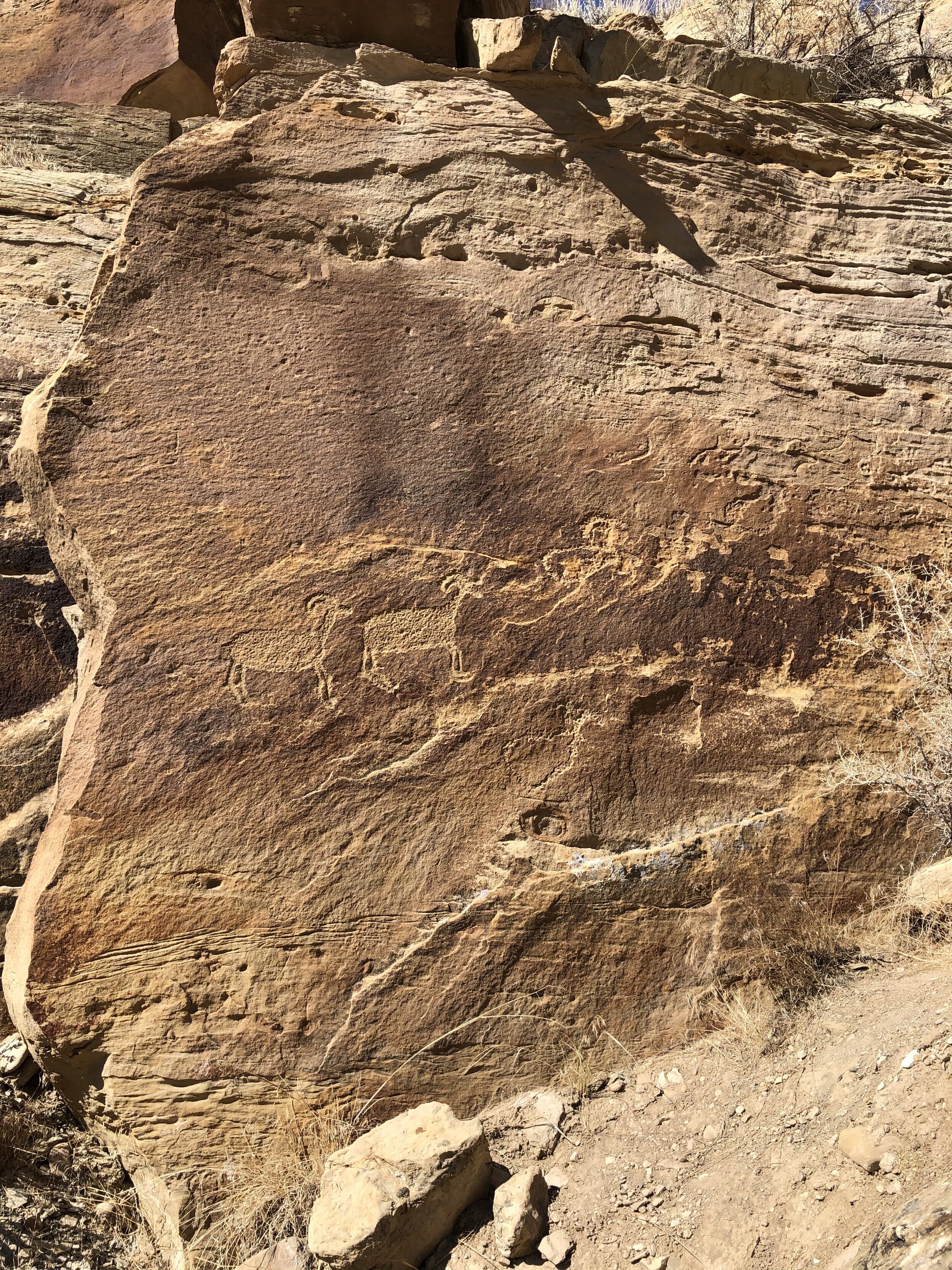

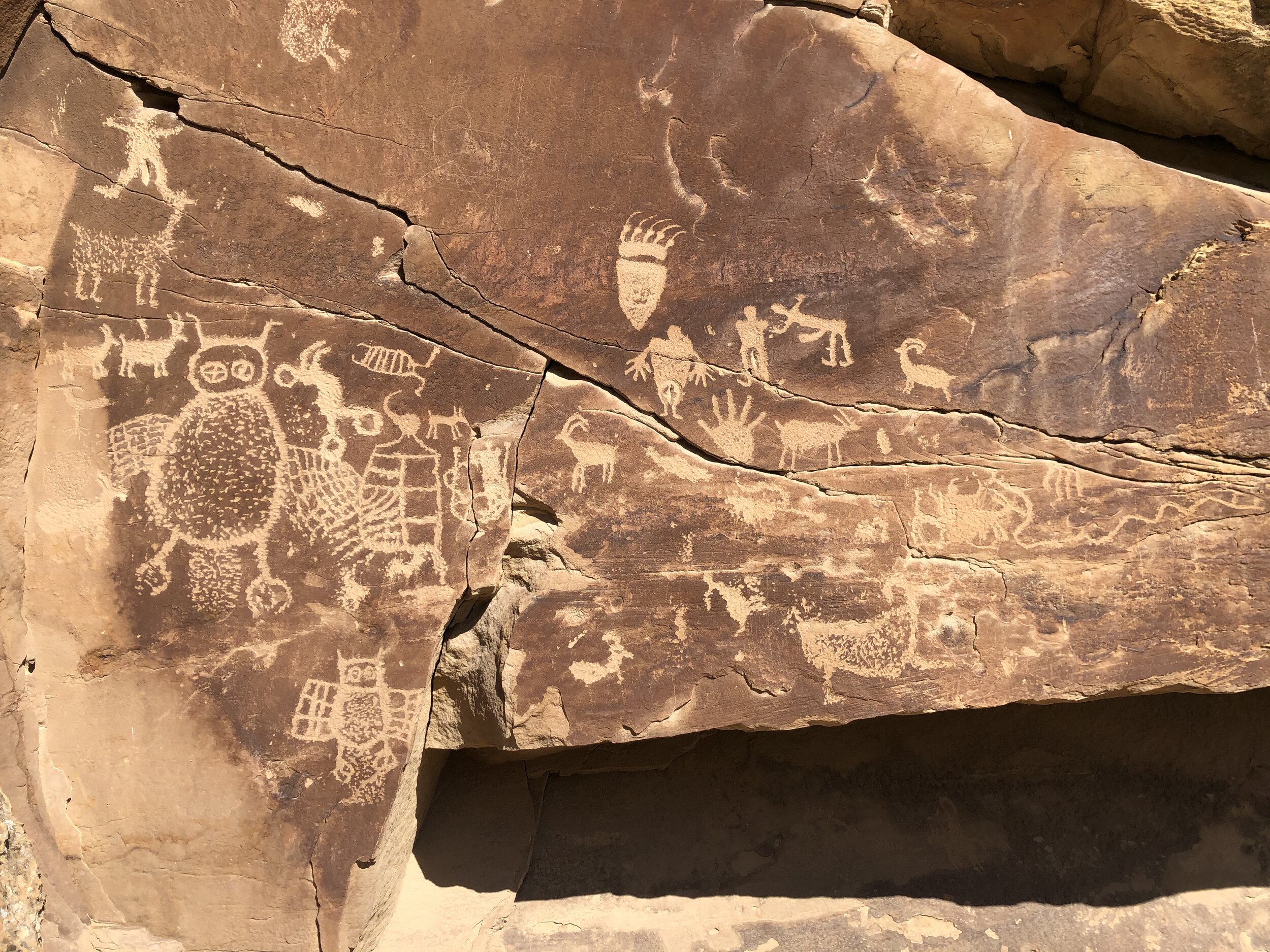


I had never seen such incredible petroglyphs. And to find them in a place I didn't even know about made them that much more special.
Before I knew it, I was crossing the border into colorful Colorado. Having lived there for a few years in the past, it's still "home" to me in many ways. This state makes me happy in so many ways.
I found a free place to camp outside Montrose. This area was not the Colorado landscape I love, but it was close to the entrance to Black Canyon of the Gunnison National Park.


The only thing I knew about this national park before visiting is that it's a canyon - that's it. Addie and I arrived at the South Rim entrance the next morning, heading first to the visitor center. The initial question I typically ask the rangers is, "What are the top things I should see?" The next question is always, "Where can I bring my dog?" Based on the ranger's answers to these questions, we headed out on the Rim Rock Trail. Adde was allowed!
The out and back three-mile trail provided fantastic views of the massive canyon.
I felt good about taking a little hike with Addie. After, we drove the South Rim Road and stopped at some of the overlooks. There were many pull-offs, so we picked and chose based on what the ranger suggested.
The rim was one perspective of this park, but the bottom of the canyon was the other. We headed back towards the south entrance station and took a left onto East Portal Road. Vehicles longer than 22 feet were not permitted. The road was long, curvy, and steep, but it led us down the canyon to the Gunnison River. It was so peaceful and quiet down there.
I was looking forward to what awaited me in the Colorado mountains…mountain towns!


