LYFE IN TOW

A year of life on the road

  • BLOG
  • ABOUT
    • THIS JOURNEY
    • WHY THE Y
    • ME, AS A PROFESSIONAL
  • CONTACT
  • PARK PHOTOS
    • Shenandoah National Park
    • Mammoth Cave National Park
    • Great Smoky Mountains National Park
    • Congaree National Park
    • Everglades National Park
    • Biscayne National Park
    • Dry Tortugas National Park
    • Hot Springs National Park
    • Big Bend National Park
    • Guadalupe Mountains National Park
    • Carlsbad Caverns National Park
    • Channel Islands National Park
    • Pinnacles National Park
    • Sequoia & Kings Canyon National Parks
    • Yosemite National Park
    • Lassen Volcanic National Park
    • Redwood National & State Parks
    • Crater Lake National Park
    • Olympic National Park
    • Mount Rainier National Park
    • North Cascades National Park
    • Glacier National Park
    • Grand Teton National Park
    • Yellowstone National Park
    • Zion National Park
    • Bryce Canyon National Park
    • Capitol Reef National Park
    • Black Canyon of the Gunnison National Park
    • Great Sand Dunes National Park
    • Mesa Verde National Park
    • Arches National Park
    • Canyonlands National Park
    • Petrified Forest National Park
    • Saguaro National Park
    • Death Valley National Park
    • Grand Canyon National Park
  • BOOKS
IMG_4254.jpg

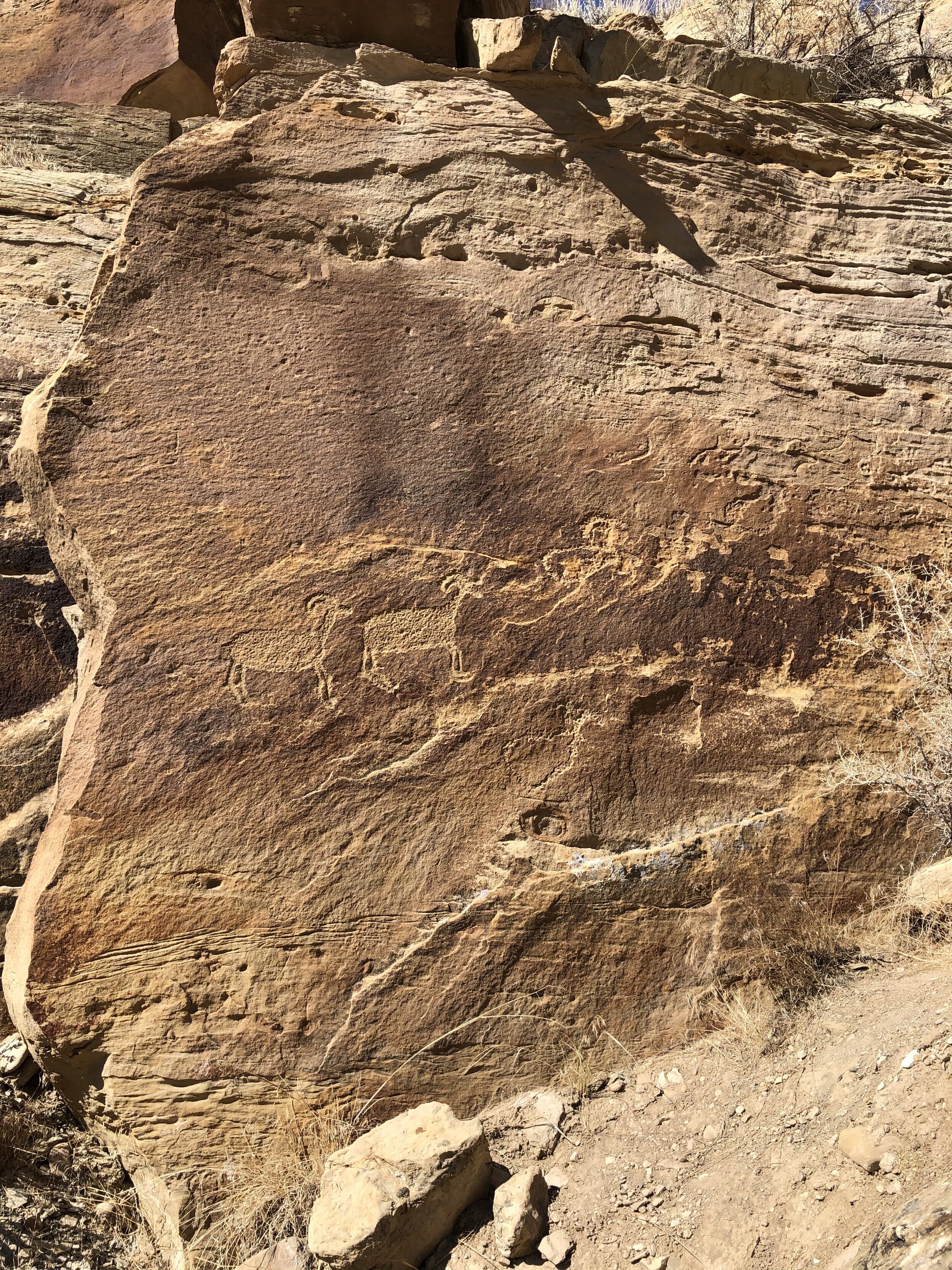
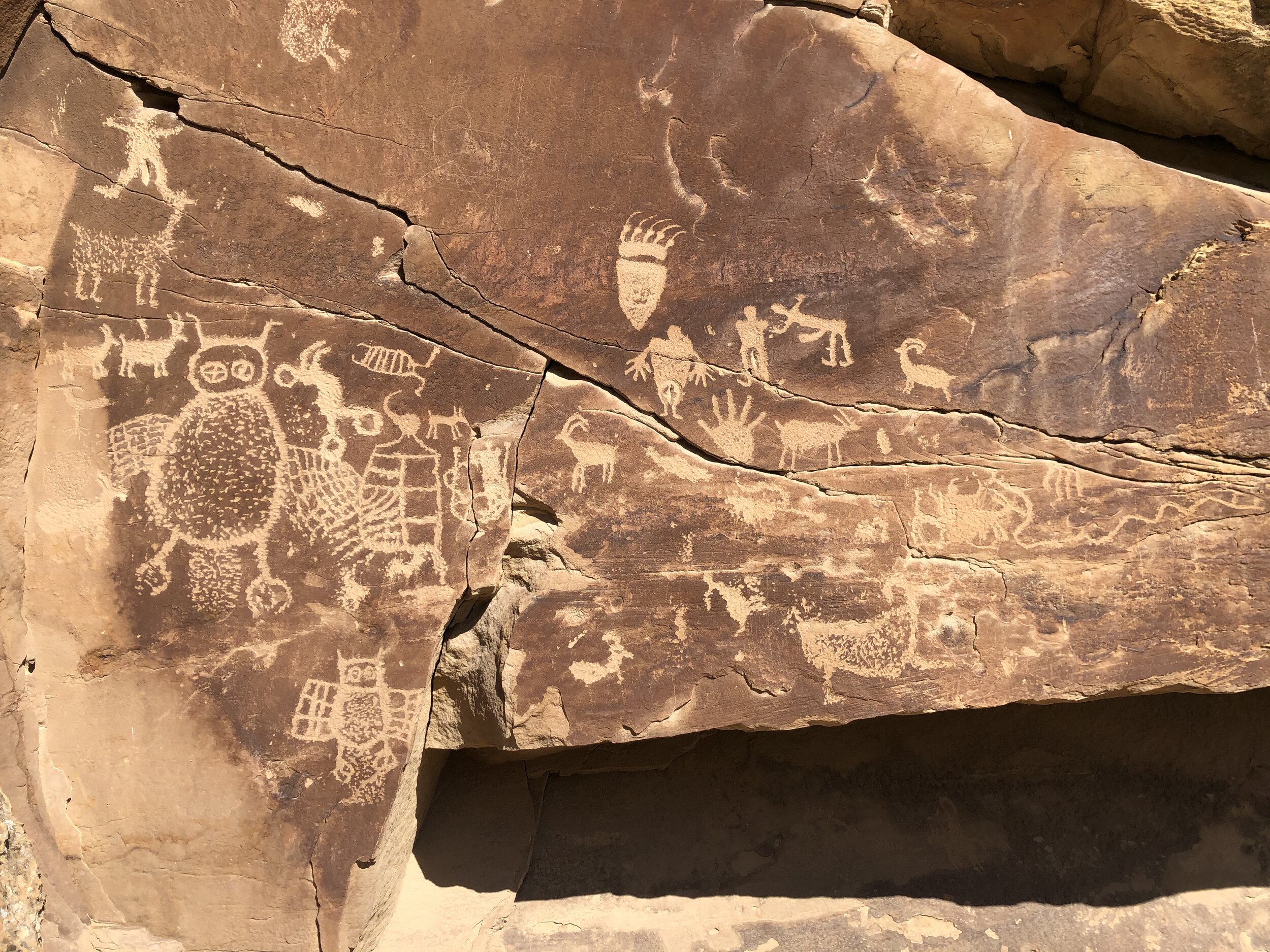
#54: Arches National Park

November 03, 2020 by Sarah Williams in National Parks

Arches National Park is not very large, but it’s like Zion or Yellowstone in that it’s a popular one, with a lot to see. To navigate it most efficiently, I consulted help from a third party called Dirt in my Shoes. I bought a 2-day itinerary (online) from Dirt in my Shoes, and it took the stress out of me having to plan out how I was to do it myself. 

I rolled into Moab - the town which hosts Arches - late afternoon. It was still cold but more manageable than it was in Colorado. On my way to some dispersed camping land, I drove right past the park entrance, so I went ahead and got my park sign photo out of the way. 

My dispersed campsite was good enough for one night. I mean, I really can’t complain about this view. 

IMG_7034.jpg

As beautiful as this scenery is, I wanted a campsite where I would feel comfortable leaving the Airstream while exploring the park. This one was just not it.

The next morning, I left somewhat early to take a ride over to Goose Island Campground. One site was unoccupied, and I grabbed it. Soon thereafter, I unhitched the trailer and headed into the park. Simultaneously, I found a last-minute Rover sitter for Addie for the following day. There was a hike or two that I wanted to do and couldn’t bring her, unfortunately.

Addie and I ventured into downtown Moab to check out the scene. I grabbed a coffee and a bagel and visited a few shops. Nothing too eventful was happening, and I decided to make my way to the park.

Arches - Day 1:

I was shocked to find the entrance to the park uncrowded. I drove right in and didn’t have to wait in a line. I couldn’t figure out where all the visitors were. It was cold, yes, but not that cold. I asked the ranger at the gate, and she told me that it is peculiar - but not to jinx it! 

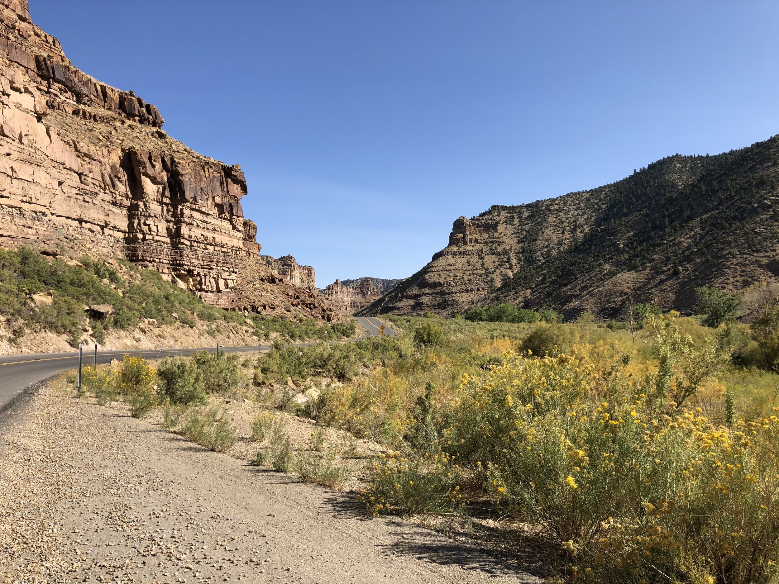
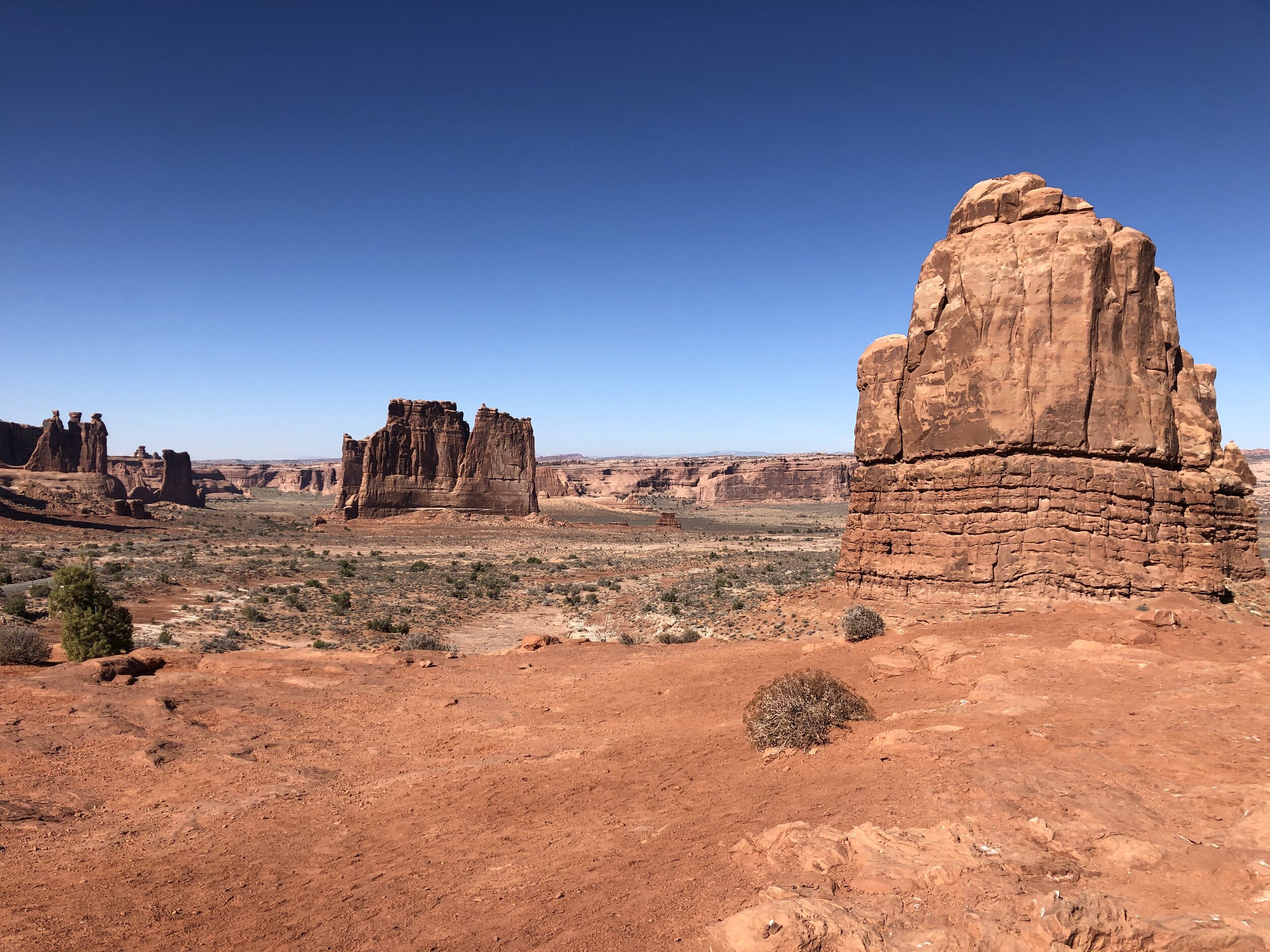
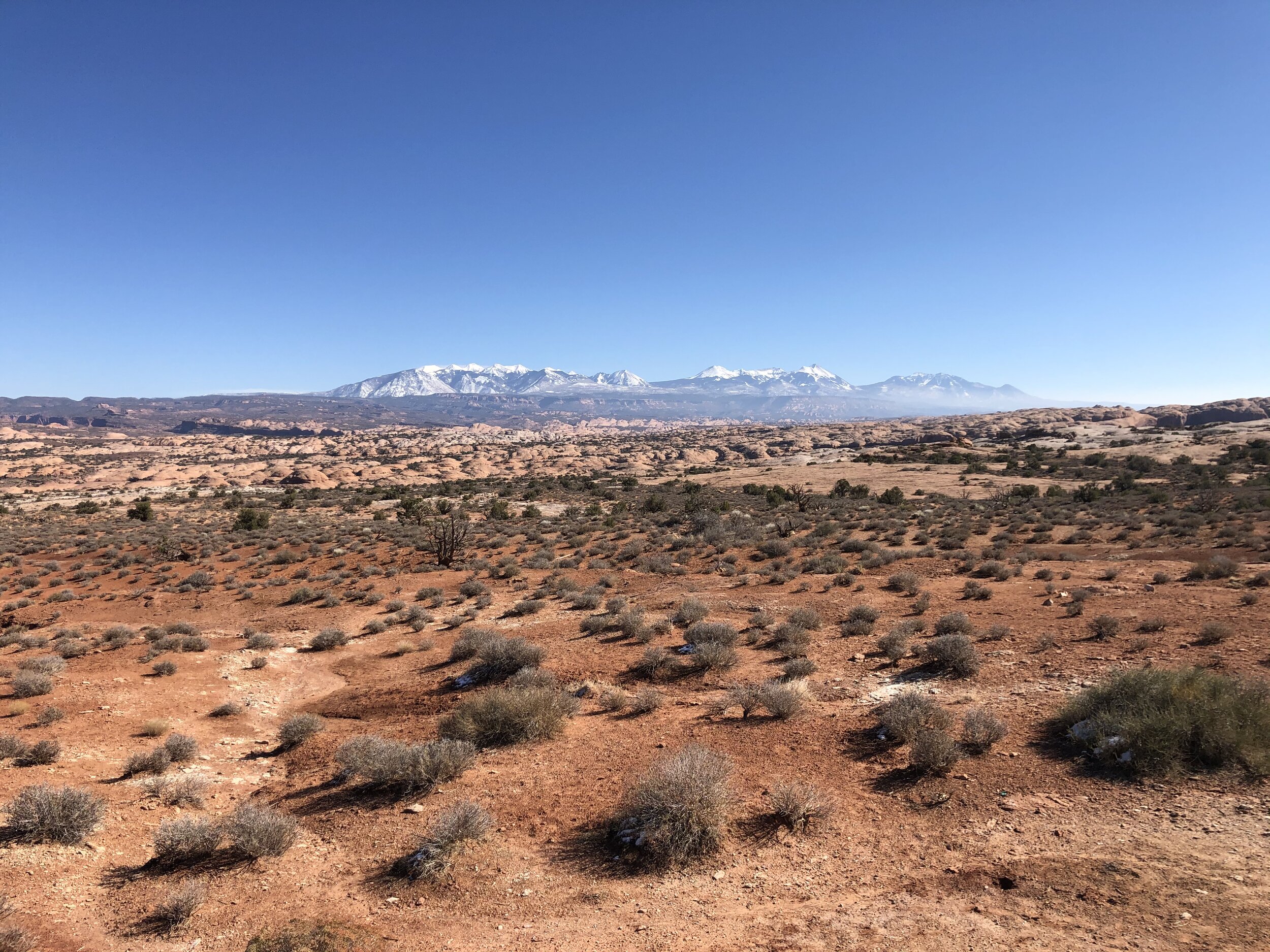
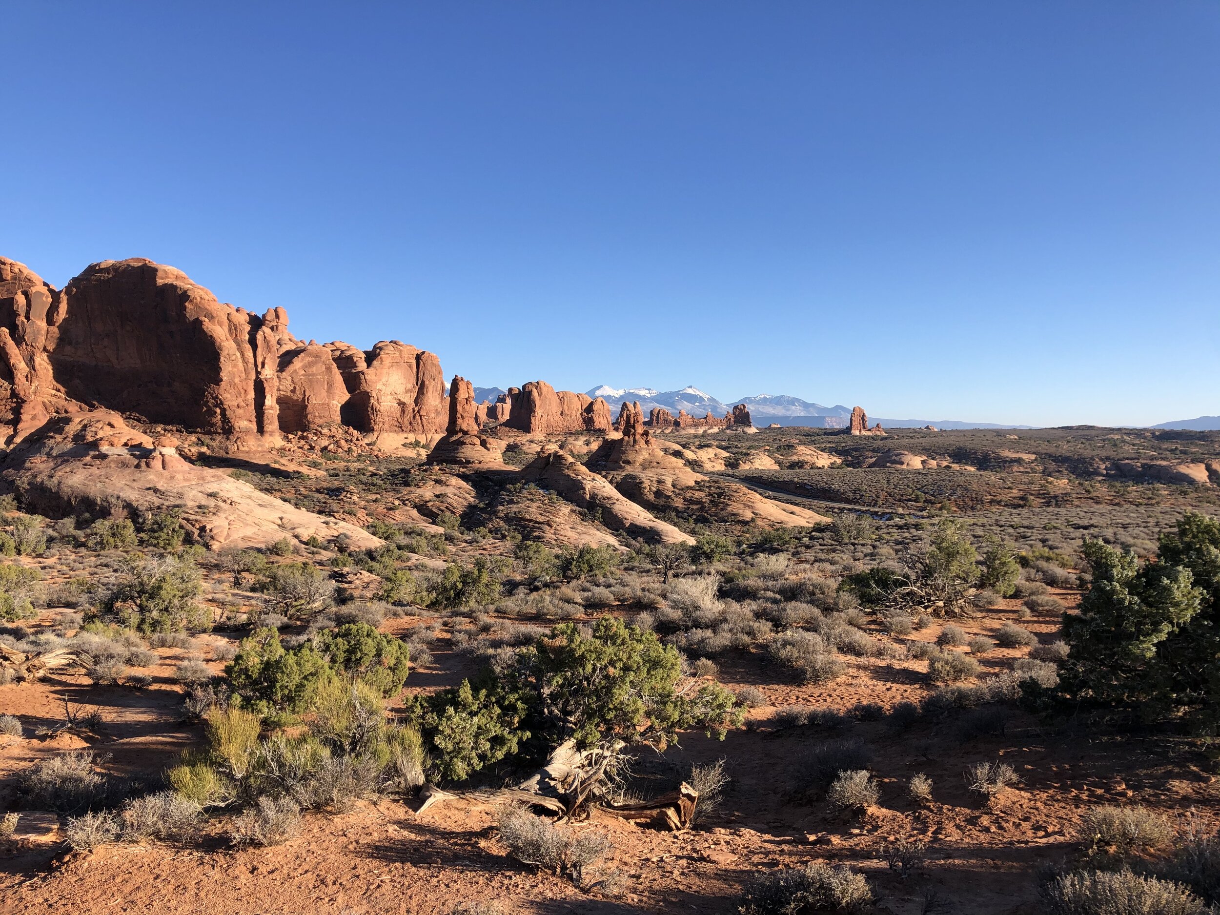
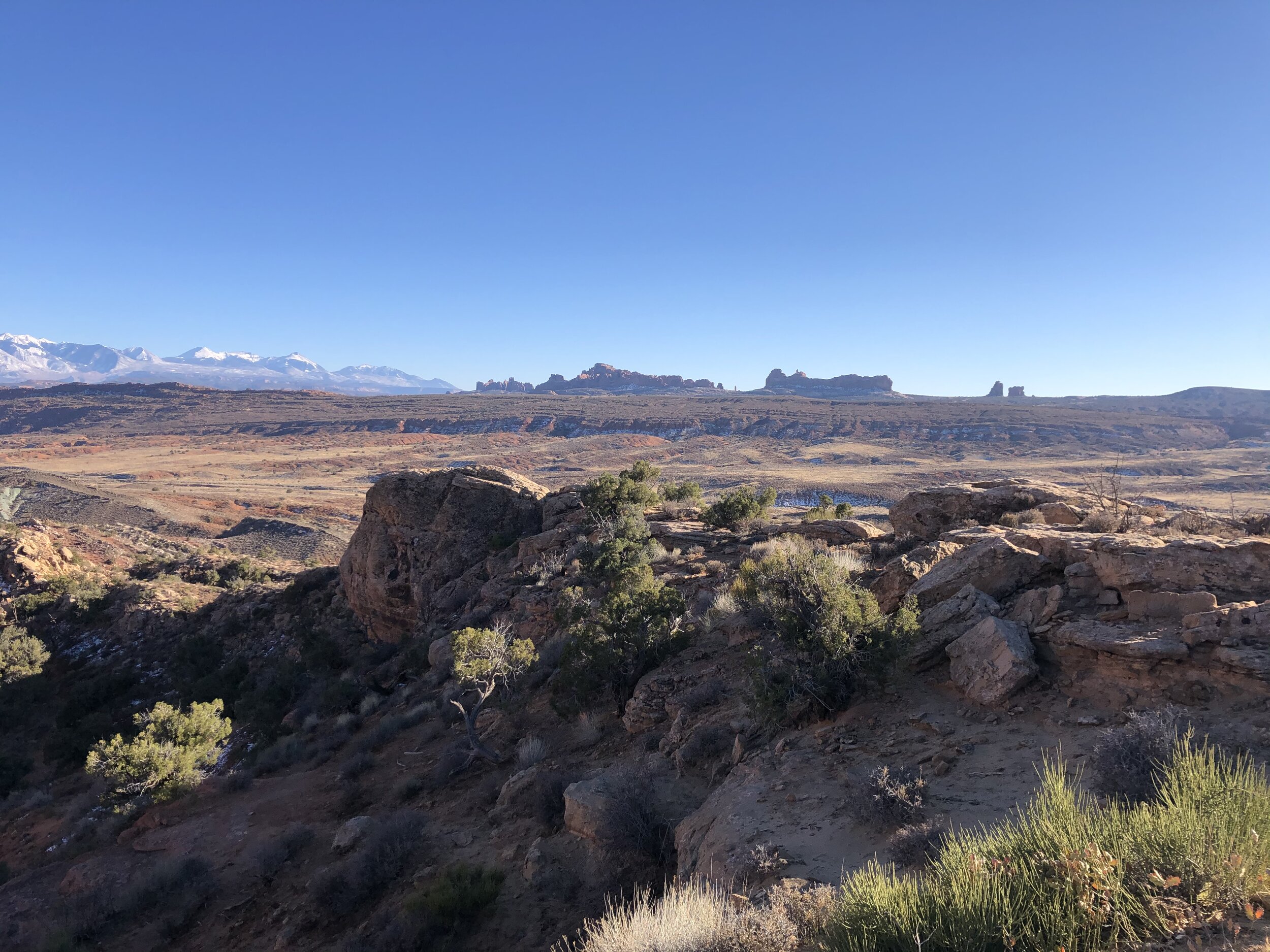
Driving in, I was in awe of what I saw. As far as I could see were red rock formations, unlike anything I had ever seen. We stopped at the La Sal Mountains Viewpoint to take it all in.

IMG_1924 2.jpg
IMG_2161.jpg
IMG_4181.jpg
IMG_6737.jpg
IMG_6887.jpg
IMG_8440.jpg
IMG_9796 2.jpg
IMG_1924 2.jpg IMG_2161.jpg IMG_4181.jpg IMG_6737.jpg IMG_6887.jpg IMG_8440.jpg IMG_9796 2.jpg

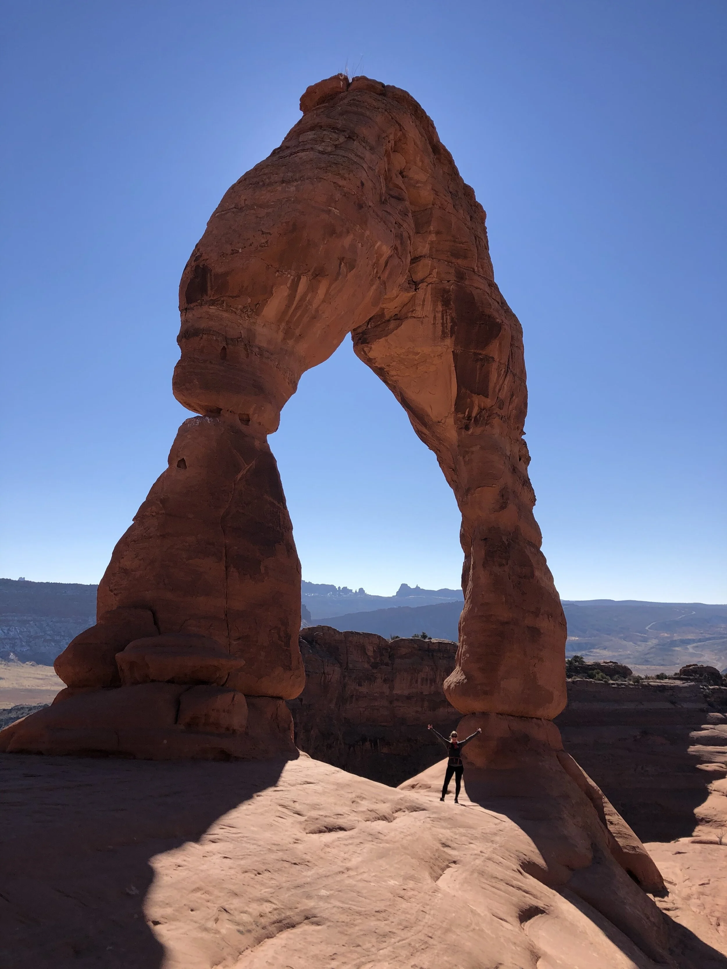
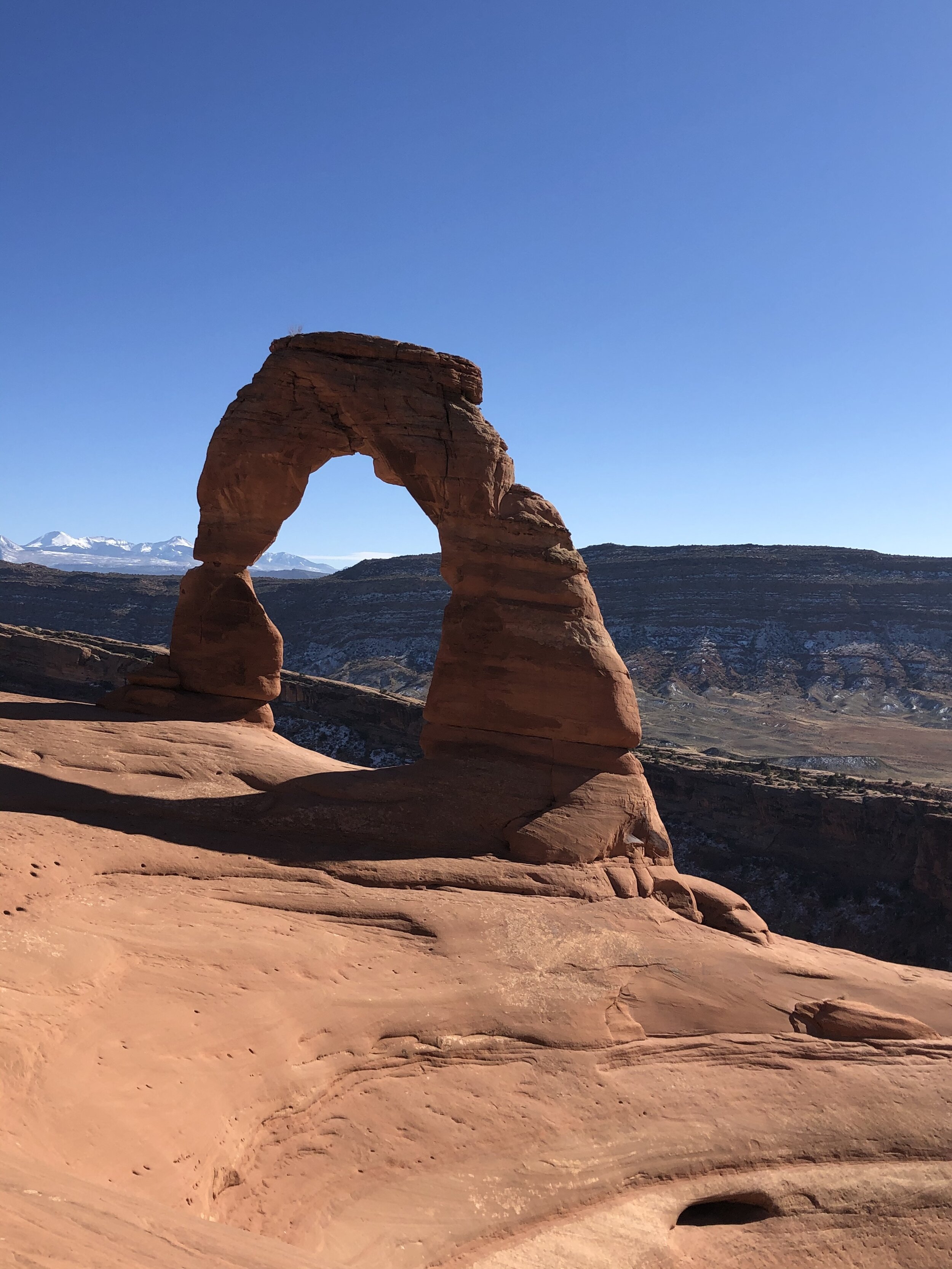
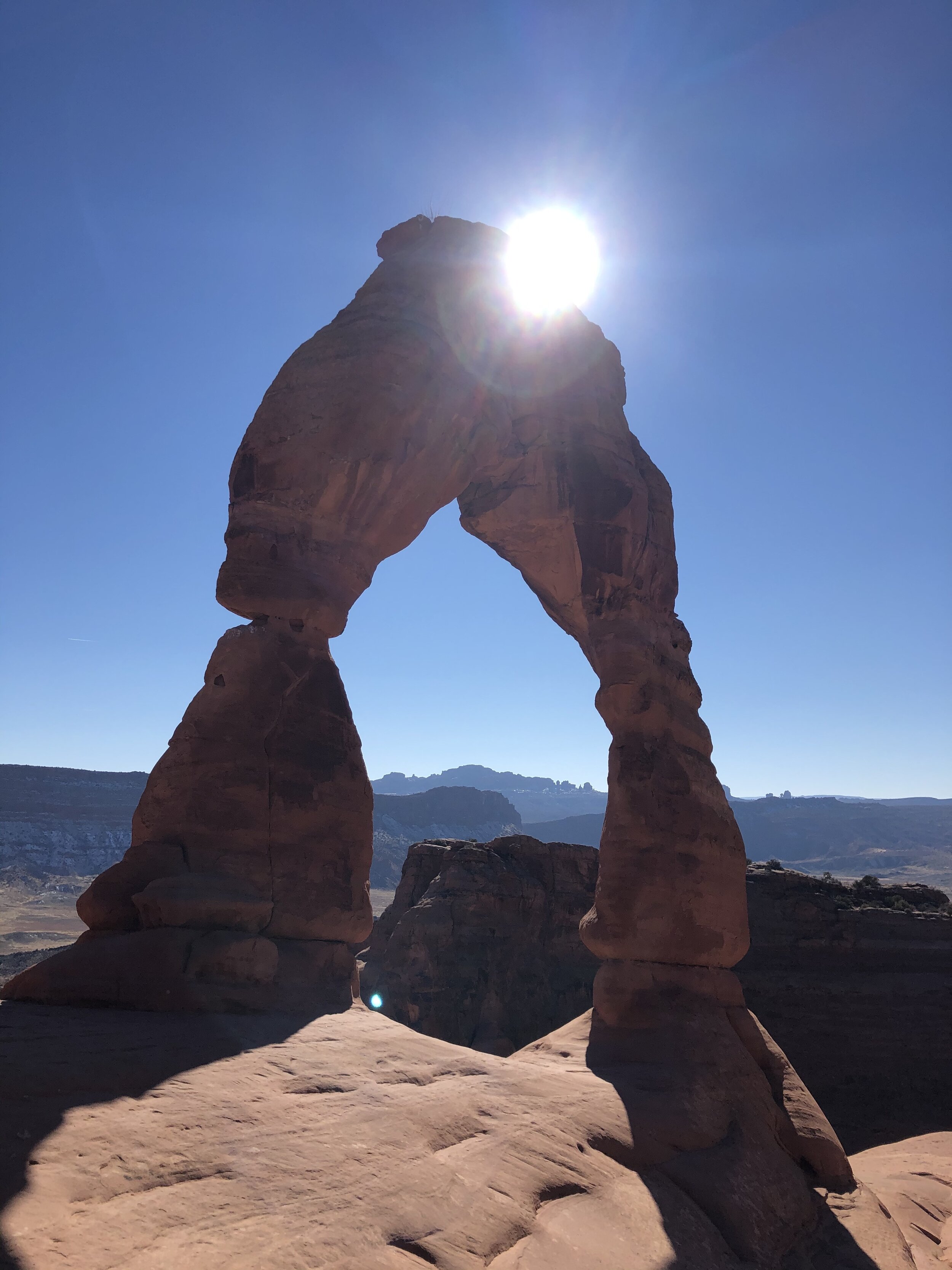
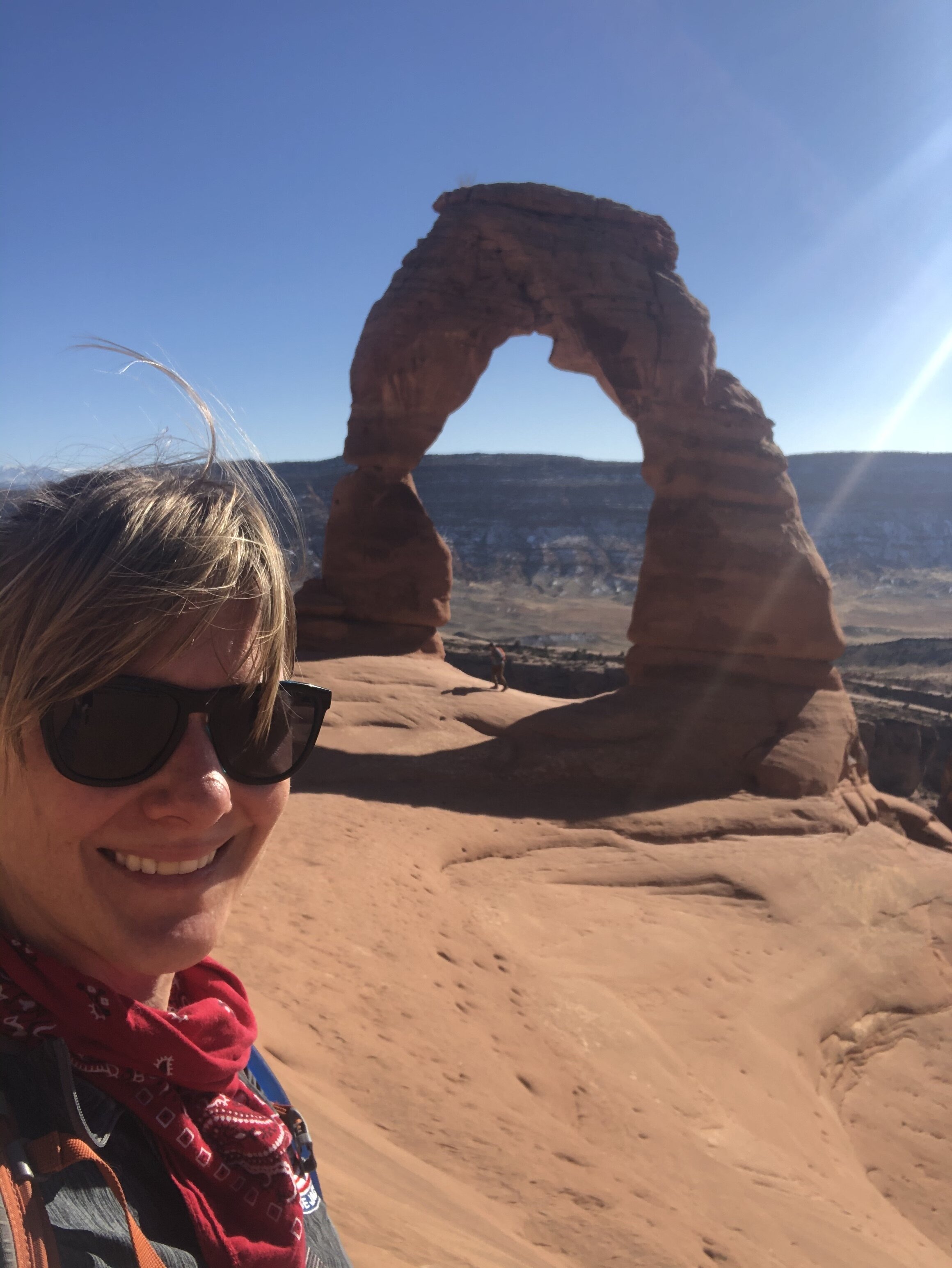
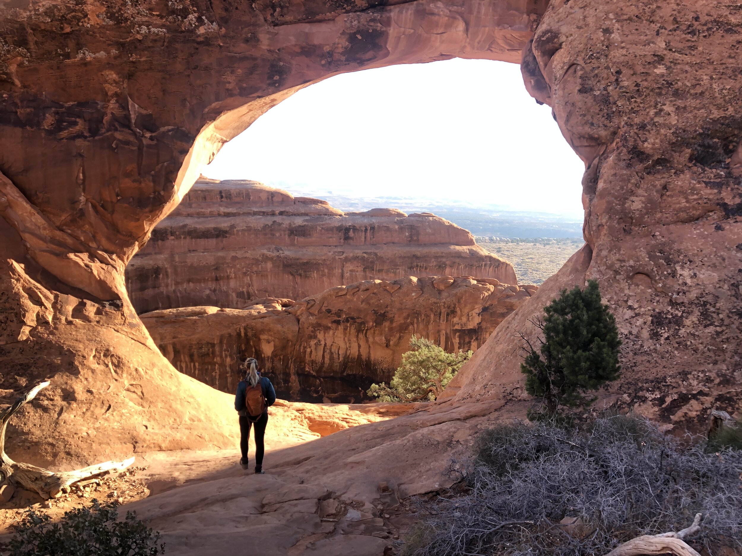
According to the Dirt in my Shoes itinerary, it's best to visit Delicate Arch first thing in the morning to beat the crowds. But, since the park (oddly) was not busy, I decided to check it out that afternoon.

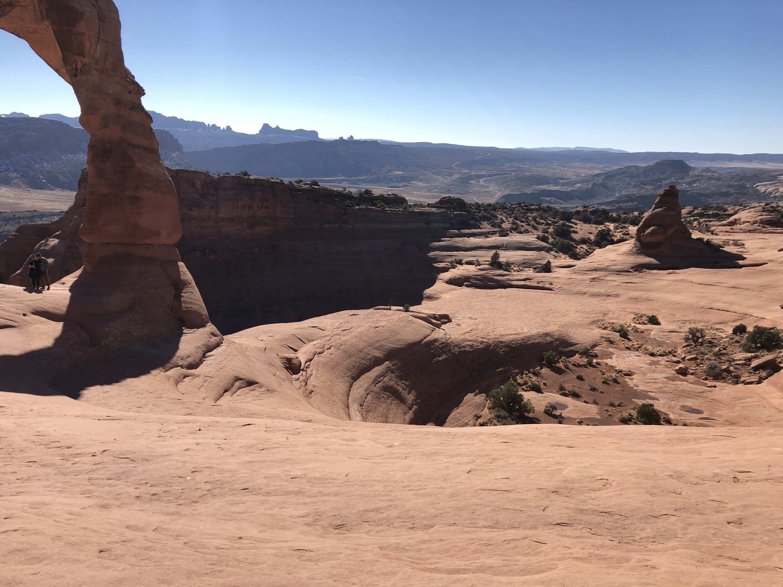
First, I drove to Upper Delicate Arch Viewpoint and Lower Delicate Arch Viewpoint - eh. Delicate Arch was still so far away, lacking the "wow" factor. The DA trail was only 3.5 miles, and the weather was cool - so cool that it would not be a problem to leave Addie in her comfy bed in the back seat of the car with the windows opened. She is so good. I also read that DA is best to visit in the late afternoon, so the timing was perfect.

I hustled on the trail, though. I hate leaving Addie. When I turned the corner to find the iconic Delicate Arch waiting for me, I was awestruck. It was breathtaking.

IMG_4254.jpg
IMG_0201.jpg
IMG_4474.jpg
IMG_8445.jpg
IMG_5917.jpg
IMG_6390.jpg
IMG_9963.jpg
IMG_4254.jpg IMG_0201.jpg IMG_4474.jpg IMG_8445.jpg IMG_5917.jpg IMG_6390.jpg IMG_9963.jpg

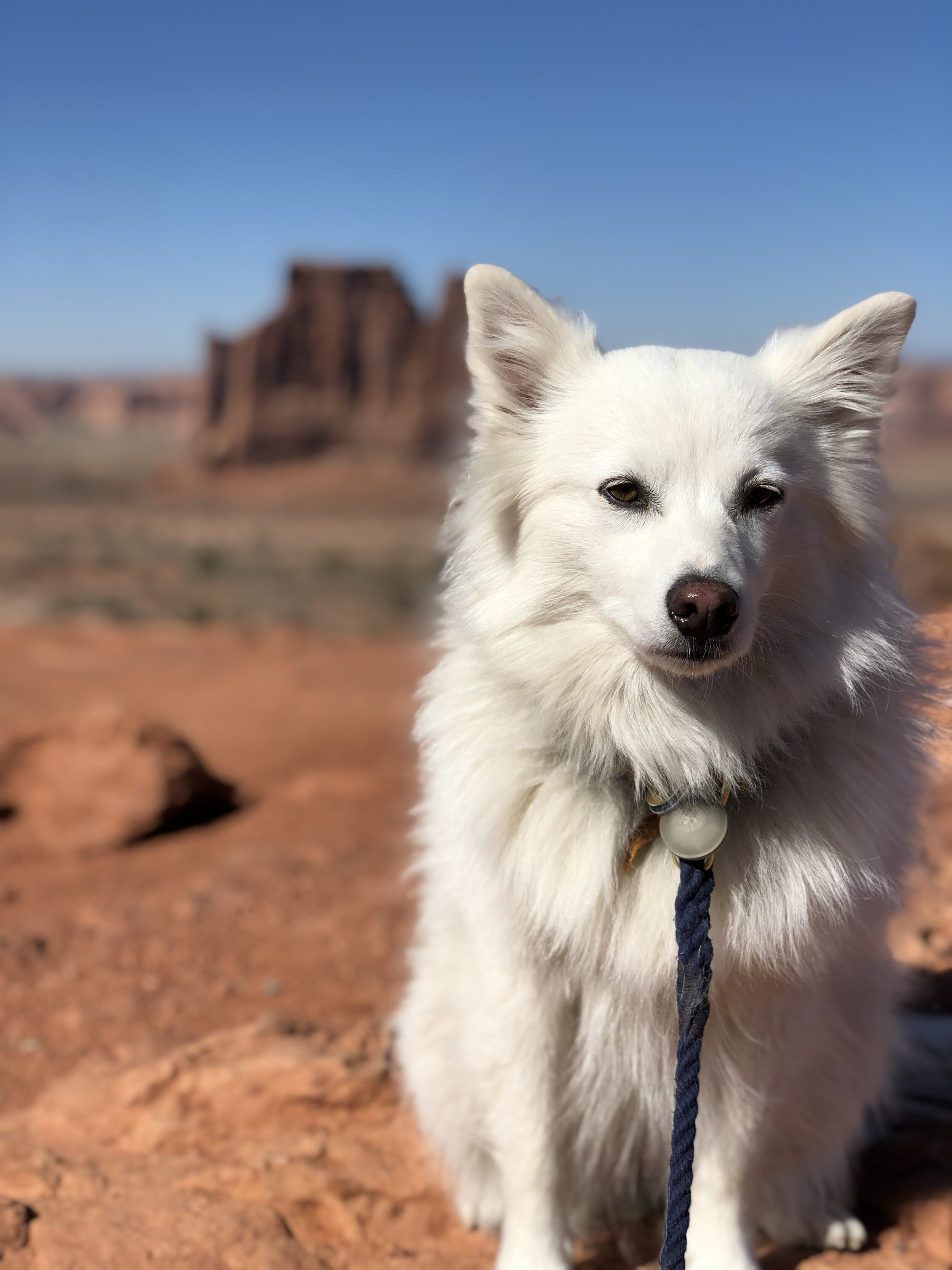
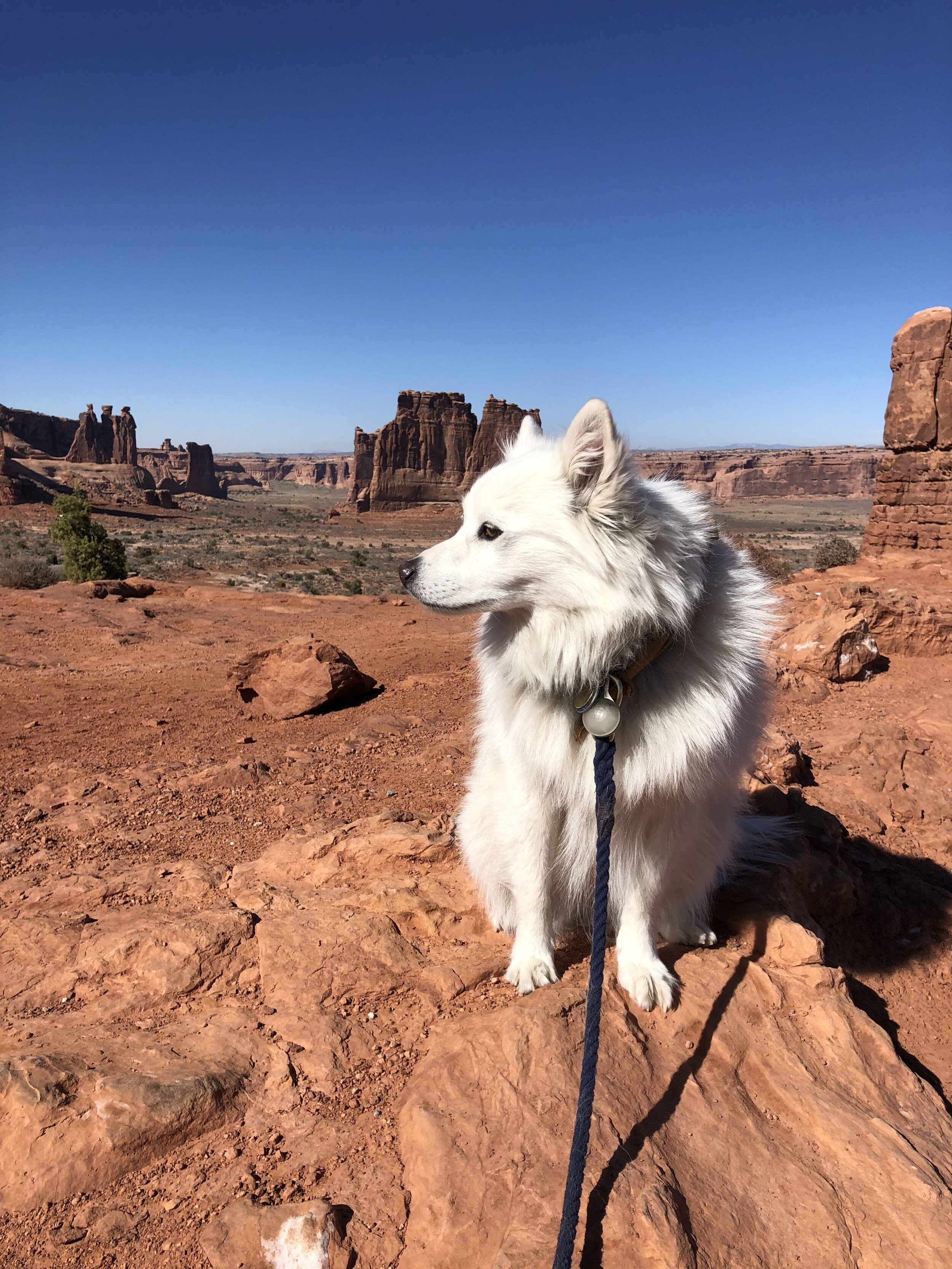
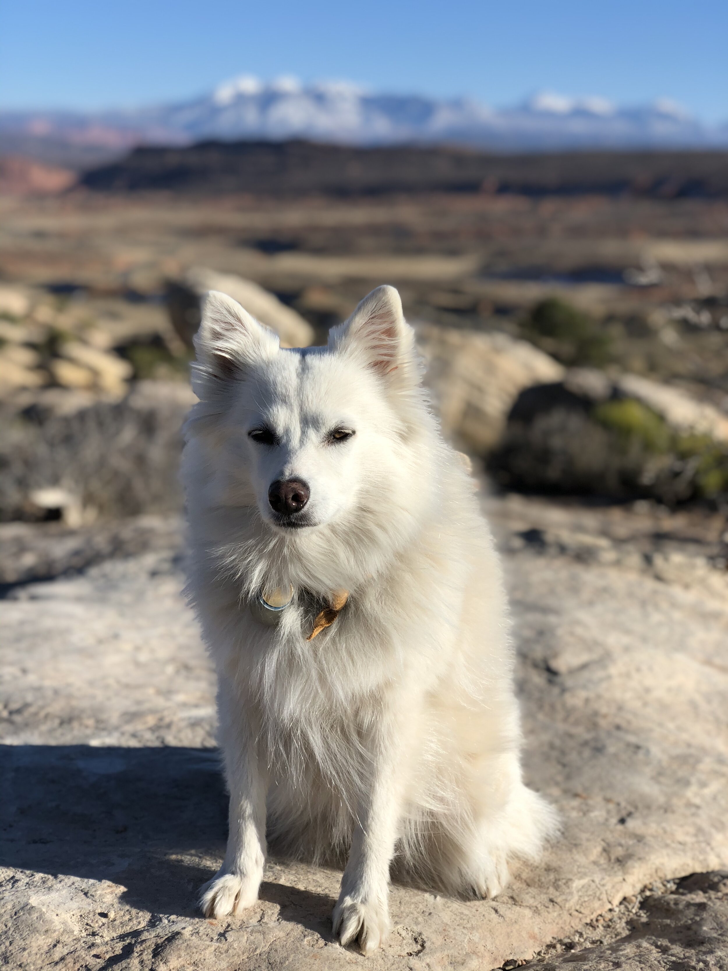
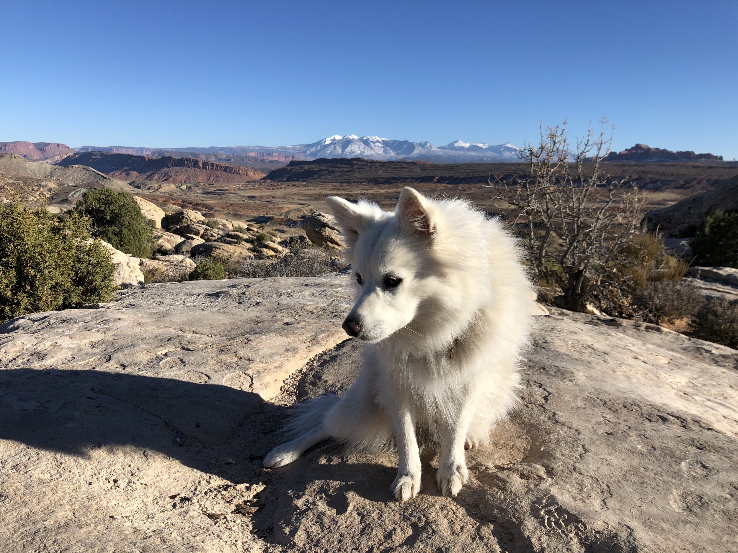
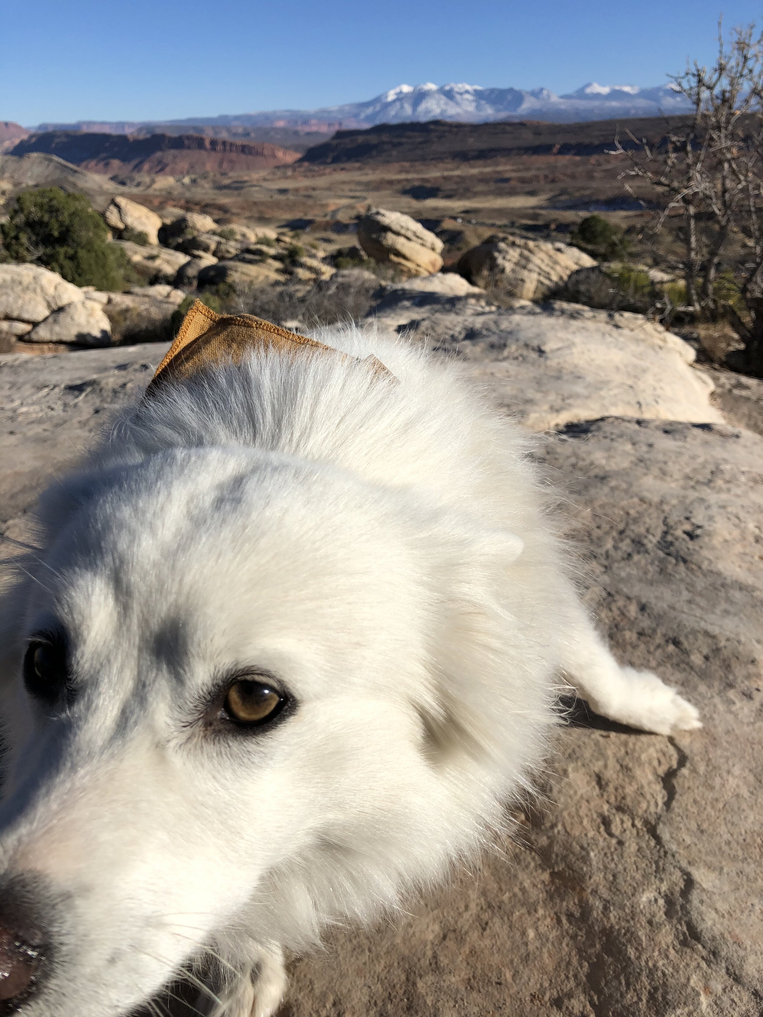
On the way back out of the park, we stopped at a few more overlooks. Beauty everywhere. Including fluffy white beauty.

IMG_2223.jpg
IMG_0887.jpg
IMG_9464.jpg
IMG_1924.jpg
IMG_2126.jpg
IMG_5637.jpg
IMG_8019.jpg
IMG_8058.jpg
IMG_9193.jpg
IMG_9654.jpg
IMG_2223.jpg IMG_0887.jpg IMG_9464.jpg IMG_1924.jpg IMG_2126.jpg IMG_5637.jpg IMG_8019.jpg IMG_8058.jpg IMG_9193.jpg IMG_9654.jpg

Arches - Day 2:

I got an early start the following morning. Even though the park wasn’t busy the last few days, I was still playing it safe by getting to the park early. I packed up, left the campsite, dropped Addie off at her sitter, and drove to the most northern end of Arches National Park. Double O Arch hike was first on the agenda for today. 

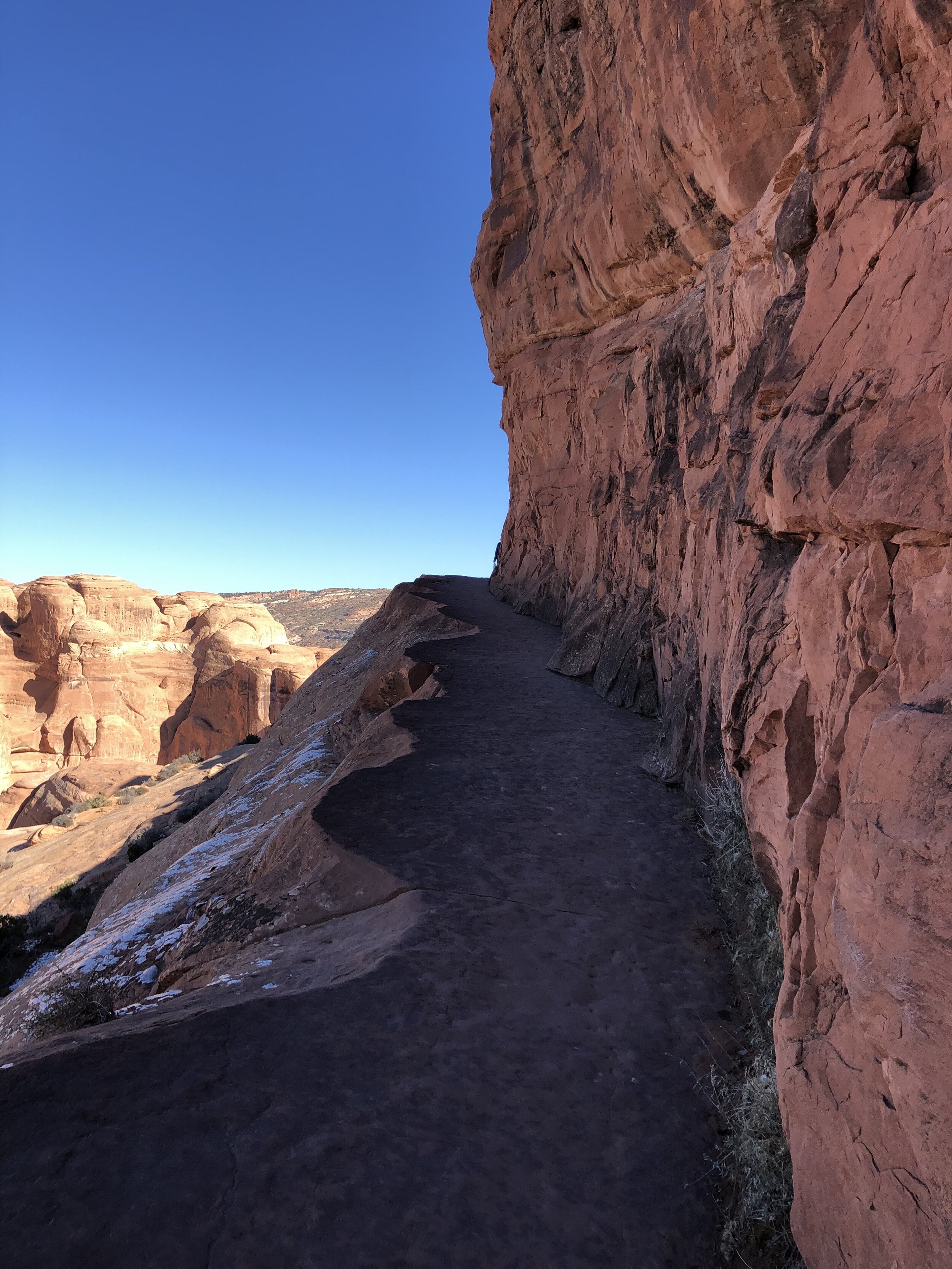
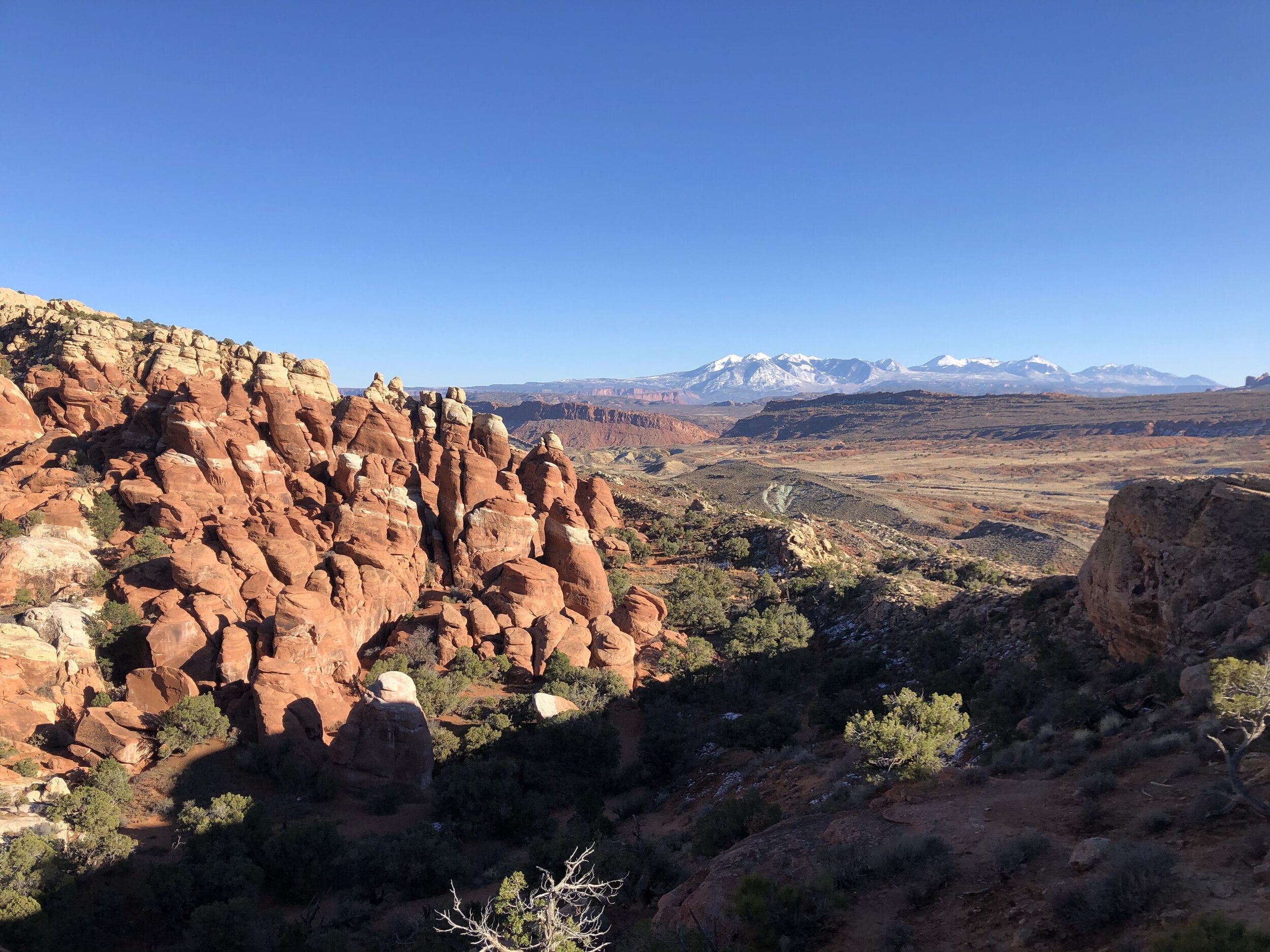
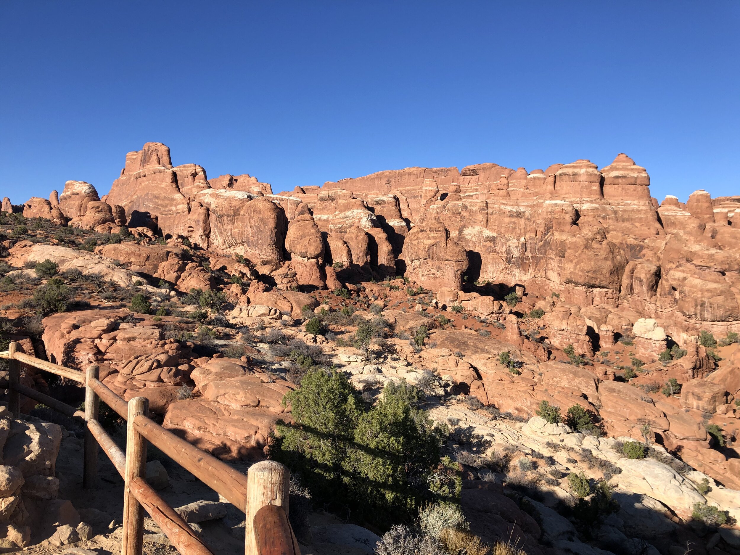
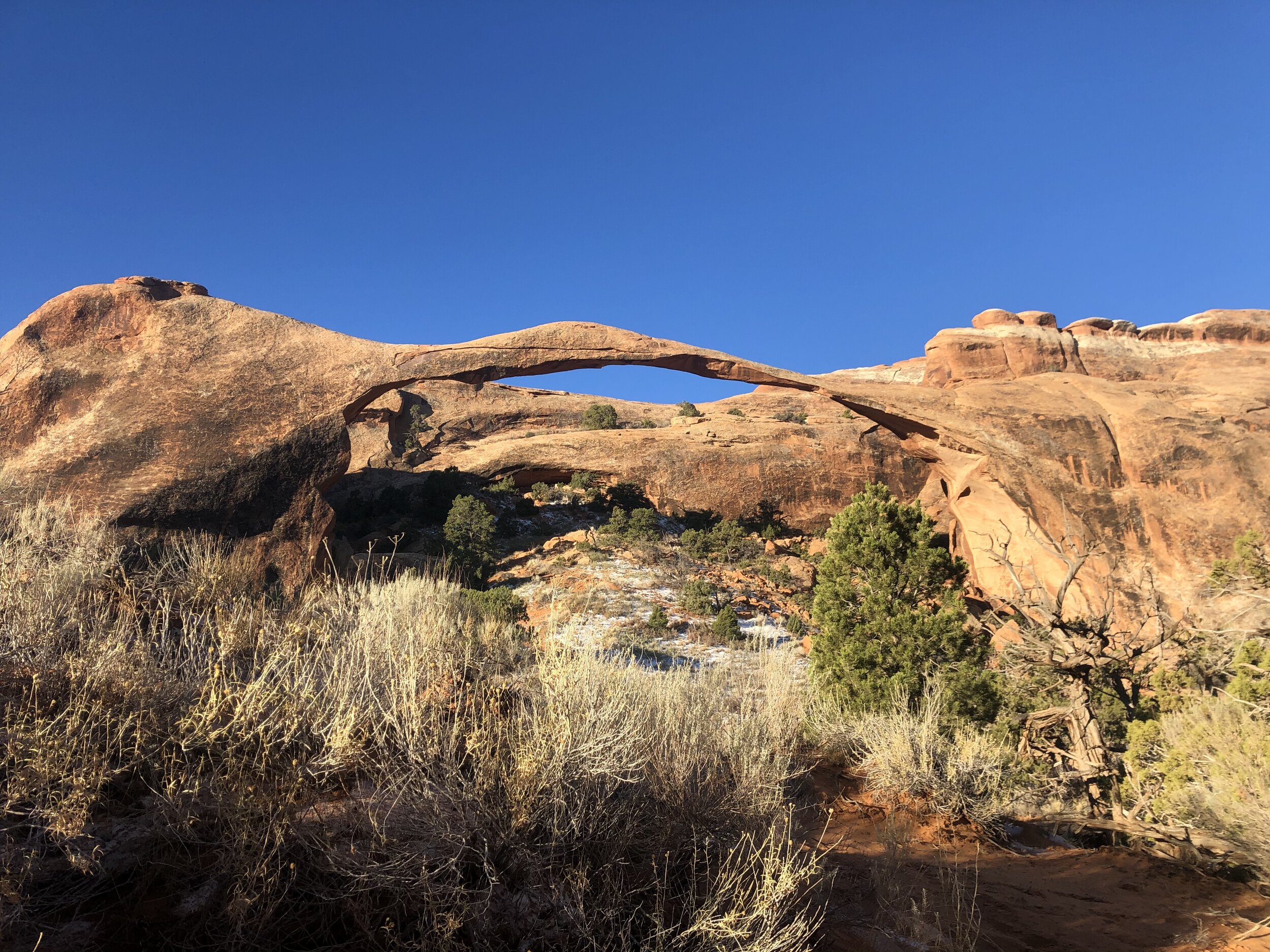
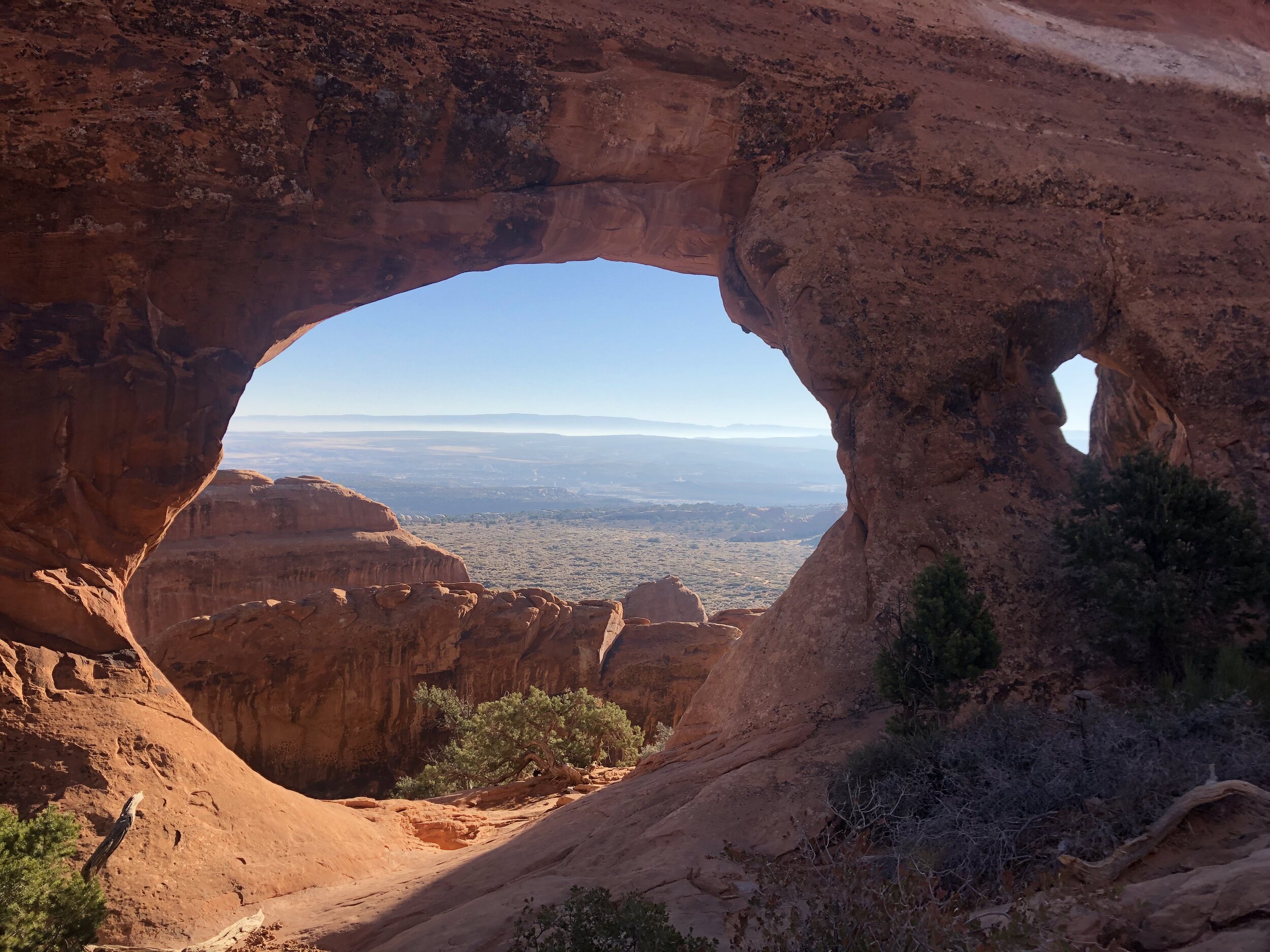
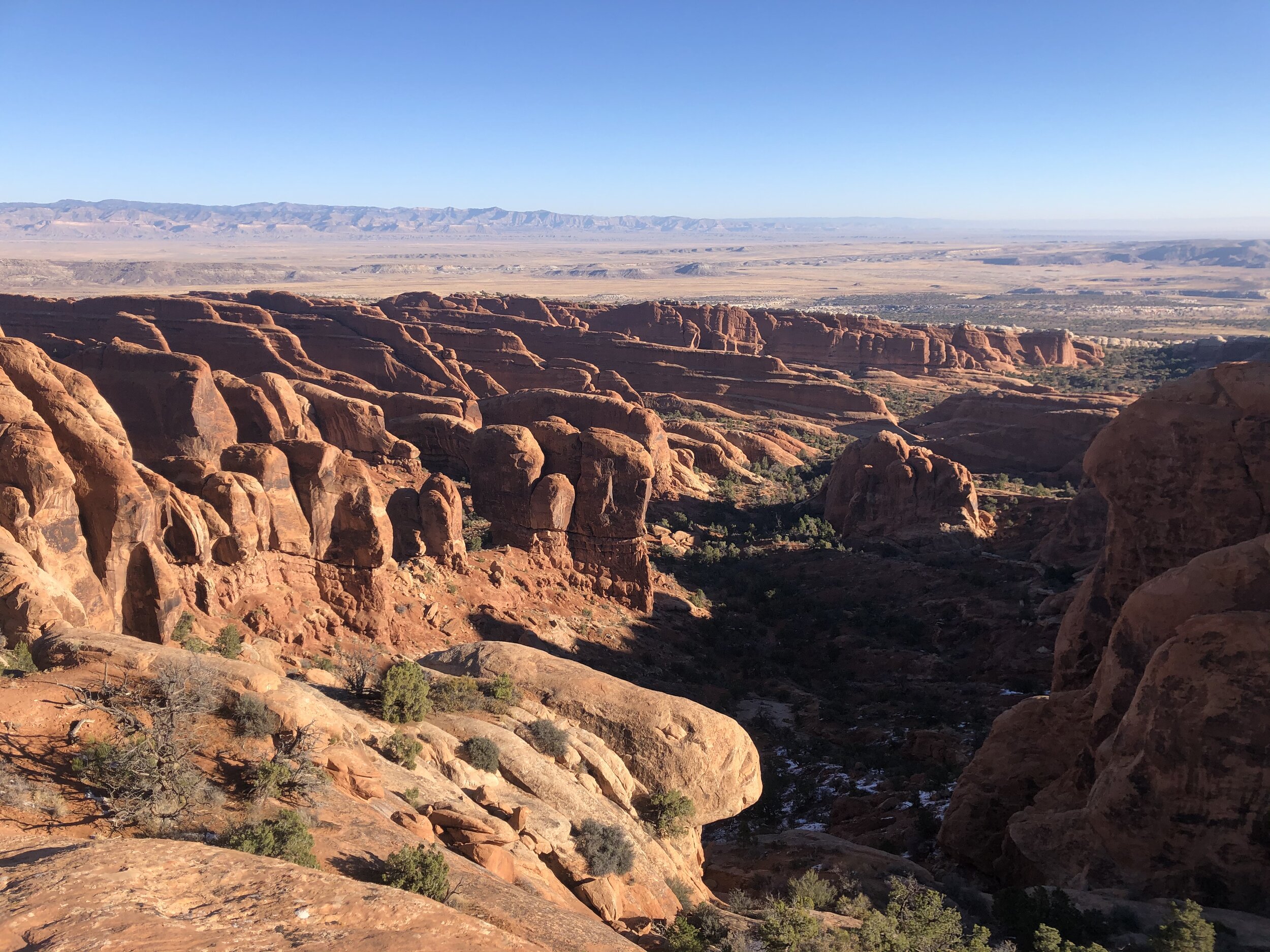
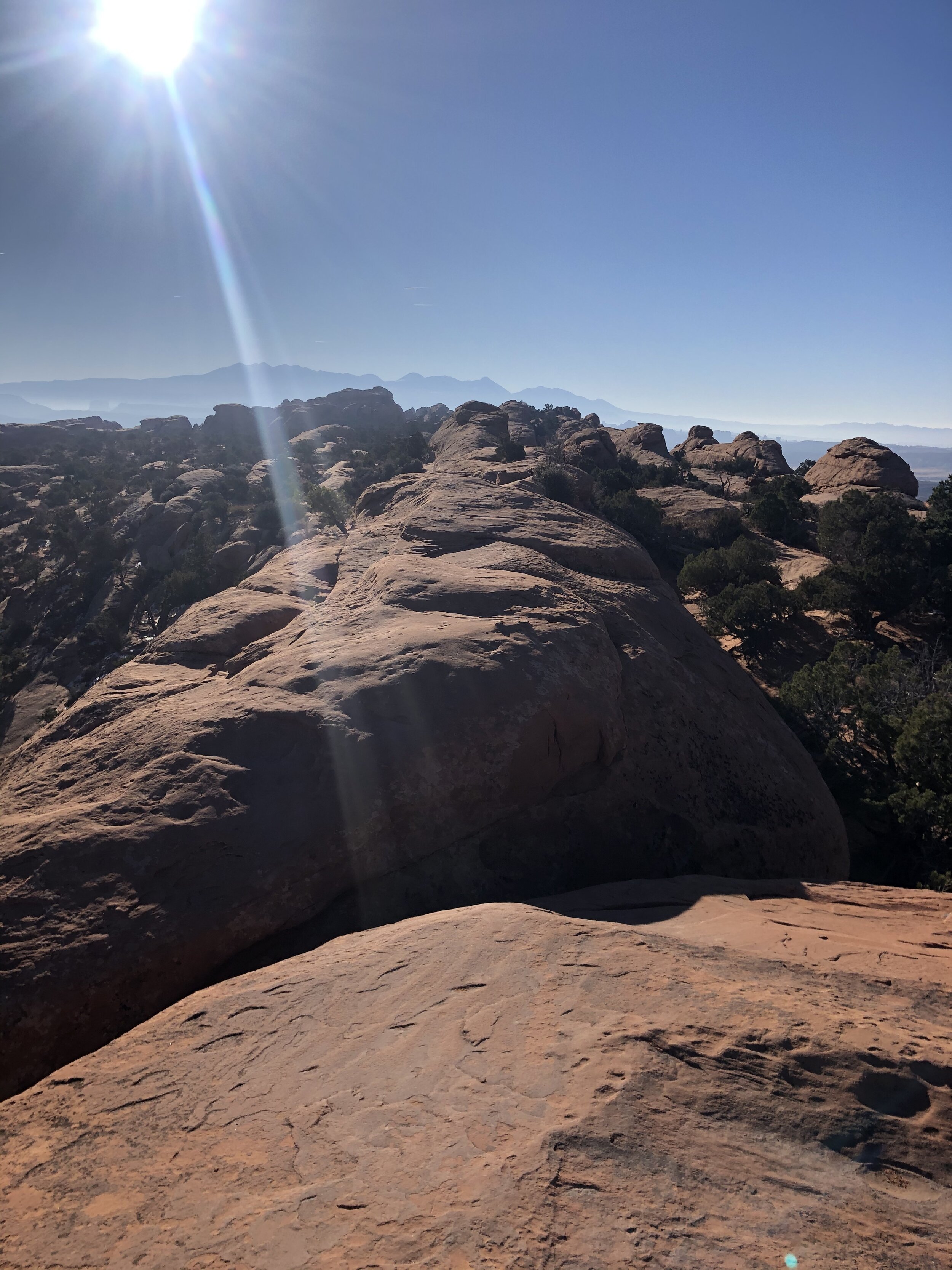
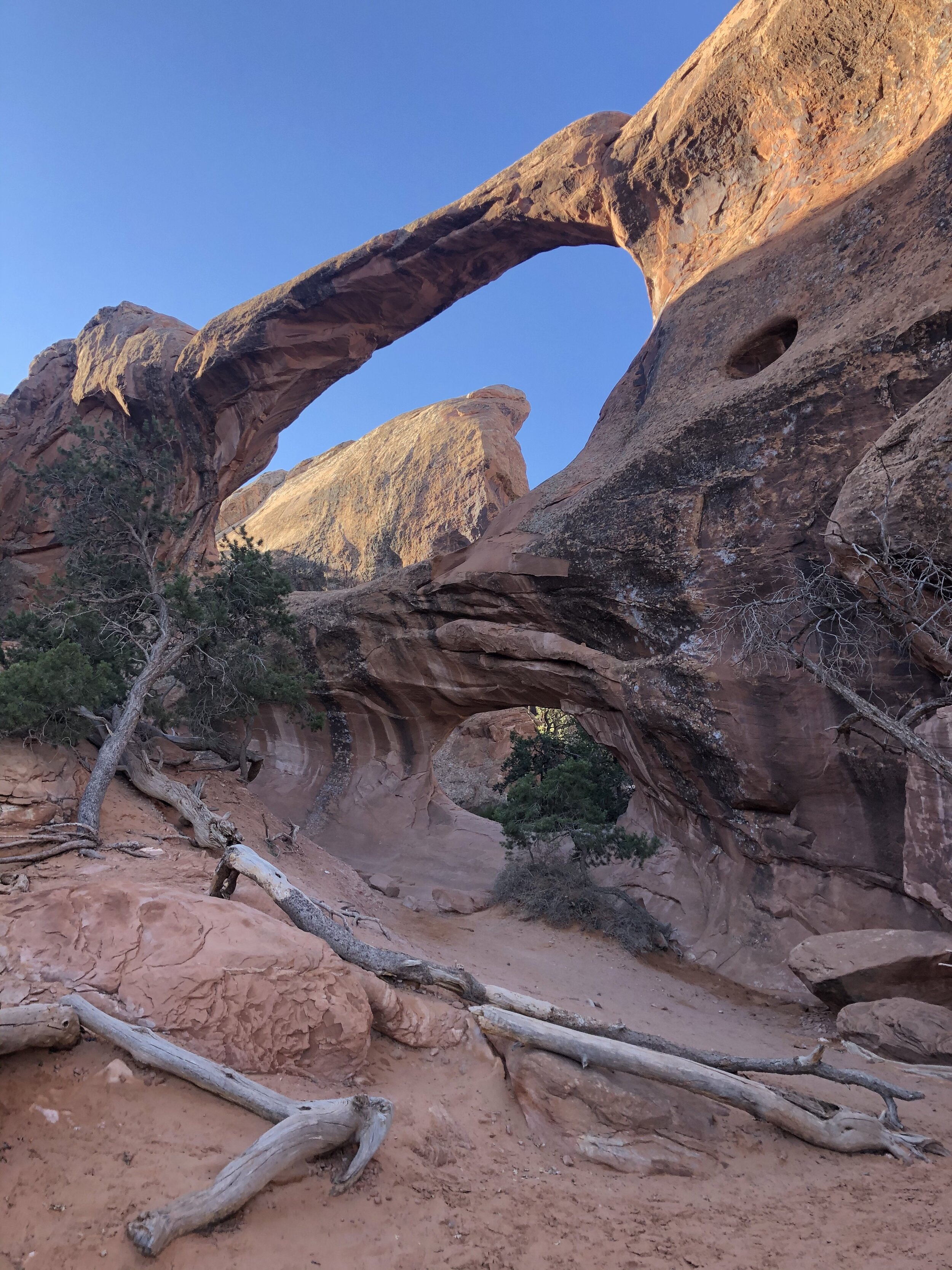
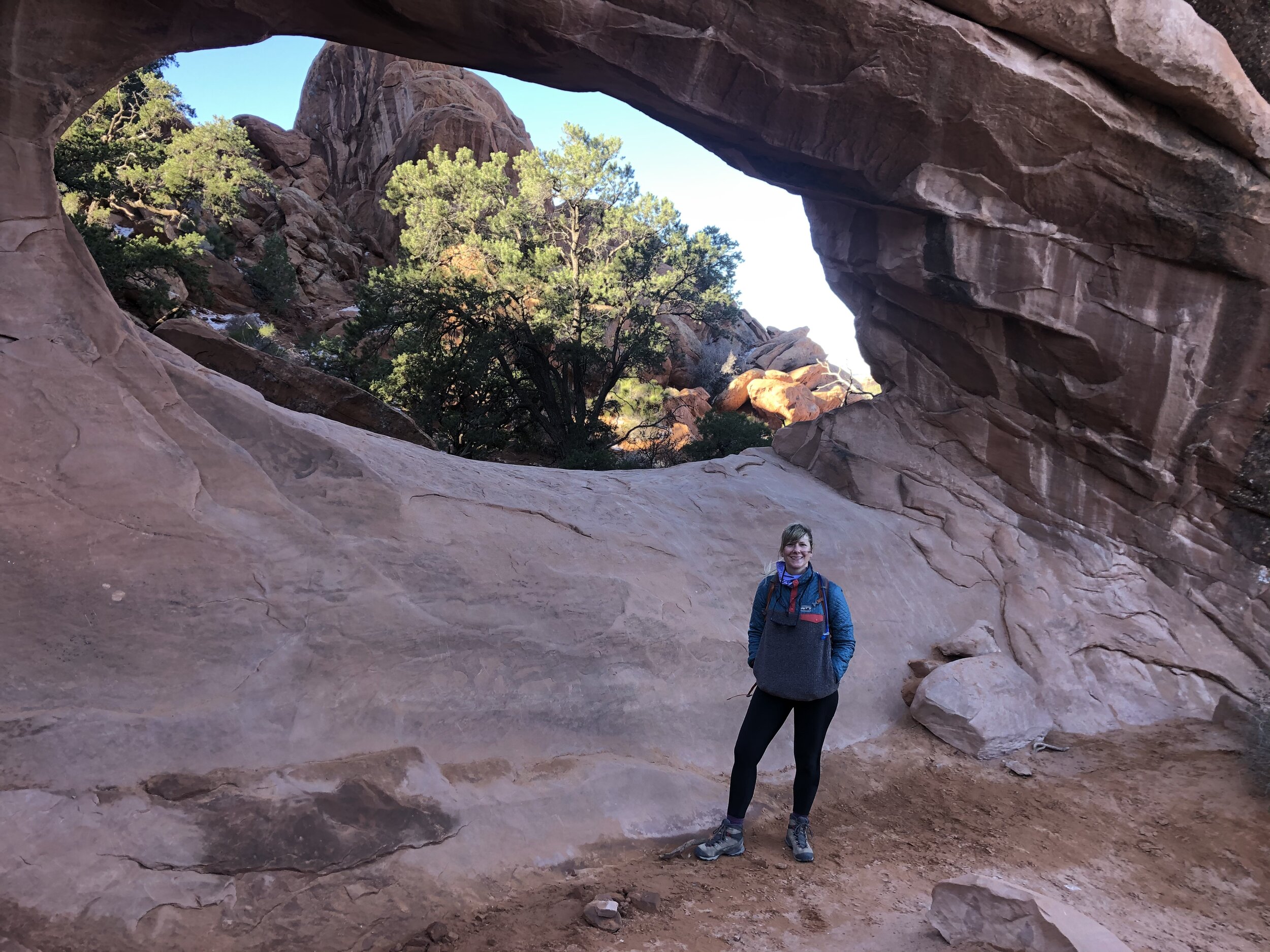
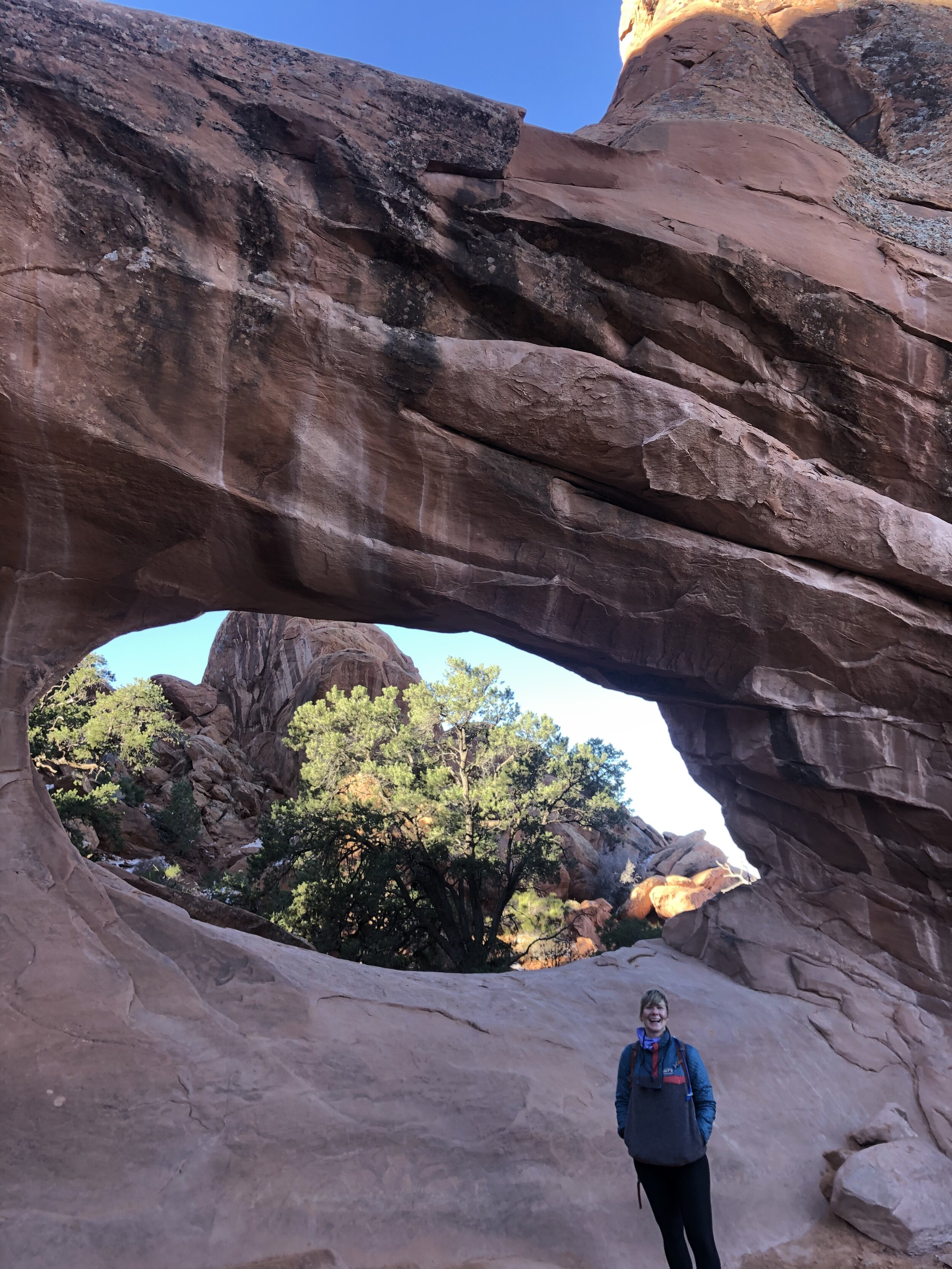
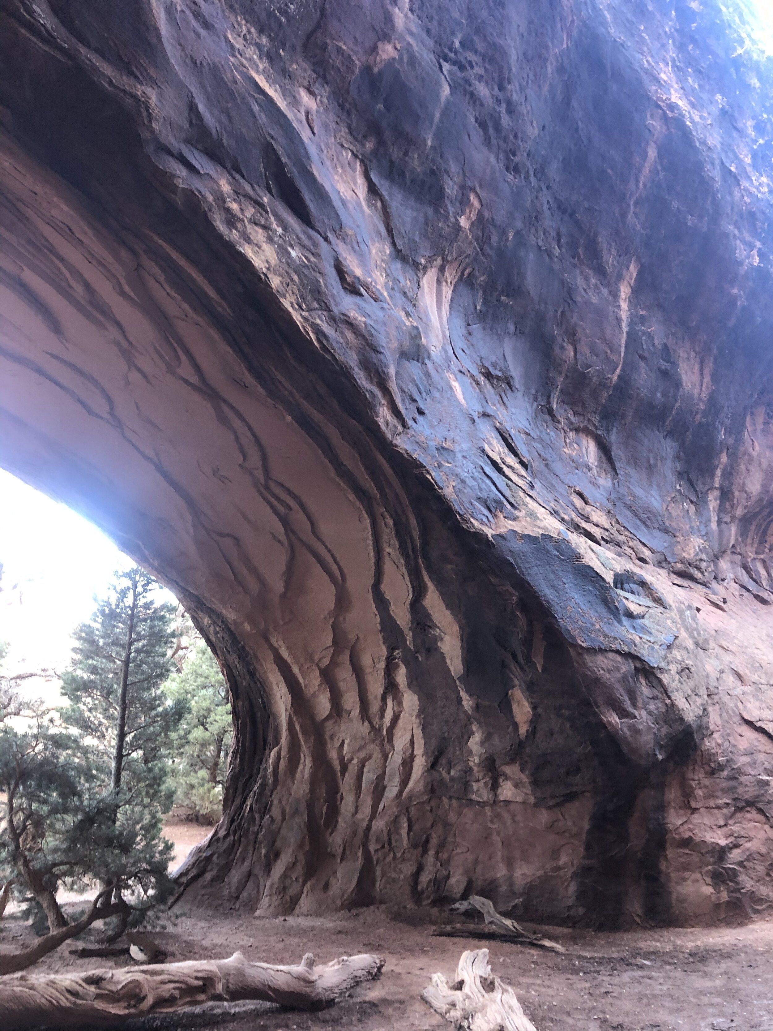
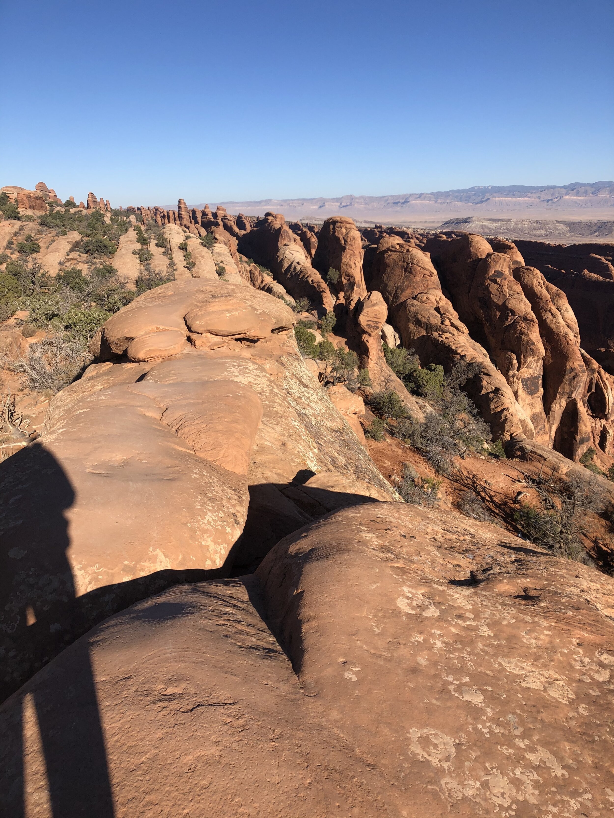
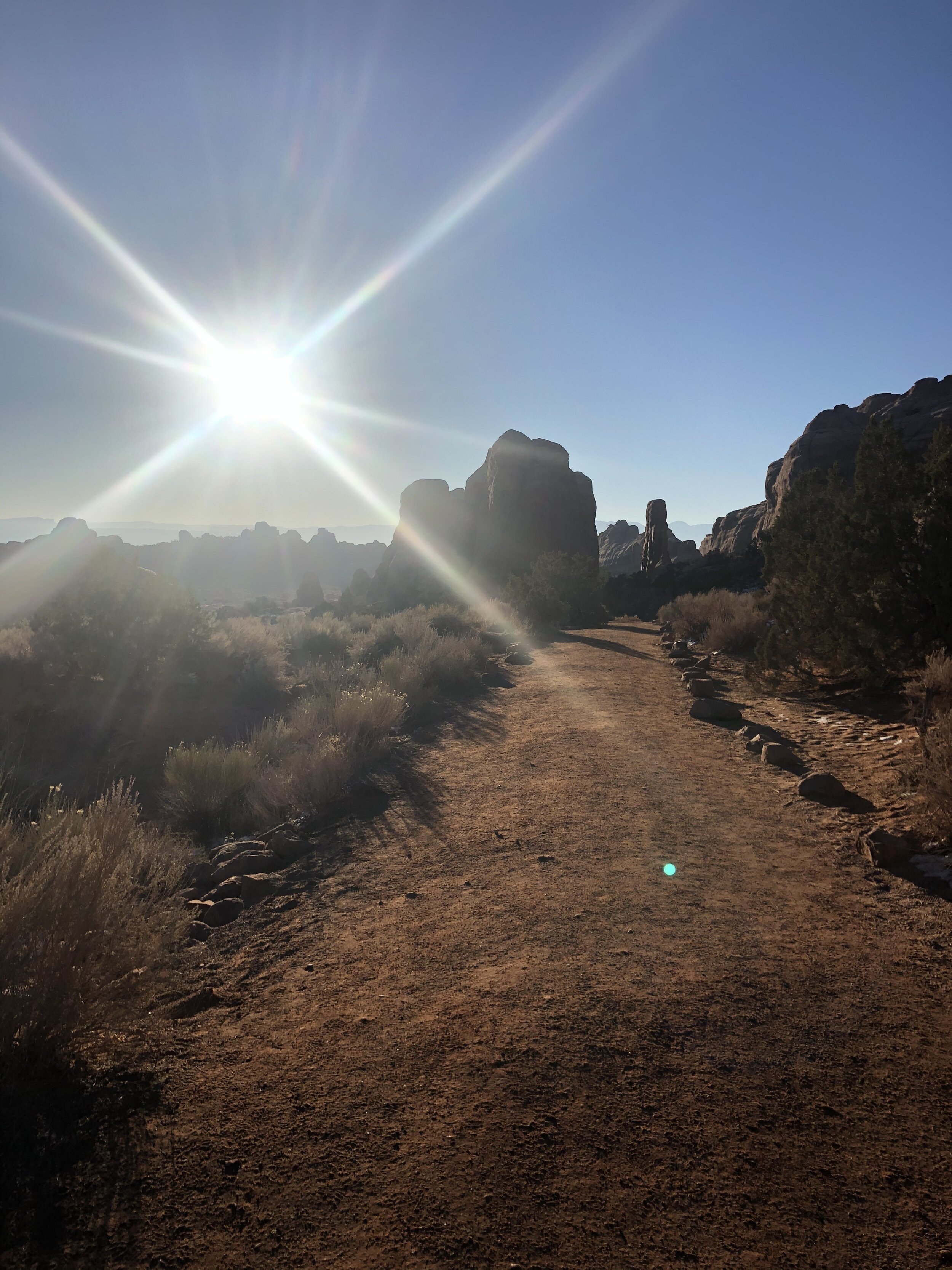
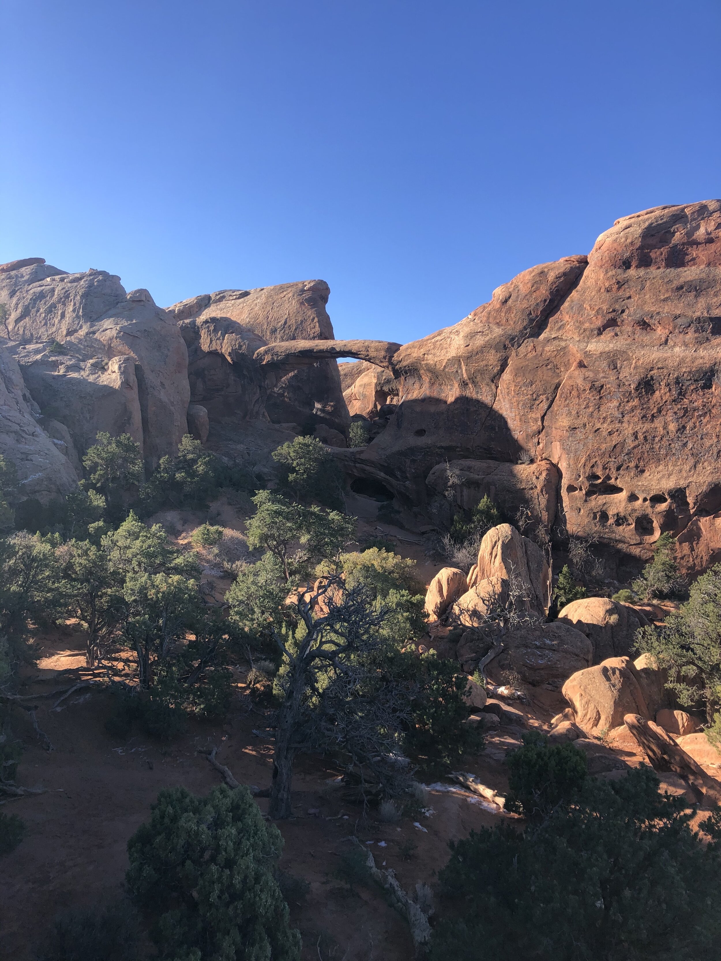
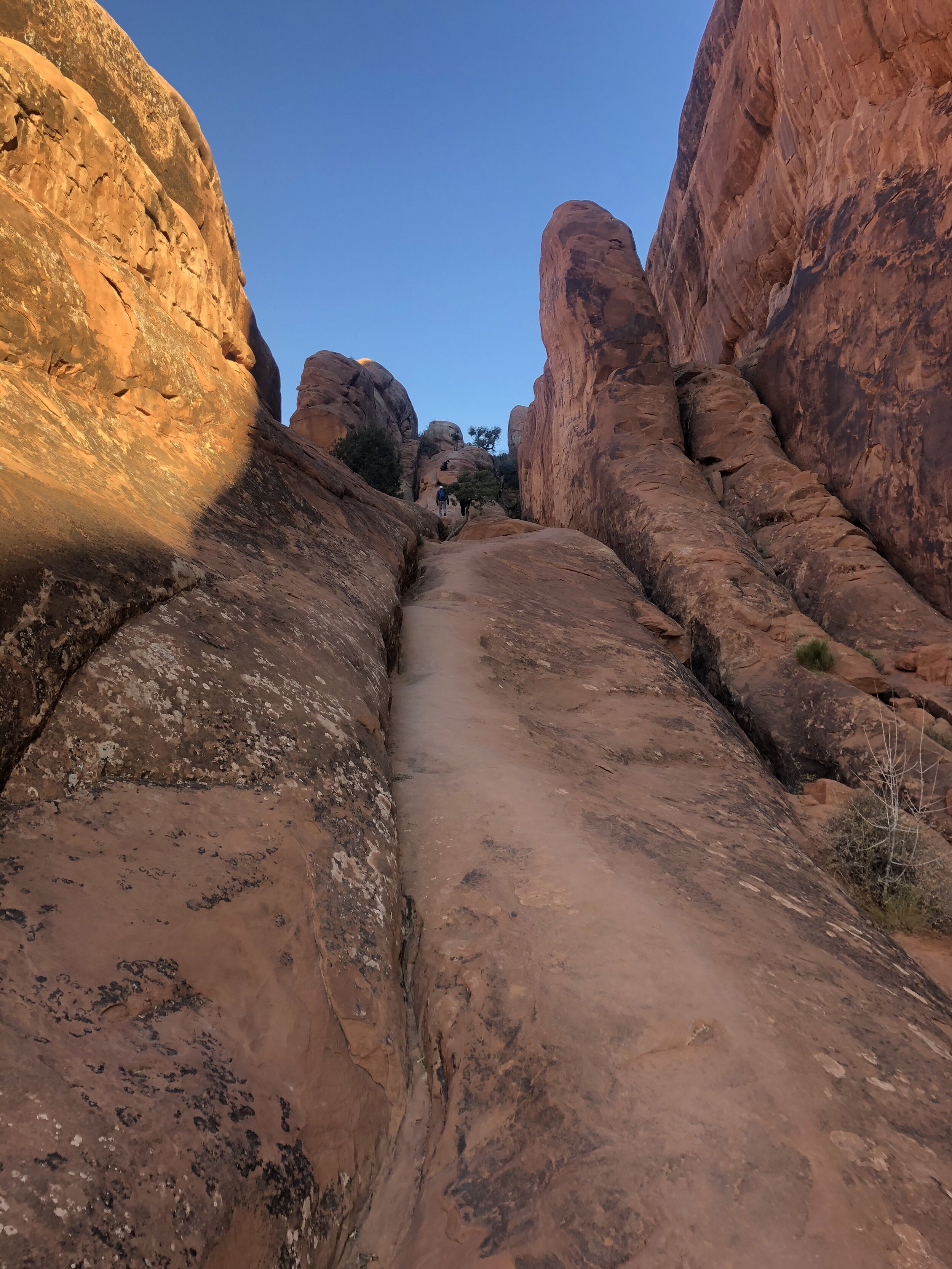
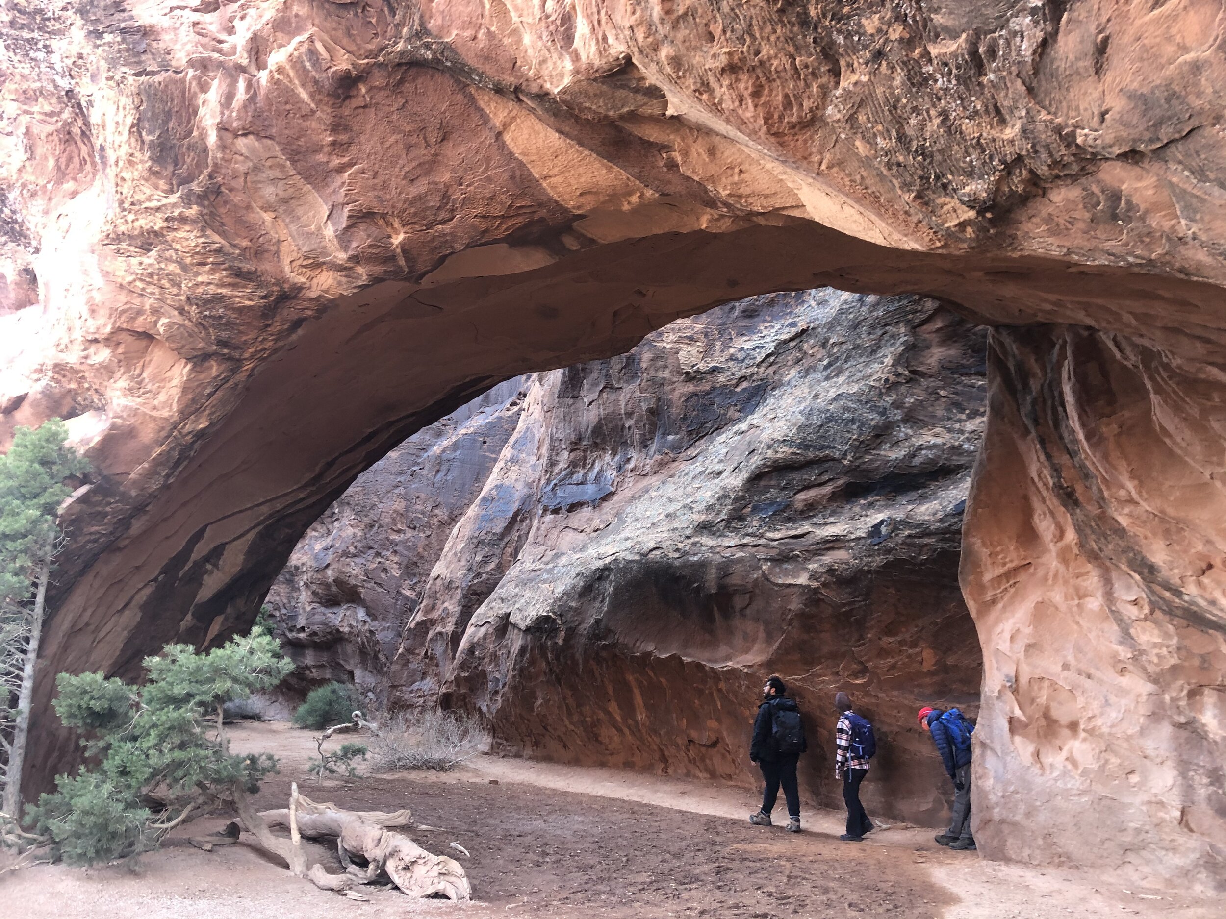
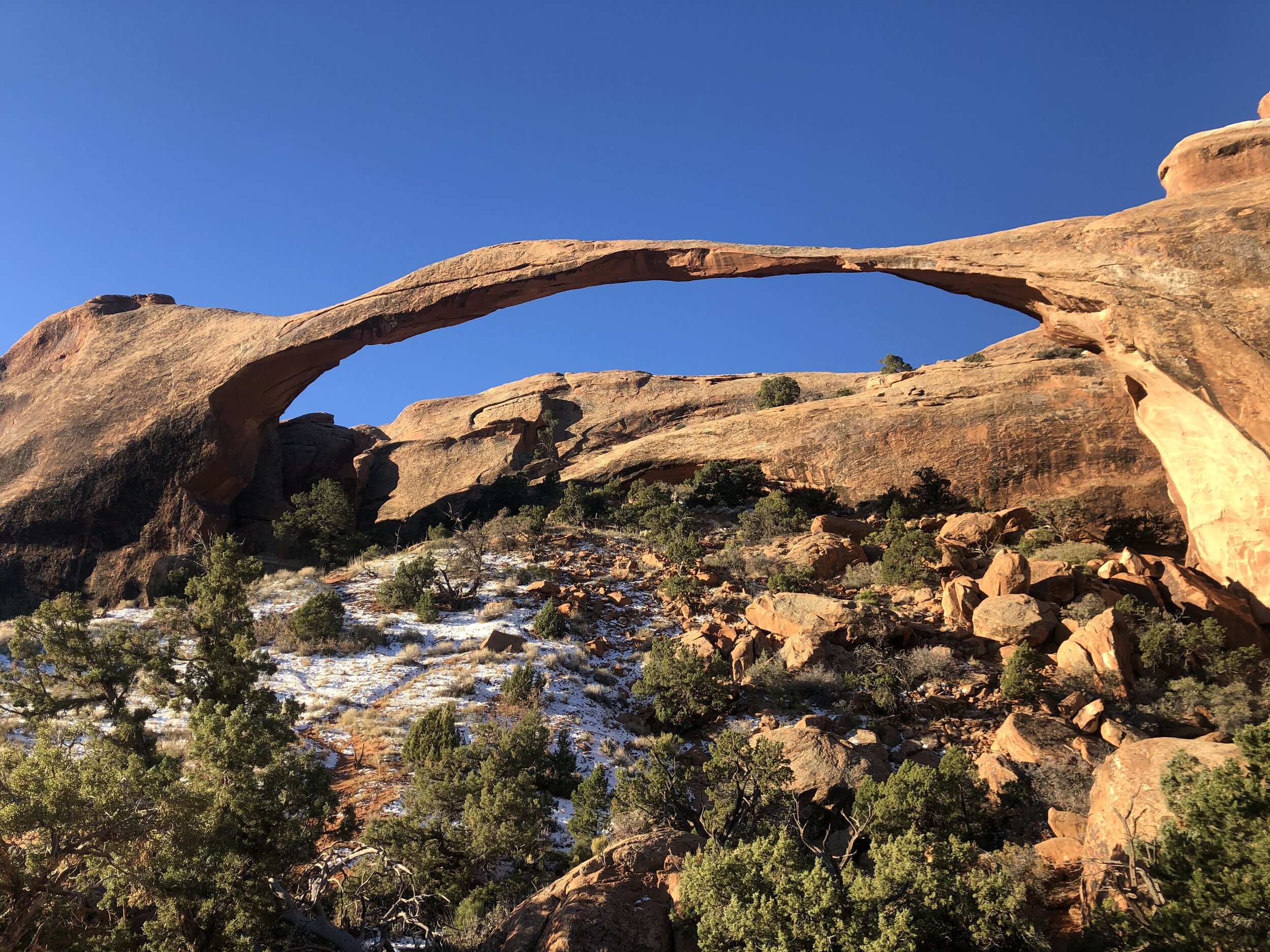
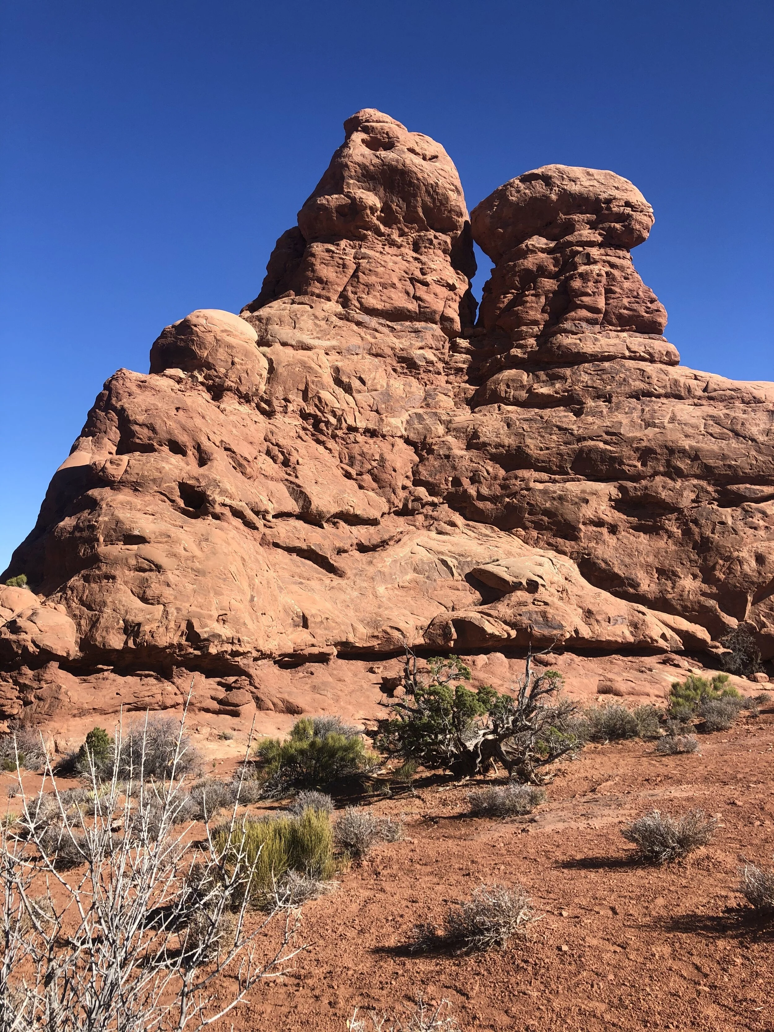
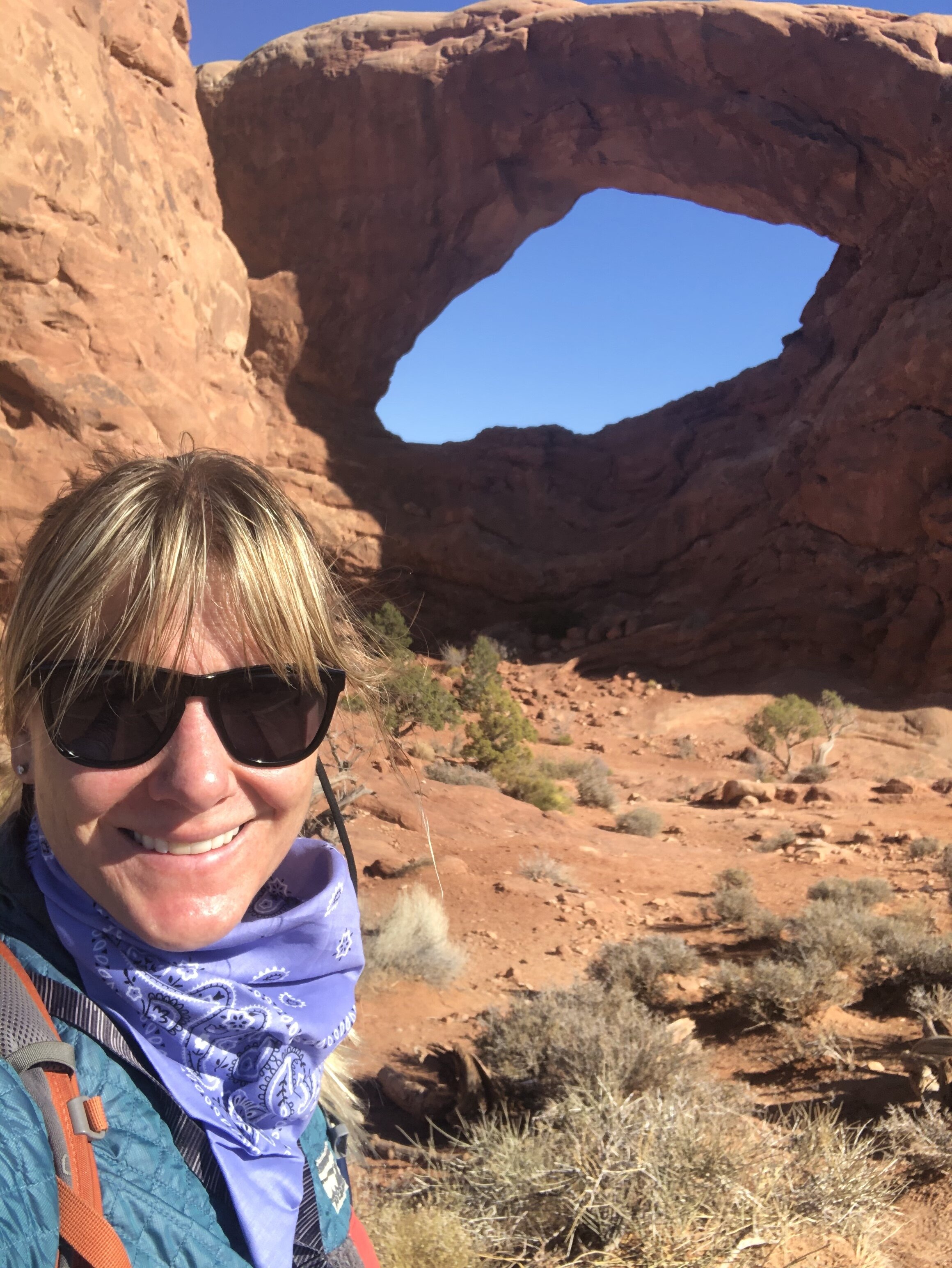
I hit the trail by 8 am. Once again, it was cold, but it got warmer as I continued moving. This trail had so many arches, including Landscape, Navajo, and Partition Arches. The final and farthest arch to see was the Double O Arch. At times the trail was ambiguous, but I found it with the help of a few hiking buddies I met along the way.

IMG_2068.jpg
IMG_2367.jpg
IMG_0532.jpg
IMG_0807.jpg
IMG_3057.jpg
IMG_4117.jpg
IMG_4338.jpg
IMG_4560.jpg
IMG_5150.jpg
IMG_5379.jpg
IMG_6226.jpg
IMG_6548.jpg
IMG_7352.jpg
IMG_7711.jpg
IMG_9705.jpg
IMG_9740.jpg
IMG_2068.jpg IMG_2367.jpg IMG_0532.jpg IMG_0807.jpg IMG_3057.jpg IMG_4117.jpg IMG_4338.jpg IMG_4560.jpg IMG_5150.jpg IMG_5379.jpg IMG_6226.jpg IMG_6548.jpg IMG_7352.jpg IMG_7711.jpg IMG_9705.jpg IMG_9740.jpg

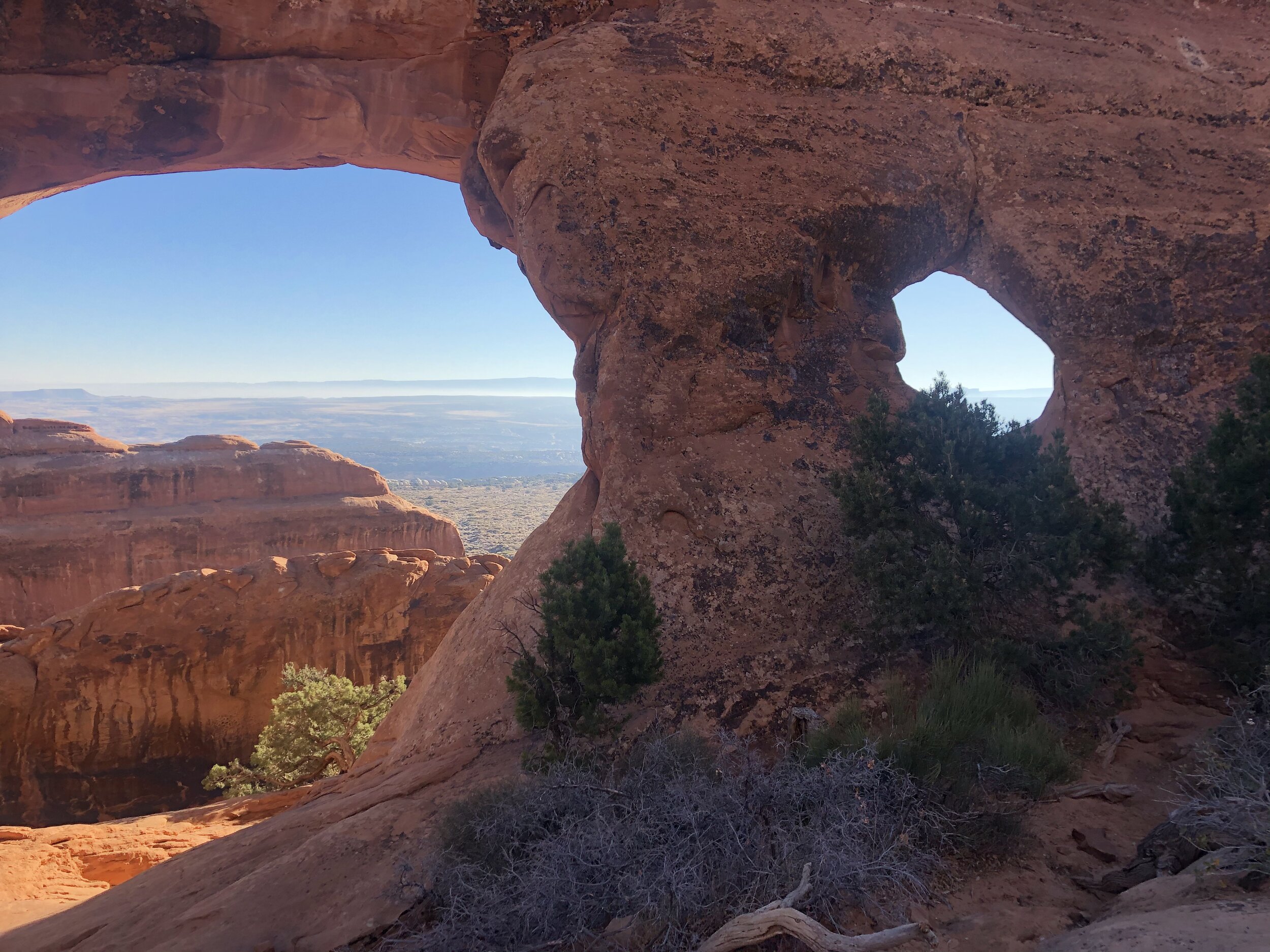
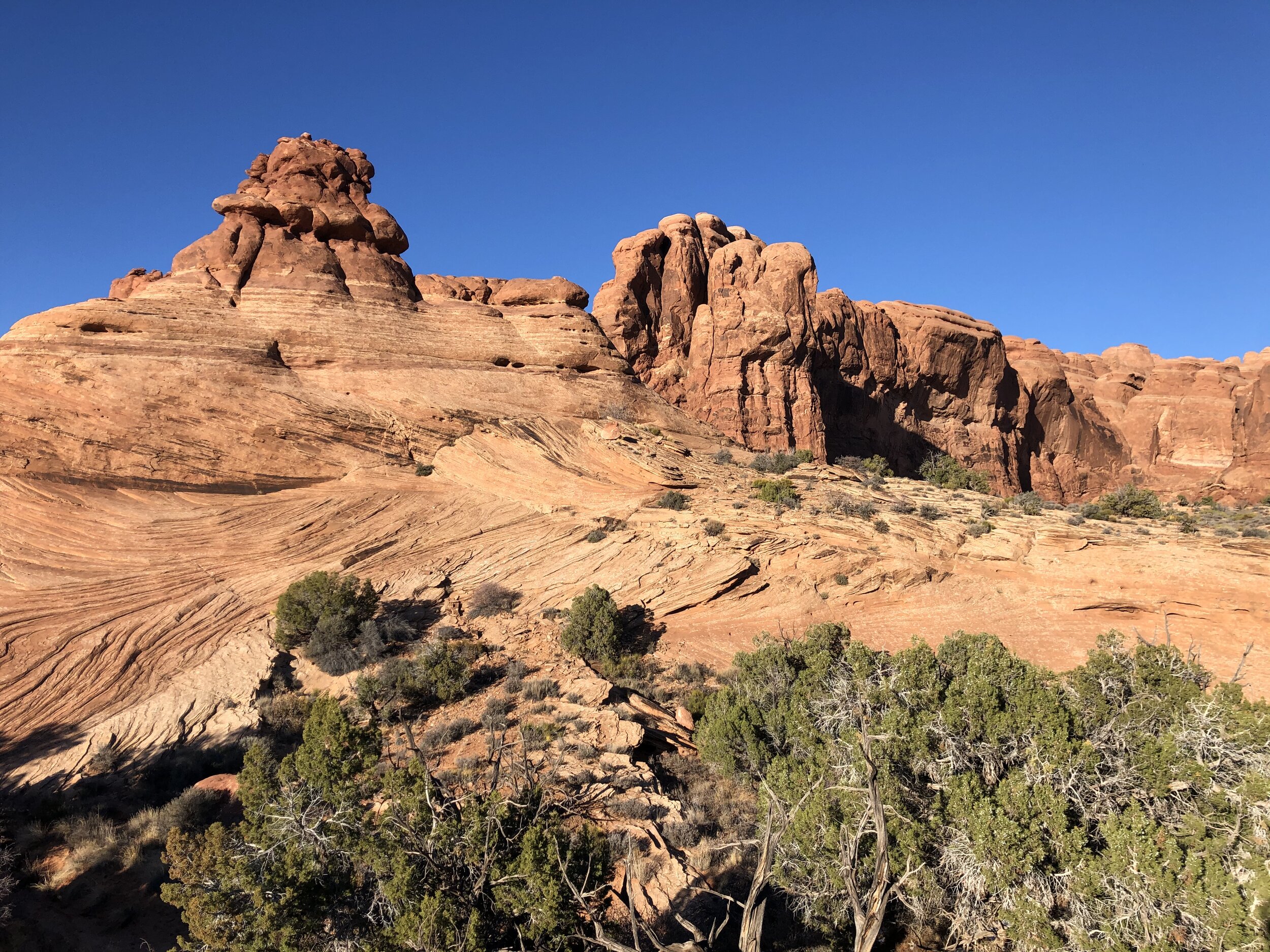
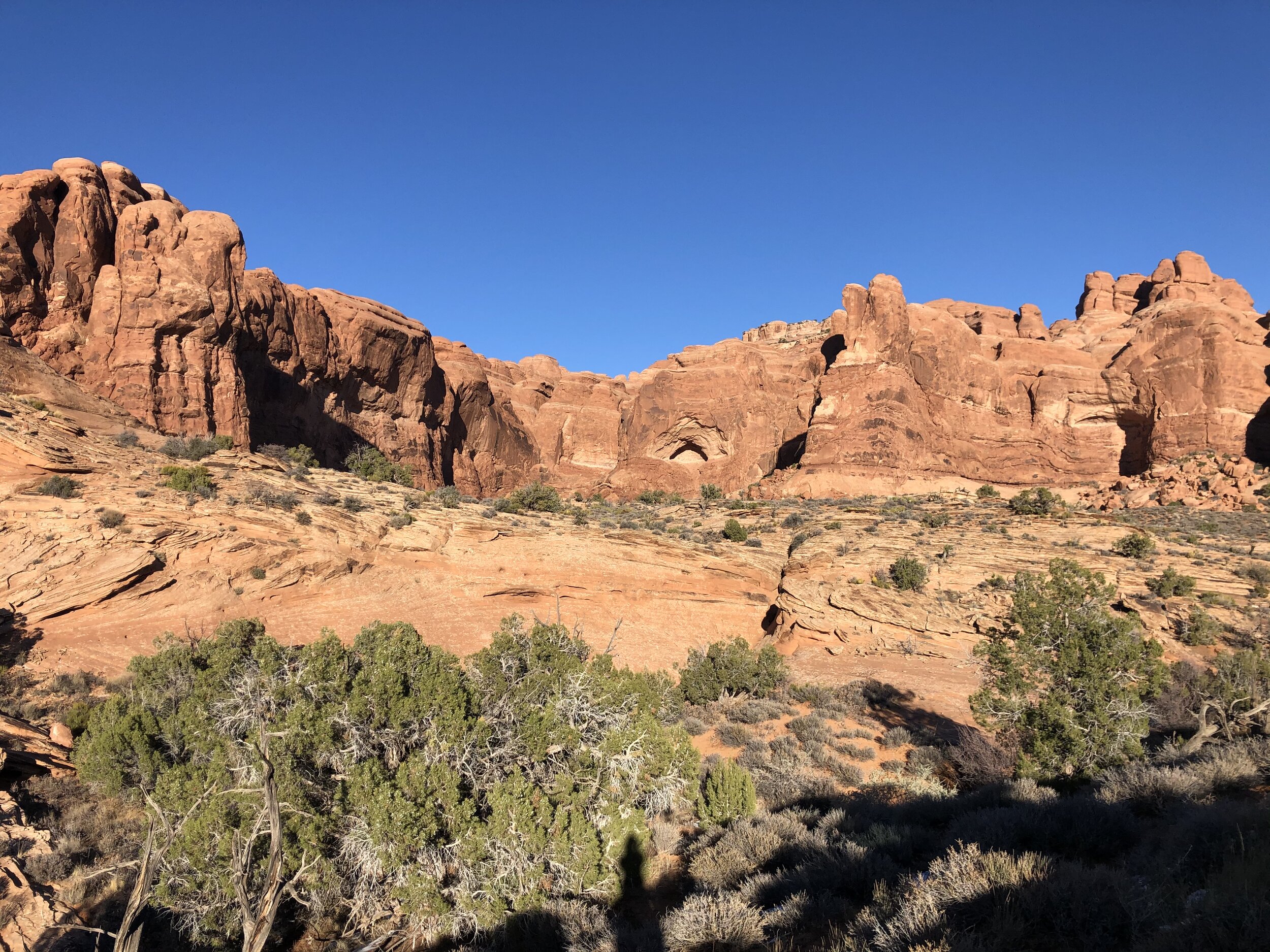
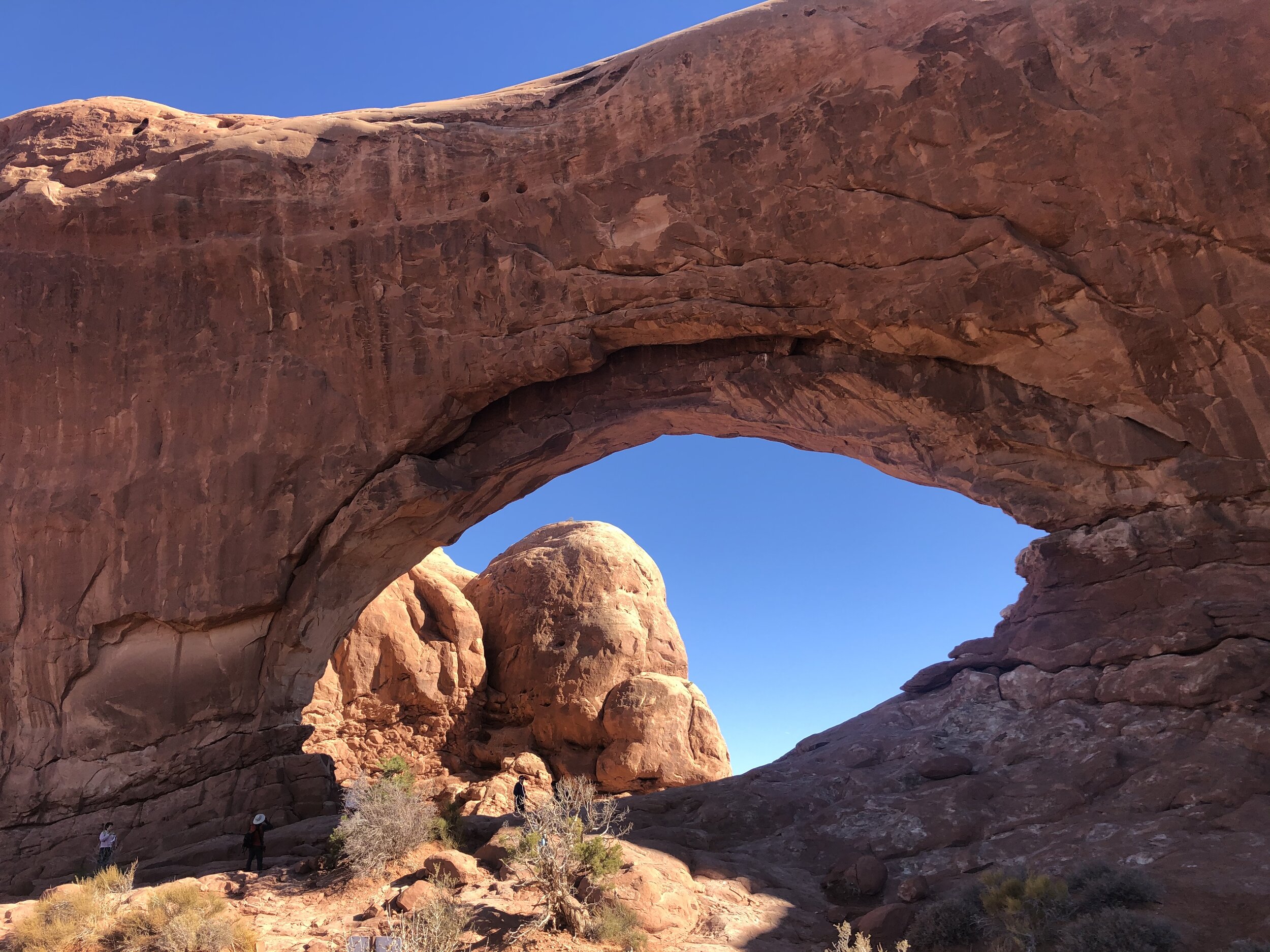
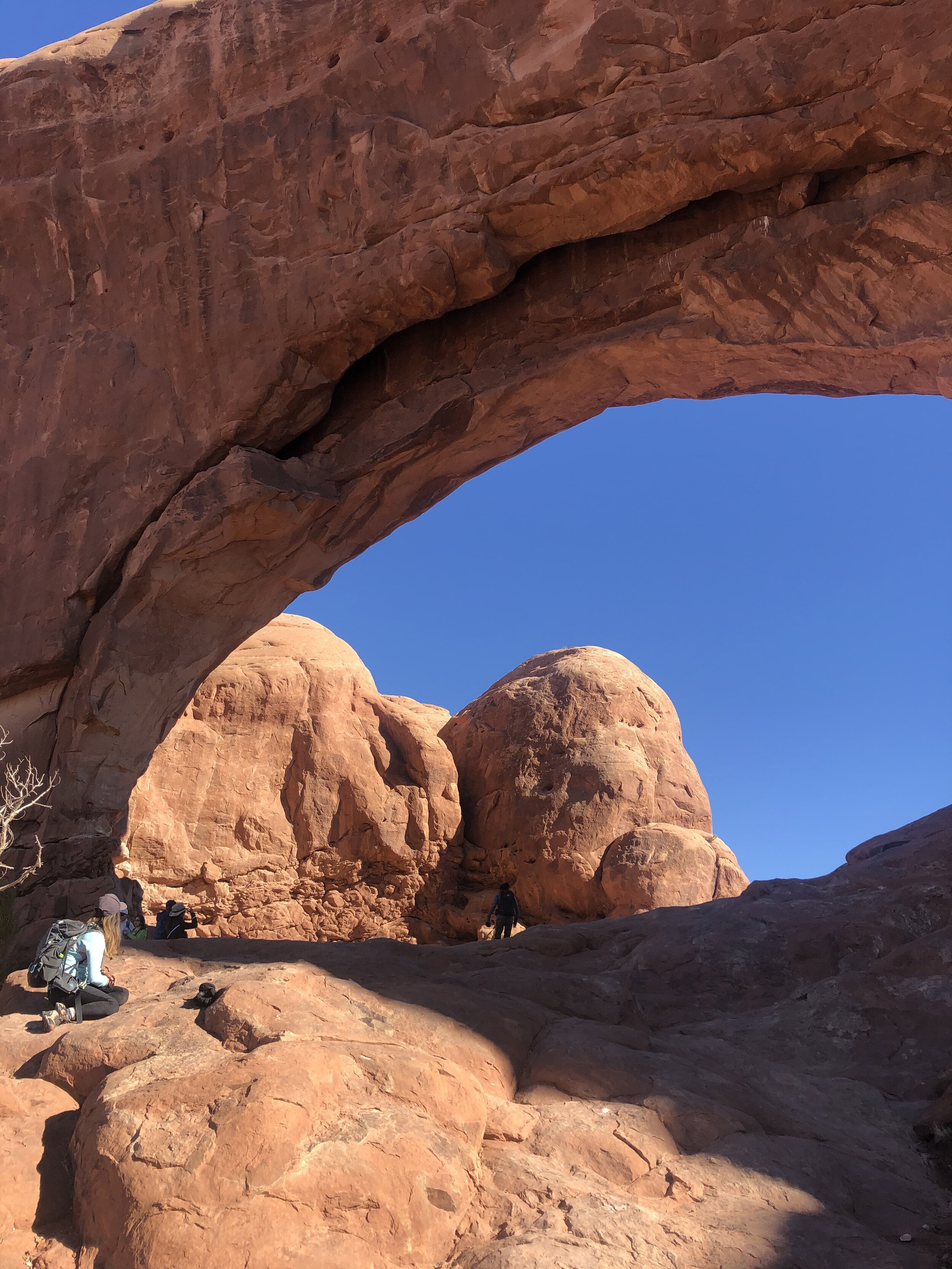
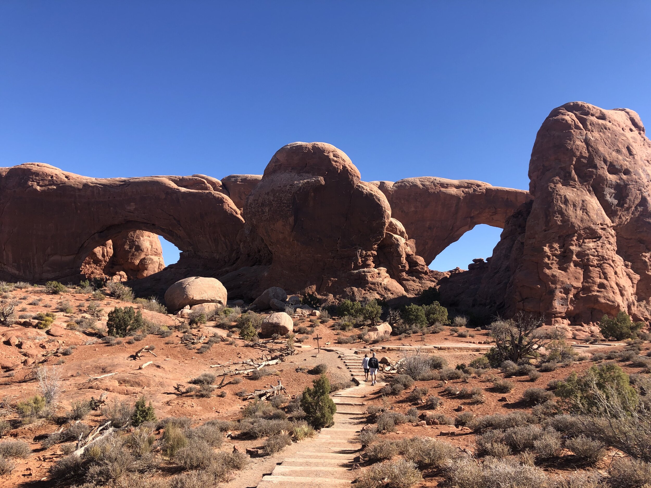
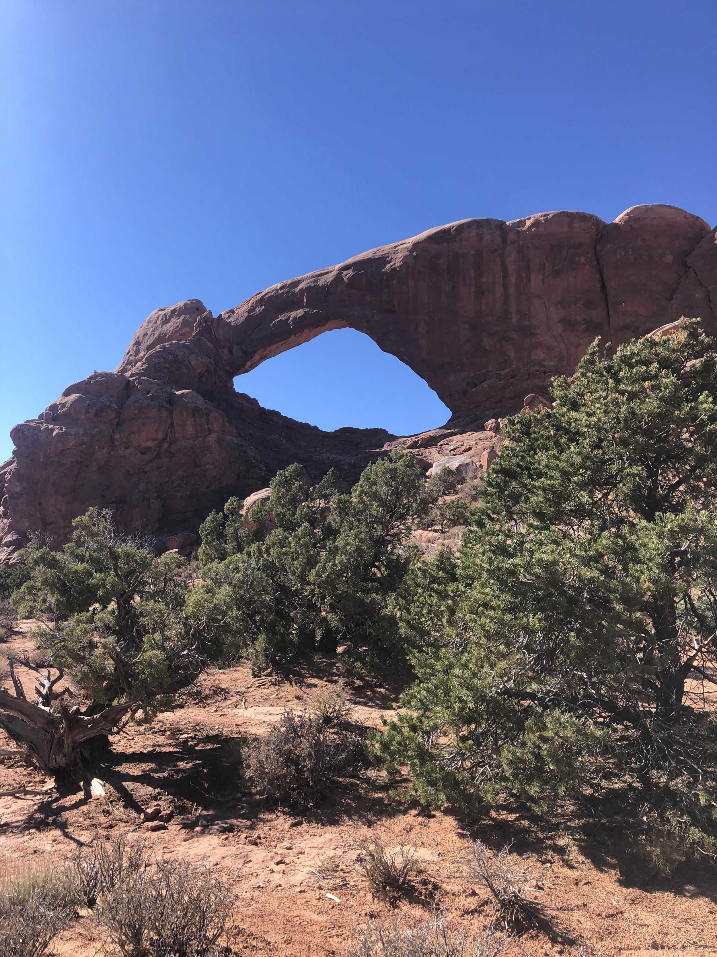
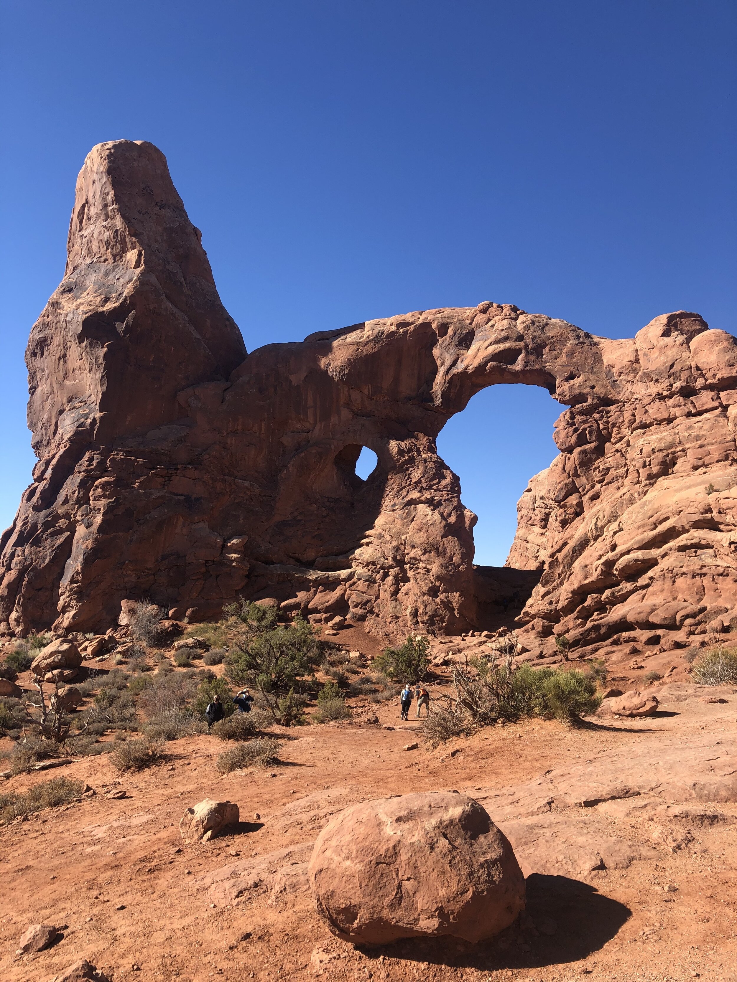
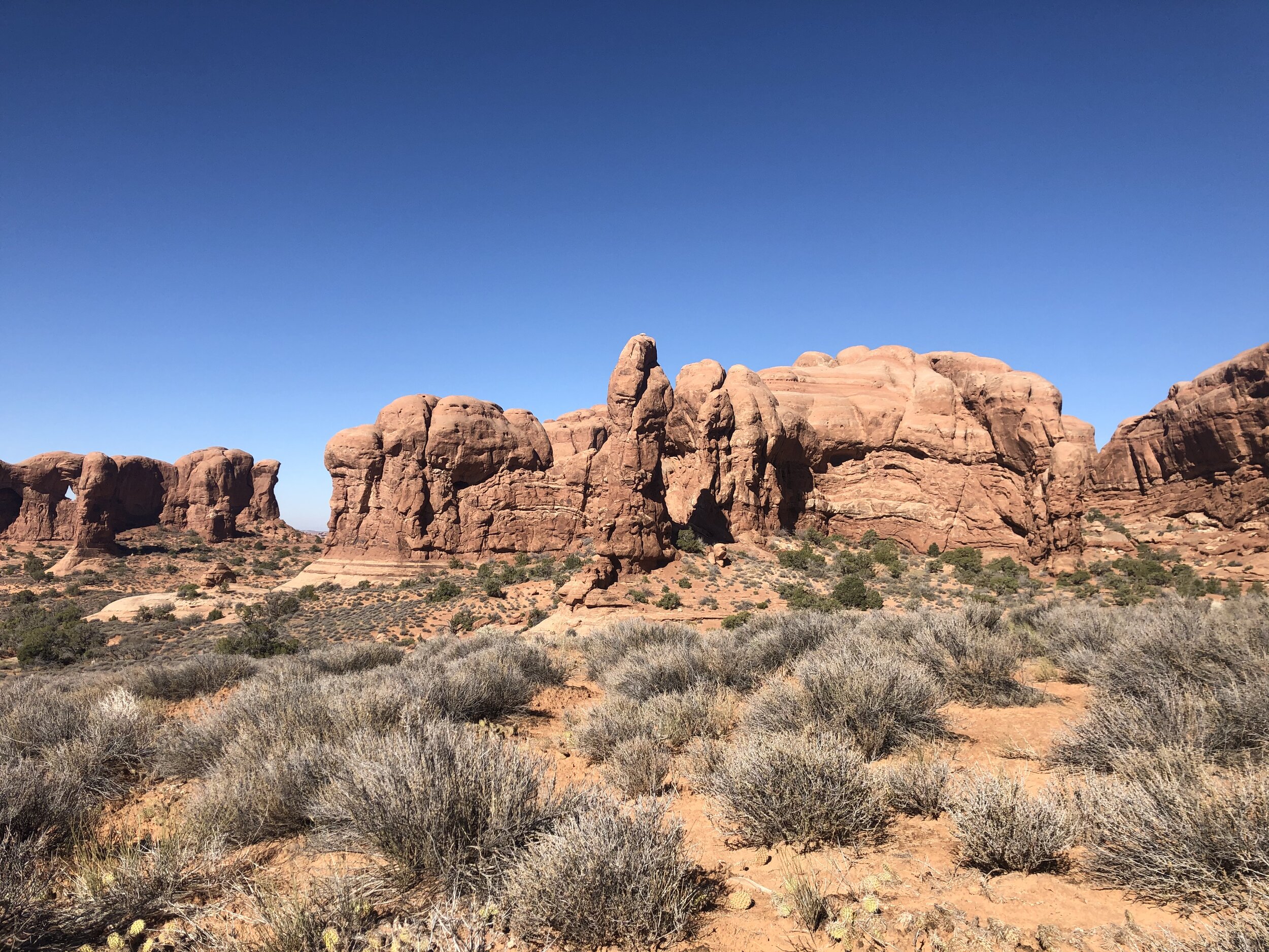
On the way out, I stopped by the Windows Section. Here live even more arches.

IMG_2218.jpg
IMG_1559.jpg
IMG_2693.jpg
IMG_2706.jpg
IMG_4354.jpg
IMG_5004.jpg
IMG_5621.jpg
IMG_5884.jpg
IMG_9929.jpg
IMG_2218.jpg IMG_1559.jpg IMG_2693.jpg IMG_2706.jpg IMG_4354.jpg IMG_5004.jpg IMG_5621.jpg IMG_5884.jpg IMG_9929.jpg

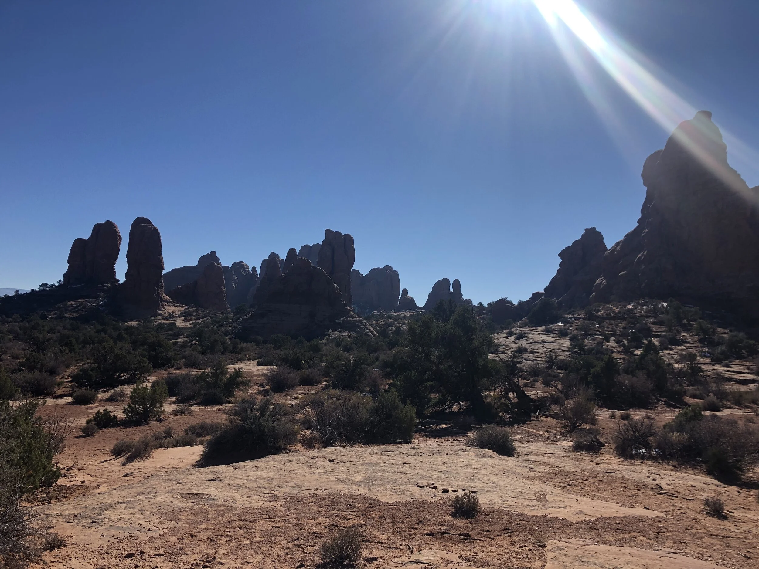
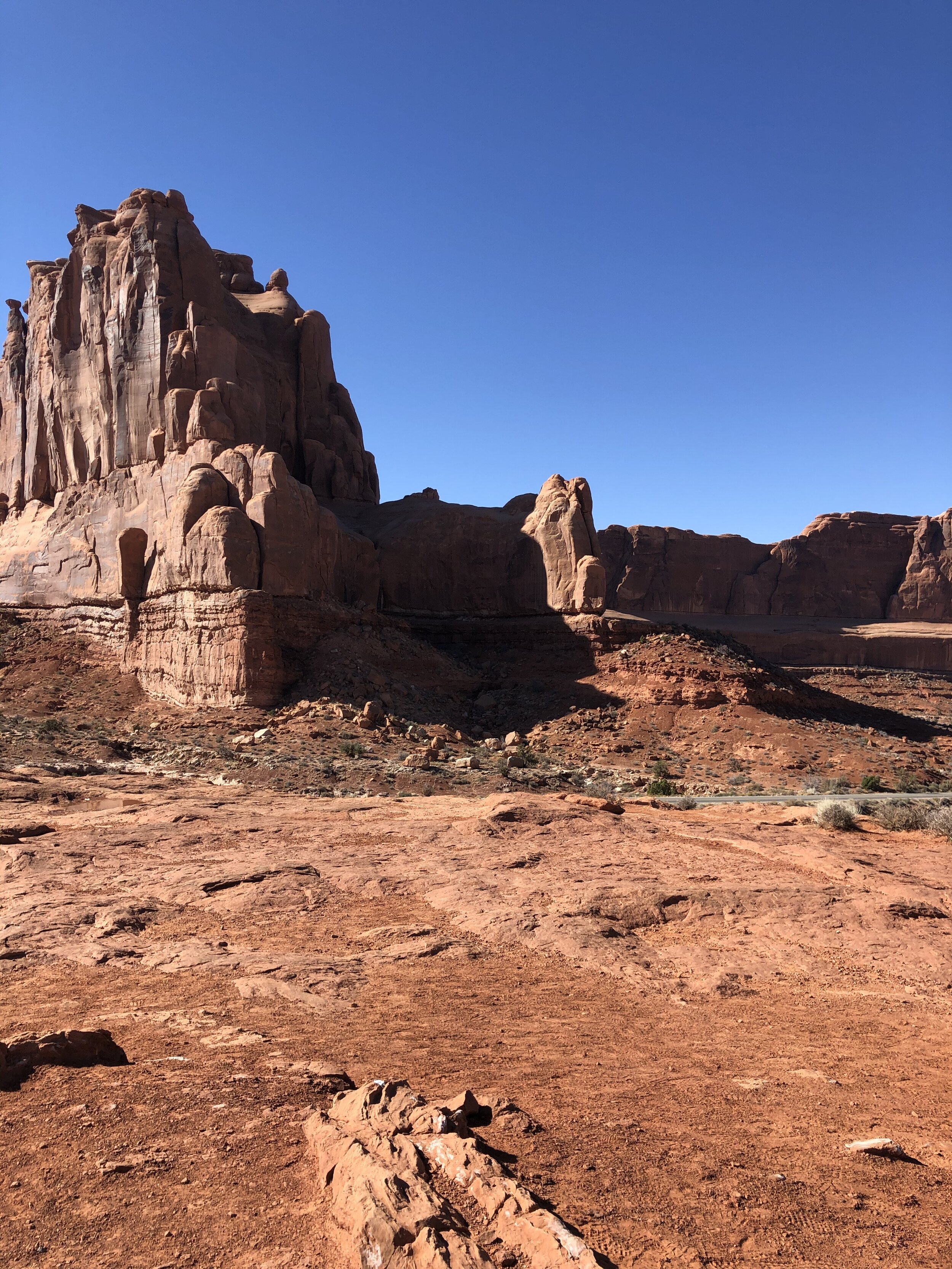
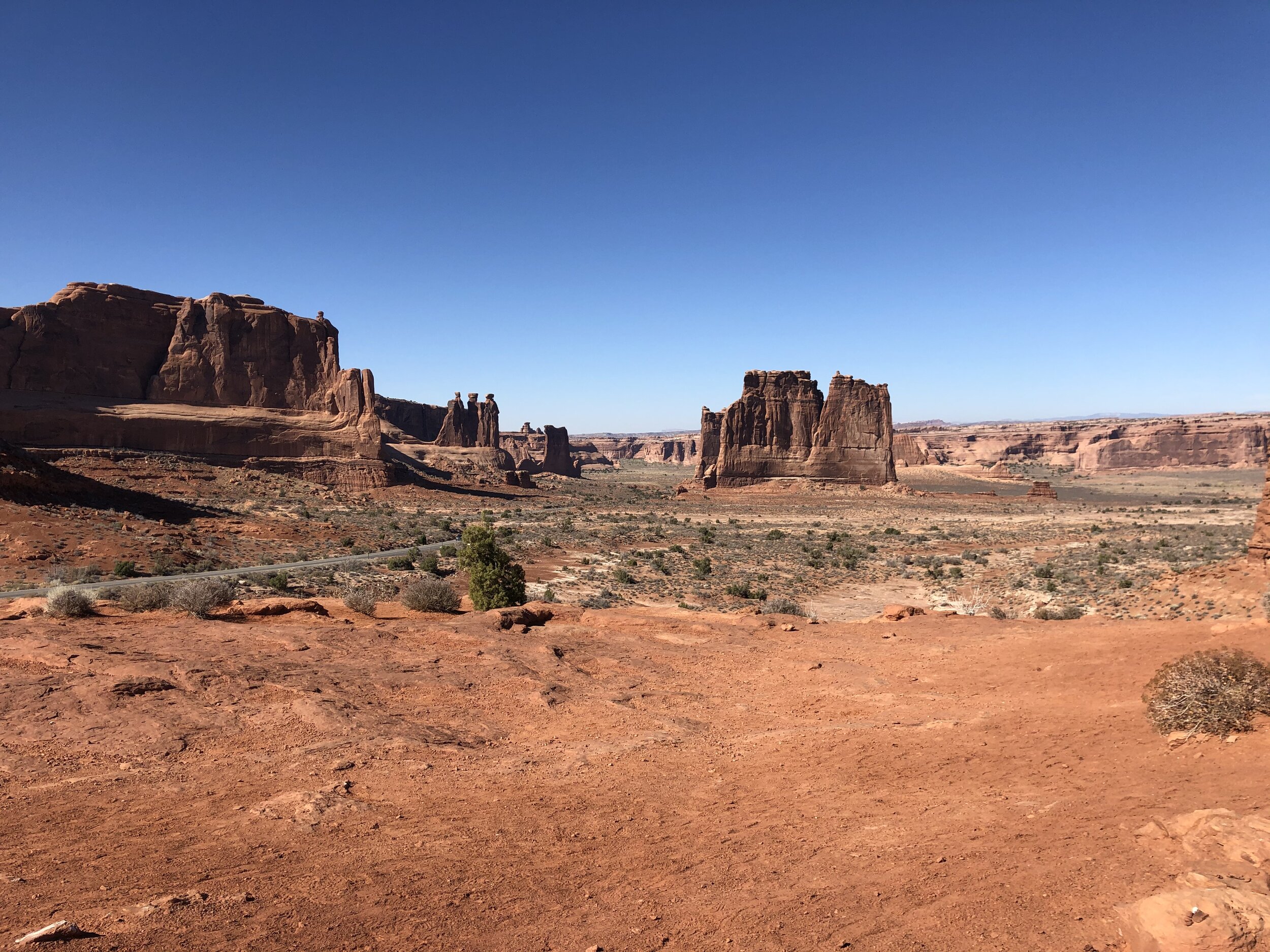
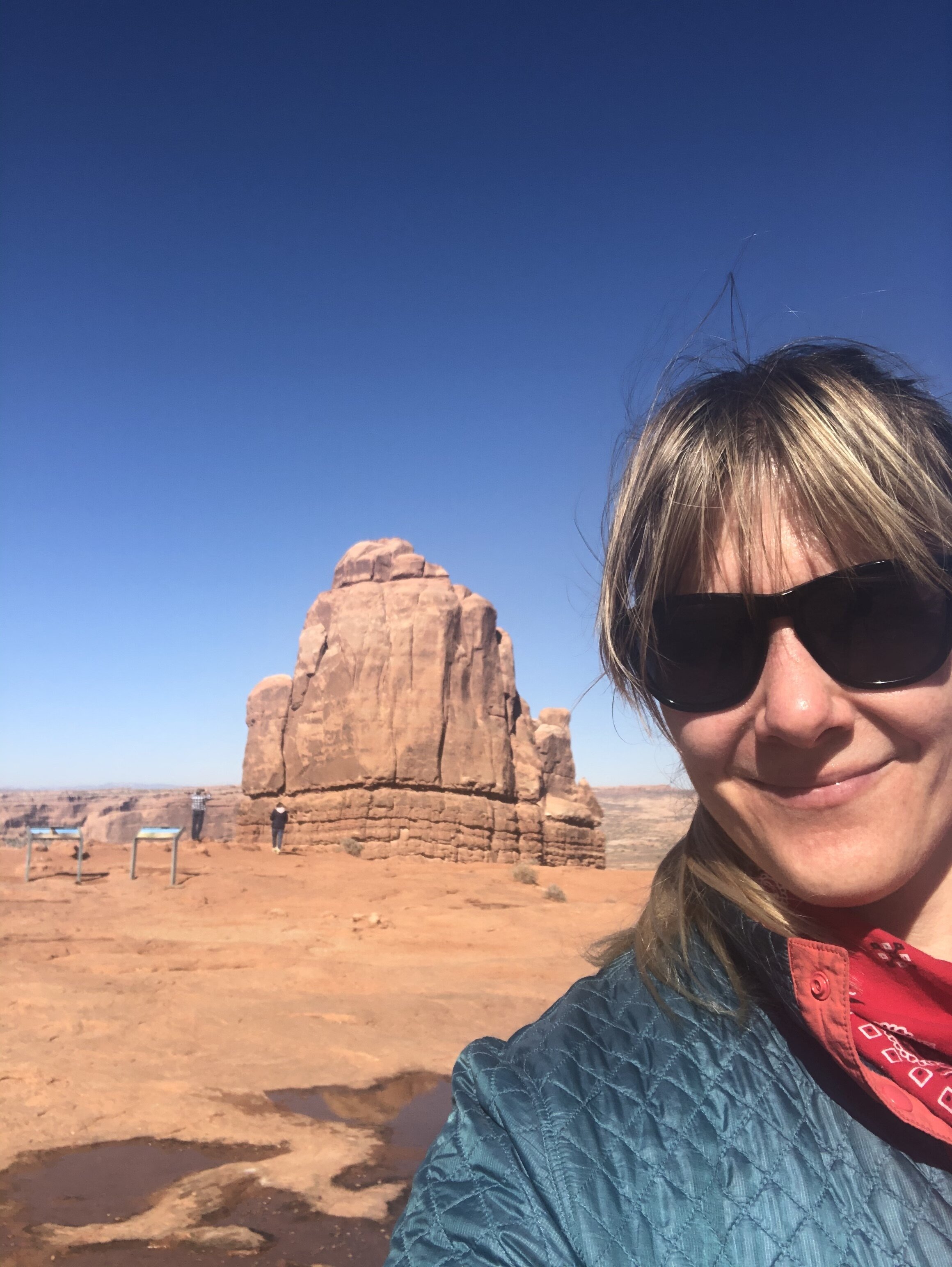
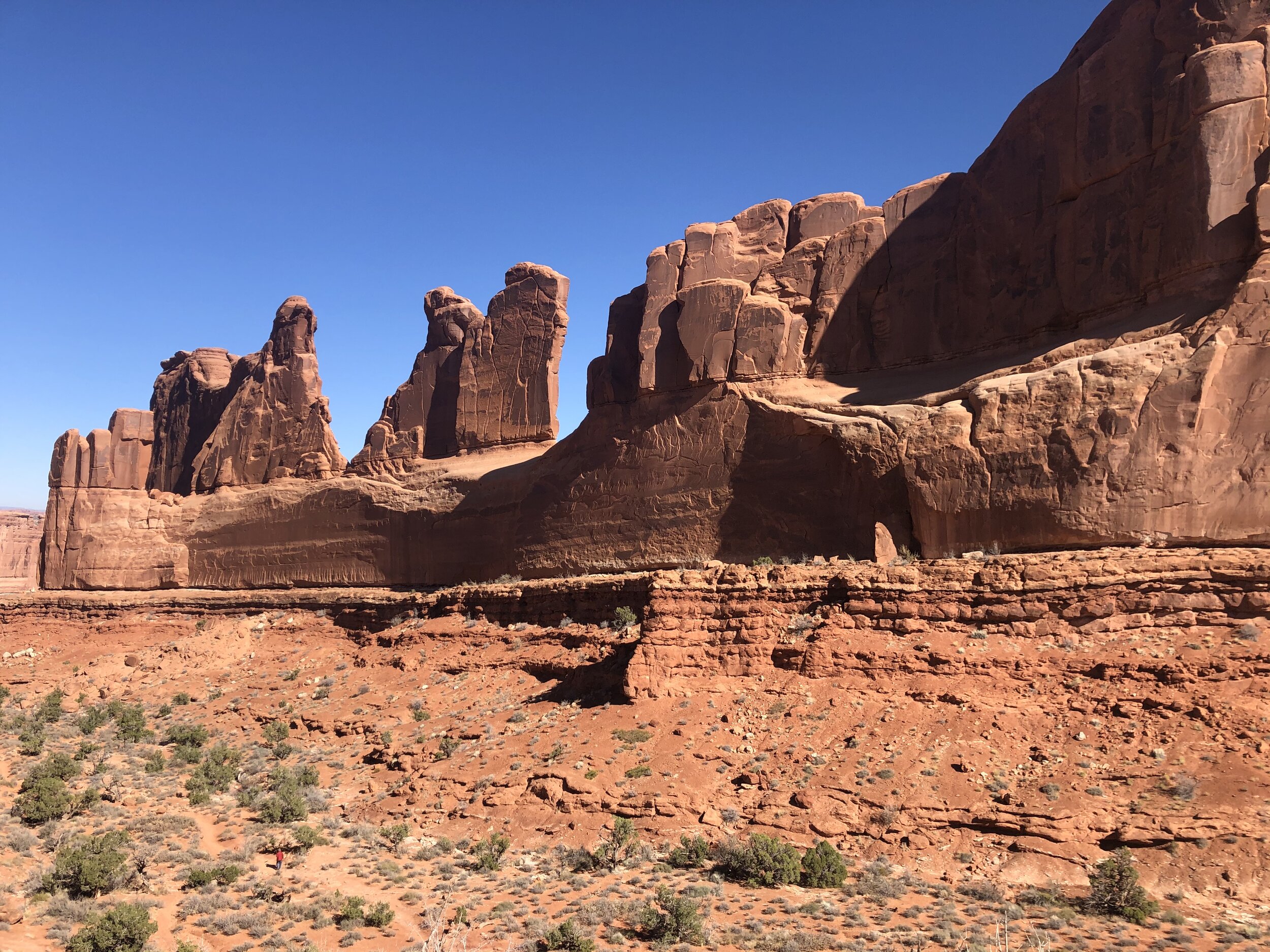
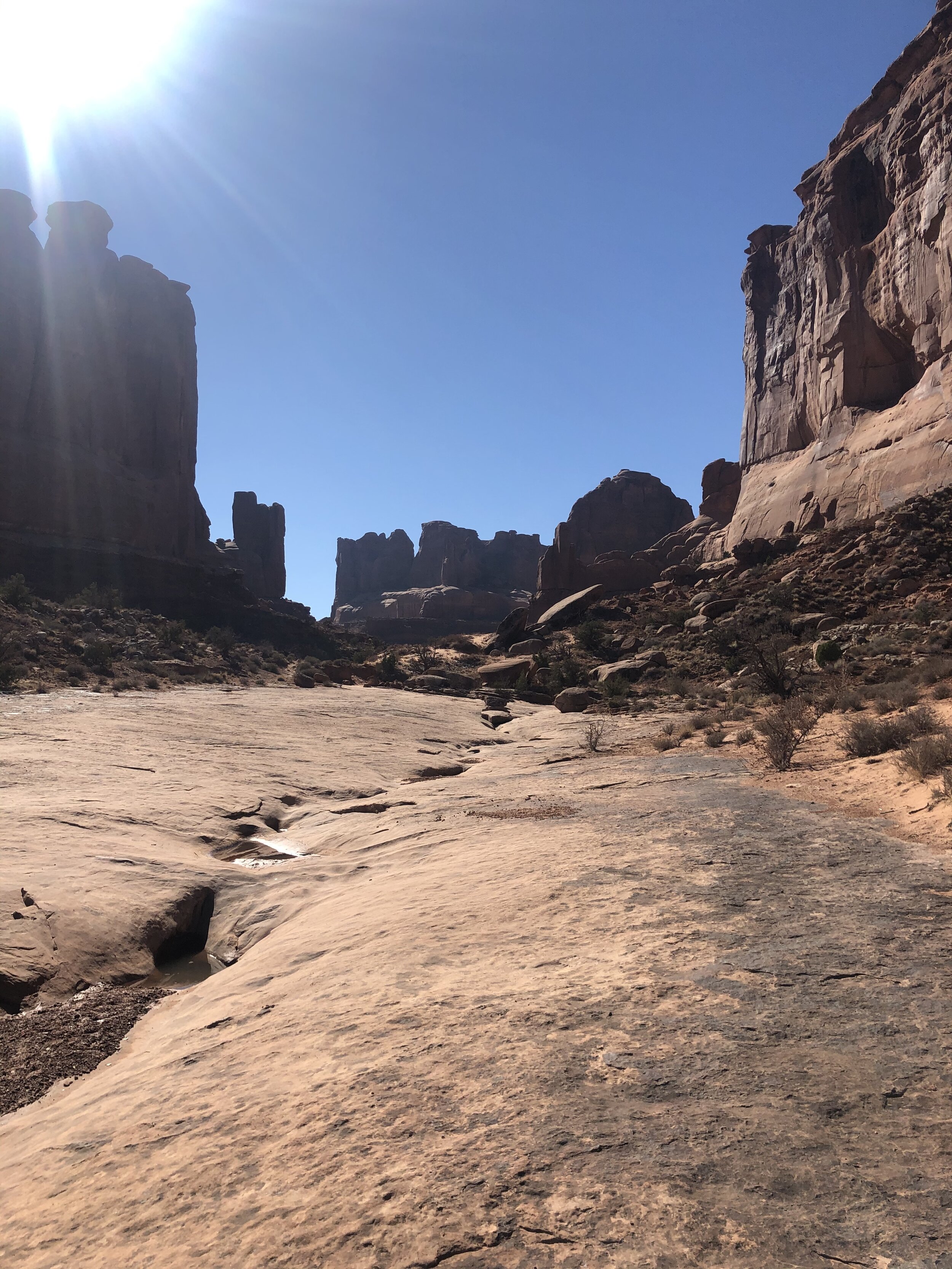
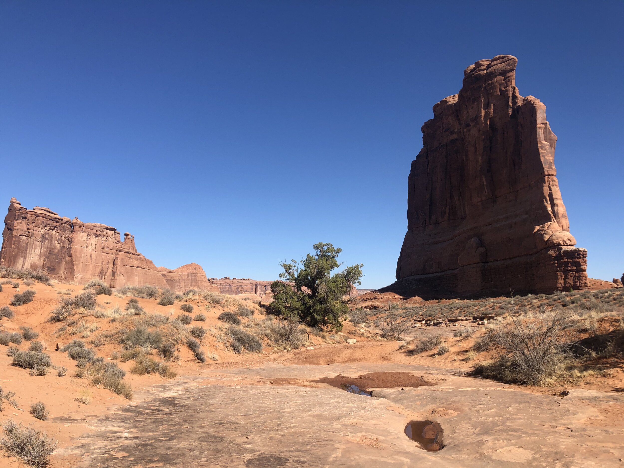
The one last stop I made was to Park Avenue and Courthouse Towers - named after what these rock formations resemble.

IMG_1001.jpg
IMG_1162.jpg
IMG_4634.jpg
IMG_9110.jpg
IMG_1001.jpg IMG_1162.jpg IMG_4634.jpg IMG_9110.jpg

I finished my second day at Arches earlier than planned, which was fine because I was ready to pick up Addie from the sitter. I scooped her very happily, got back in the car, and was on my way.

Canyonlands National Park was next, and not at all that far away.

November 03, 2020 /Sarah Williams
Arches National Park, Dirt in my Shoes, Moab, Utah, Goose Island Campground, BLM, Rover, La Sal Mountains, Delicate Arch, Double O Arch, Landscape Arch, Navajo Arch, Partition Arch, Windows Section, Courthouse Towers
National Parks
1 Comment
IMG_2677.jpg

#50: Petroglyphs & Canyons

October 08, 2020 by Sarah Williams in National Parks

There was more to see in Utah, but I deemed it time to head to Colorado. My "planned" route had gotten off track a while ago, so going off-track a little more wouldn't hurt. I sound like my mom when I say this, but I wanted to catch the Colorado Rocky Mountains' foliage. To do so, I needed to get going promptly.

The next national park I wanted to visit was Black Canyon of the Gunnison outside Montrose, CO. The drive from Salt Lake City was almost six hours, and because I didn't hit the road from SLC until later in the day, I'd stop somewhere on the way.

The first RV park I found appeared booked online. But I swung by there anyway because sometimes, when you show up, you get lucky. I didn't get lucky - it was filled. There was another park nearby in Helper, UT. It didn't look great, but it was just a stopover. It offered water and electric hookups, which was helpful.

I was only planning to stay for one night, but things changed (as they often do). I started chatting with the owner, and she recommended a few local things worth checking out. My ears perked up when she mentioned petroglyphs. I was also intrigued because the petroglyph location she mentioned was not very well-known. I love finding hidden gems. This one was called Nine-Mile Canyon.

I decided to book a second night and take the full day to explore my newly-learned-about attraction. I stopped by the historic town of Helper, before making my way to Nine-Mile Canyon.

IMG_5309.jpg
IMG_1553.jpg
IMG_4401.jpg
IMG_5091.jpg
IMG_6133.jpg
IMG_7106.jpg
IMG_7763.jpg
IMG_5309.jpg IMG_1553.jpg IMG_4401.jpg IMG_5091.jpg IMG_6133.jpg IMG_7106.jpg IMG_7763.jpg

I couldn’t put an address into Google Maps to find Nine-Mile Canyon because, well, there isn’t one. There also wasn’t a visitor center or anything like that. I had to navigate myself and figure it out. The RV park lady gave me a paper listing out mile-markers along the canyon road and what to find at each. That was all I had, but I found this map after following the verbal directions to the canyon entrance.

IMG_3823.jpg

Addie and I were off on an adventure. I reset my odometer at the start to ensure I was on-par with the mile-markers on the "ditto." At first, the petroglyphs were tough to spot, but I got good at it as I got farther into the canyon. It was like a fun game spotting all the rock drawings. Some were right off the road, and some were viewable after a quick hike.

IMG_7994.jpg
IMG_0670.jpg
IMG_1860.jpg
IMG_2137.jpg
IMG_2188.jpg
IMG_2223.jpg
IMG_2671.jpg
IMG_3288.jpg
IMG_3397.jpg
IMG_4551.jpg
IMG_5015.jpg
IMG_1320.jpg
IMG_5459.jpg
IMG_5755.jpg
IMG_5792.jpg
IMG_6118.jpg
IMG_7765.jpg
IMG_8396.jpg
IMG_8414.jpg
IMG_8666.jpg
IMG_9061.jpg
IMG_9852.jpg
IMG_9946.jpg
IMG_7994.jpg IMG_0670.jpg IMG_1860.jpg IMG_2137.jpg IMG_2188.jpg IMG_2223.jpg IMG_2671.jpg IMG_3288.jpg IMG_3397.jpg IMG_4551.jpg IMG_5015.jpg IMG_1320.jpg IMG_5459.jpg IMG_5755.jpg IMG_5792.jpg IMG_6118.jpg IMG_7765.jpg IMG_8396.jpg IMG_8414.jpg IMG_8666.jpg IMG_9061.jpg IMG_9852.jpg IMG_9946.jpg

I had never seen such incredible petroglyphs. And to find them in a place I didn't even know about made them that much more special.

Before I knew it, I was crossing the border into colorful Colorado. Having lived there for a few years in the past, it's still "home" to me in many ways. This state makes me happy in so many ways.

I found a free place to camp outside Montrose. This area was not the Colorado landscape I love, but it was close to the entrance to Black Canyon of the Gunnison National Park.

IMG_0110.jpg
IMG_1939.jpg
IMG_3782.jpg
IMG_3783.jpg
IMG_3784.jpg
IMG_3785.jpg
IMG_0110.jpg IMG_1939.jpg IMG_3782.jpg IMG_3783.jpg IMG_3784.jpg IMG_3785.jpg

The only thing I knew about this national park before visiting is that it's a canyon - that's it. Addie and I arrived at the South Rim entrance the next morning, heading first to the visitor center. The initial question I typically ask the rangers is, "What are the top things I should see?" The next question is always, "Where can I bring my dog?" Based on the ranger's answers to these questions, we headed out on the Rim Rock Trail. Adde was allowed!

The out and back three-mile trail provided fantastic views of the massive canyon.

IMG_7586.jpg
IMG_1555.jpg
IMG_5319.jpg
IMG_5976.jpg
IMG_9491.jpg

I felt good about taking a little hike with Addie. After, we drove the South Rim Road and stopped at some of the overlooks. There were many pull-offs, so we picked and chose based on what the ranger suggested.

IMG_5159.jpg
IMG_0046.jpg
IMG_0763.jpg
IMG_0844.jpg
IMG_2273.jpg
IMG_2590.jpg
IMG_2731.jpg
IMG_8635.jpg
IMG_4270.jpg
IMG_5128.jpg

The rim was one perspective of this park, but the bottom of the canyon was the other. We headed back towards the south entrance station and took a left onto East Portal Road. Vehicles longer than 22 feet were not permitted. The road was long, curvy, and steep, but it led us down the canyon to the Gunnison River. It was so peaceful and quiet down there.

IMG_0326.jpg
IMG_3990.jpg

I was looking forward to what awaited me in the Colorado mountains…mountain towns!

October 08, 2020 /Sarah Williams
Montrose, Black Canyon of the Gunnison, petroglyph, Utah, Colorado, Rocky Mountains, nine-mile canyon, rim rock trail, gunnison river
National Parks
Comment

@lyfeintow