LYFE IN TOW

A year of life on the road

  • BLOG
  • ABOUT
    • THIS JOURNEY
    • WHY THE Y
    • ME, AS A PROFESSIONAL
  • CONTACT
  • PARK PHOTOS
    • Shenandoah National Park
    • Mammoth Cave National Park
    • Great Smoky Mountains National Park
    • Congaree National Park
    • Everglades National Park
    • Biscayne National Park
    • Dry Tortugas National Park
    • Hot Springs National Park
    • Big Bend National Park
    • Guadalupe Mountains National Park
    • Carlsbad Caverns National Park
    • Channel Islands National Park
    • Pinnacles National Park
    • Sequoia & Kings Canyon National Parks
    • Yosemite National Park
    • Lassen Volcanic National Park
    • Redwood National & State Parks
    • Crater Lake National Park
    • Olympic National Park
    • Mount Rainier National Park
    • North Cascades National Park
    • Glacier National Park
    • Grand Teton National Park
    • Yellowstone National Park
    • Zion National Park
    • Bryce Canyon National Park
    • Capitol Reef National Park
    • Black Canyon of the Gunnison National Park
    • Great Sand Dunes National Park
    • Mesa Verde National Park
    • Arches National Park
    • Canyonlands National Park
    • Petrified Forest National Park
    • Saguaro National Park
    • Death Valley National Park
    • Grand Canyon National Park
  • BOOKS
IMG_2677.jpg

#50: Petroglyphs & Canyons

October 08, 2020 by Sarah Williams in National Parks

There was more to see in Utah, but I deemed it time to head to Colorado. My "planned" route had gotten off track a while ago, so going off-track a little more wouldn't hurt. I sound like my mom when I say this, but I wanted to catch the Colorado Rocky Mountains' foliage. To do so, I needed to get going promptly.

The next national park I wanted to visit was Black Canyon of the Gunnison outside Montrose, CO. The drive from Salt Lake City was almost six hours, and because I didn't hit the road from SLC until later in the day, I'd stop somewhere on the way.

The first RV park I found appeared booked online. But I swung by there anyway because sometimes, when you show up, you get lucky. I didn't get lucky - it was filled. There was another park nearby in Helper, UT. It didn't look great, but it was just a stopover. It offered water and electric hookups, which was helpful.

I was only planning to stay for one night, but things changed (as they often do). I started chatting with the owner, and she recommended a few local things worth checking out. My ears perked up when she mentioned petroglyphs. I was also intrigued because the petroglyph location she mentioned was not very well-known. I love finding hidden gems. This one was called Nine-Mile Canyon.

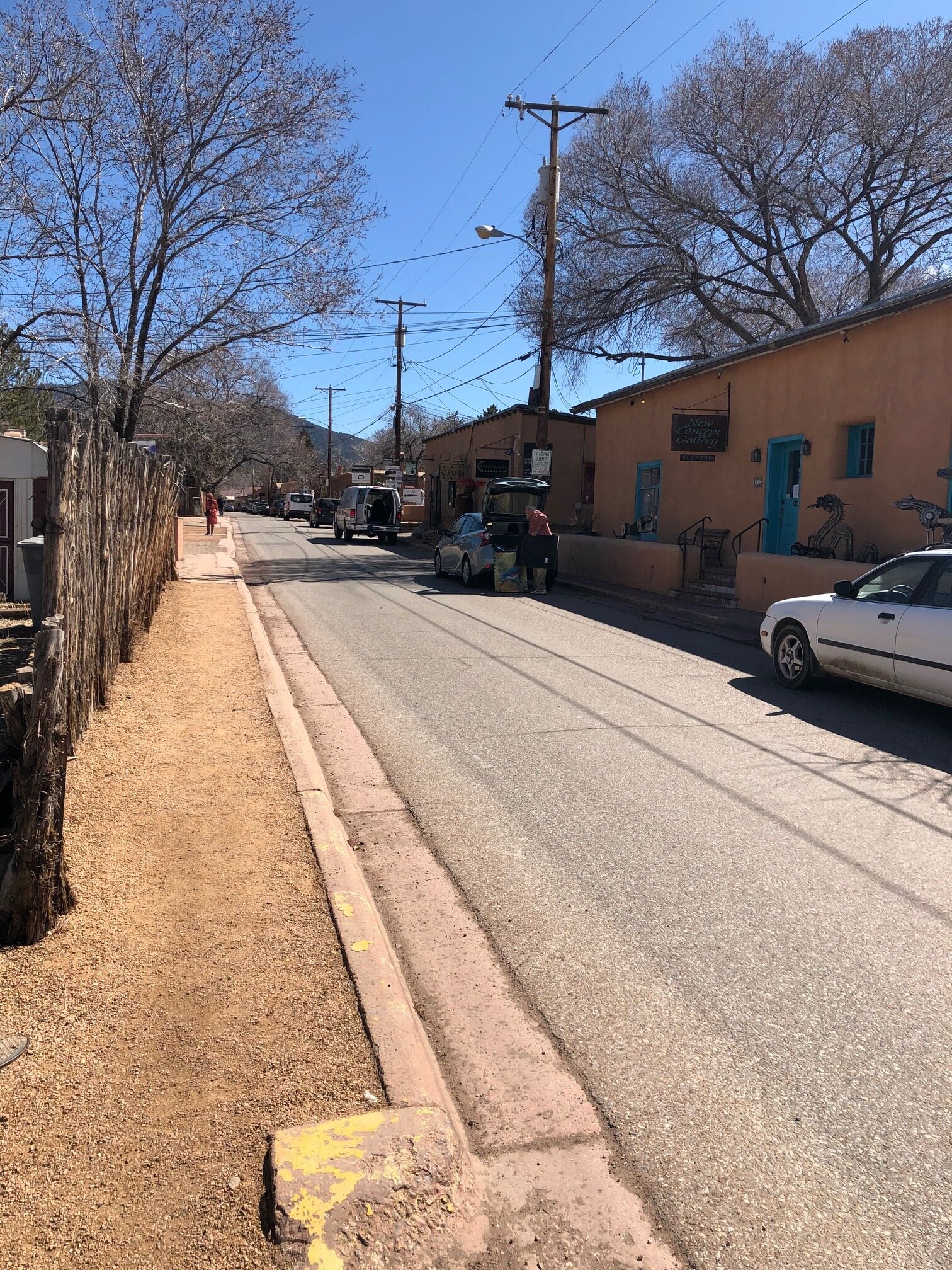
I decided to book a second night and take the full day to explore my newly-learned-about attraction. I stopped by the historic town of Helper, before making my way to Nine-Mile Canyon.

IMG_5309.jpg
IMG_1553.jpg
IMG_4401.jpg
IMG_5091.jpg
IMG_6133.jpg
IMG_7106.jpg
IMG_7763.jpg
IMG_5309.jpg IMG_1553.jpg IMG_4401.jpg IMG_5091.jpg IMG_6133.jpg IMG_7106.jpg IMG_7763.jpg

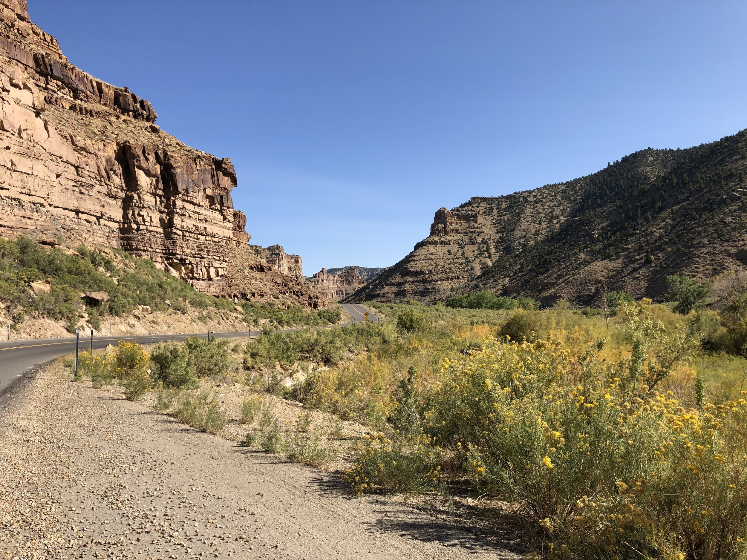
I couldn’t put an address into Google Maps to find Nine-Mile Canyon because, well, there isn’t one. There also wasn’t a visitor center or anything like that. I had to navigate myself and figure it out. The RV park lady gave me a paper listing out mile-markers along the canyon road and what to find at each. That was all I had, but I found this map after following the verbal directions to the canyon entrance.

IMG_3823.jpg

Addie and I were off on an adventure. I reset my odometer at the start to ensure I was on-par with the mile-markers on the "ditto." At first, the petroglyphs were tough to spot, but I got good at it as I got farther into the canyon. It was like a fun game spotting all the rock drawings. Some were right off the road, and some were viewable after a quick hike.

IMG_7994.jpg
IMG_0670.jpg
IMG_1860.jpg
IMG_2137.jpg
IMG_2188.jpg
IMG_2223.jpg
IMG_2671.jpg
IMG_3288.jpg
IMG_3397.jpg
IMG_4551.jpg
IMG_5015.jpg
IMG_1320.jpg
IMG_5459.jpg
IMG_5755.jpg
IMG_5792.jpg
IMG_6118.jpg
IMG_7765.jpg
IMG_8396.jpg
IMG_8414.jpg
IMG_8666.jpg
IMG_9061.jpg
IMG_9852.jpg
IMG_9946.jpg
IMG_7994.jpg IMG_0670.jpg IMG_1860.jpg IMG_2137.jpg IMG_2188.jpg IMG_2223.jpg IMG_2671.jpg IMG_3288.jpg IMG_3397.jpg IMG_4551.jpg IMG_5015.jpg IMG_1320.jpg IMG_5459.jpg IMG_5755.jpg IMG_5792.jpg IMG_6118.jpg IMG_7765.jpg IMG_8396.jpg IMG_8414.jpg IMG_8666.jpg IMG_9061.jpg IMG_9852.jpg IMG_9946.jpg

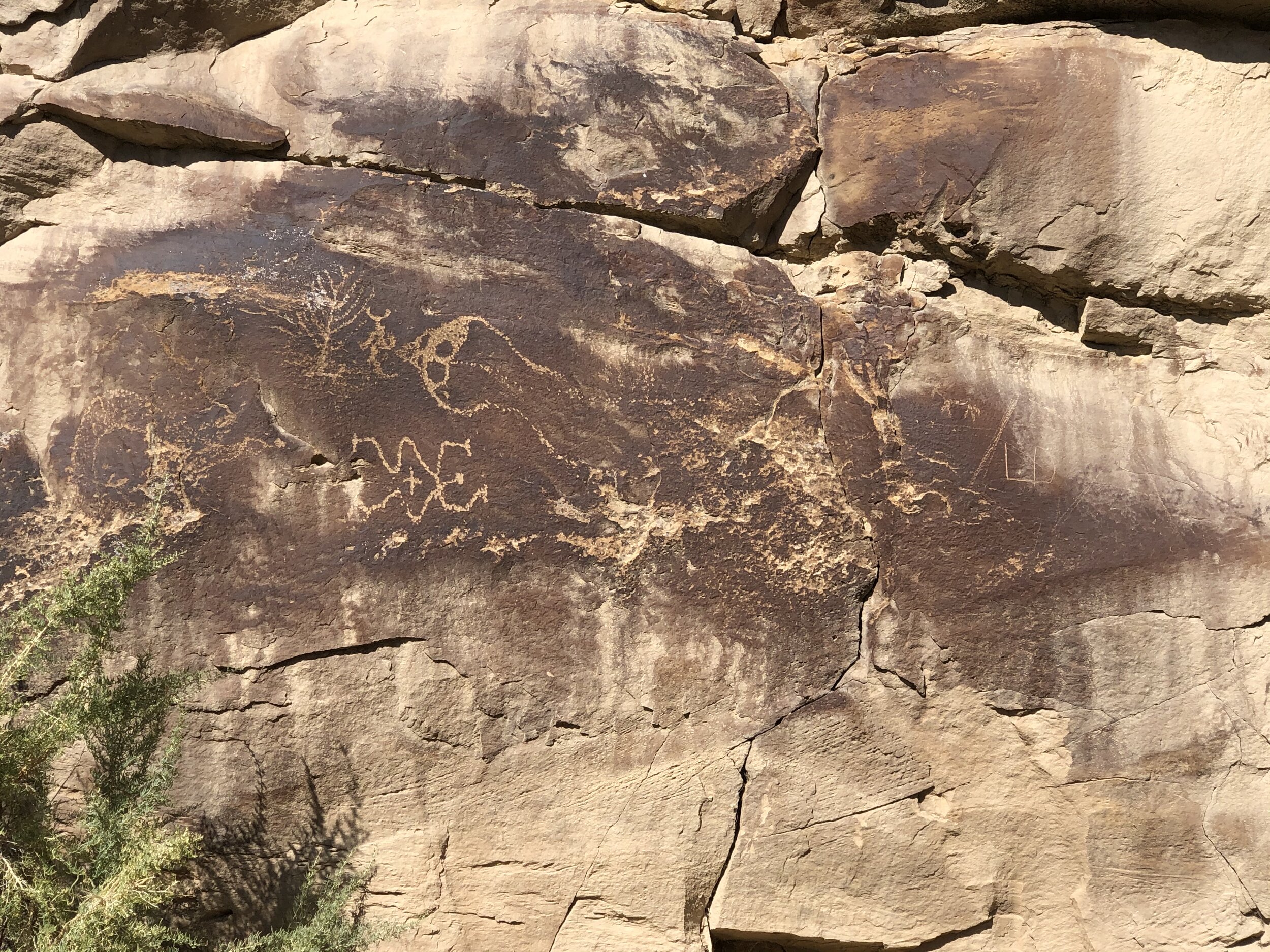
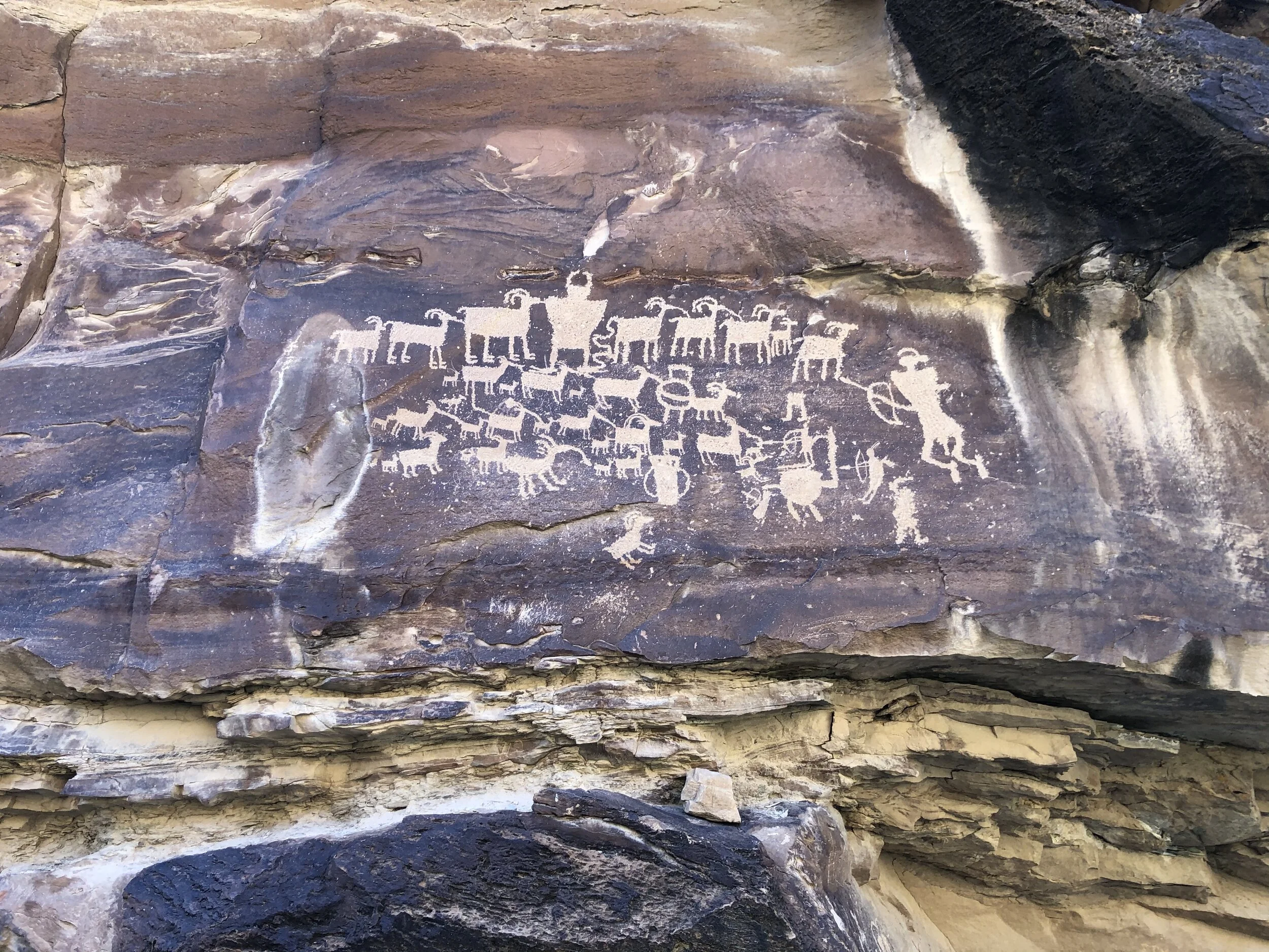
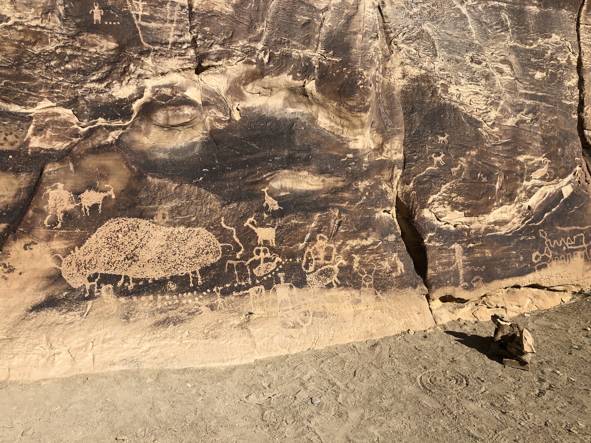
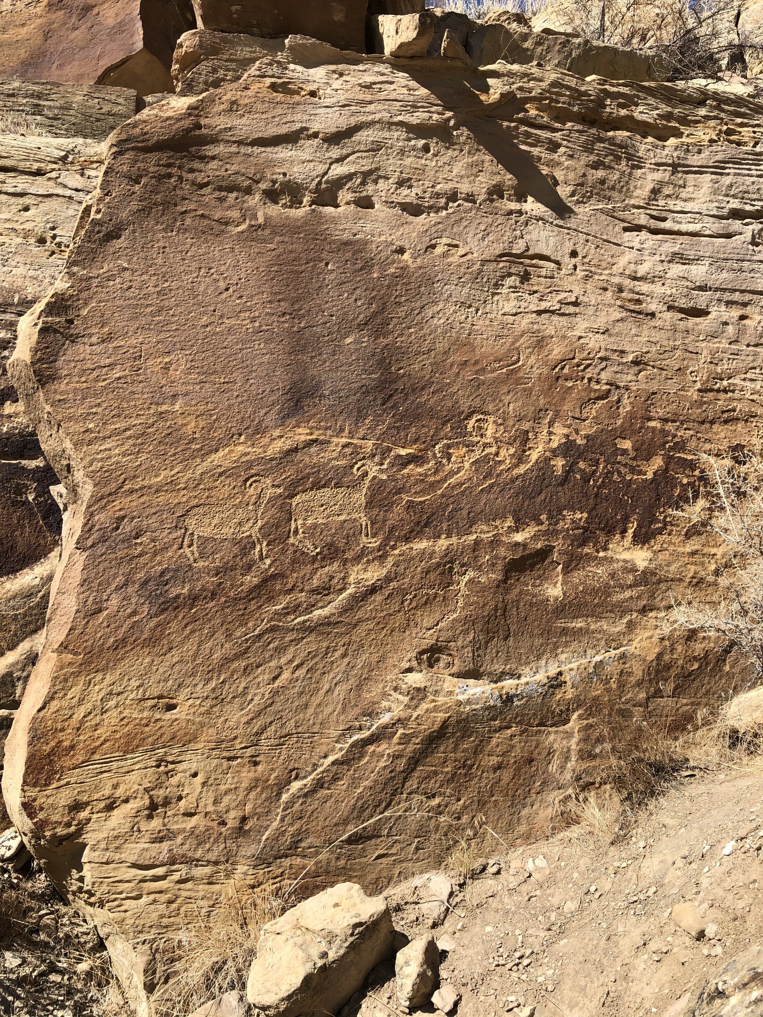
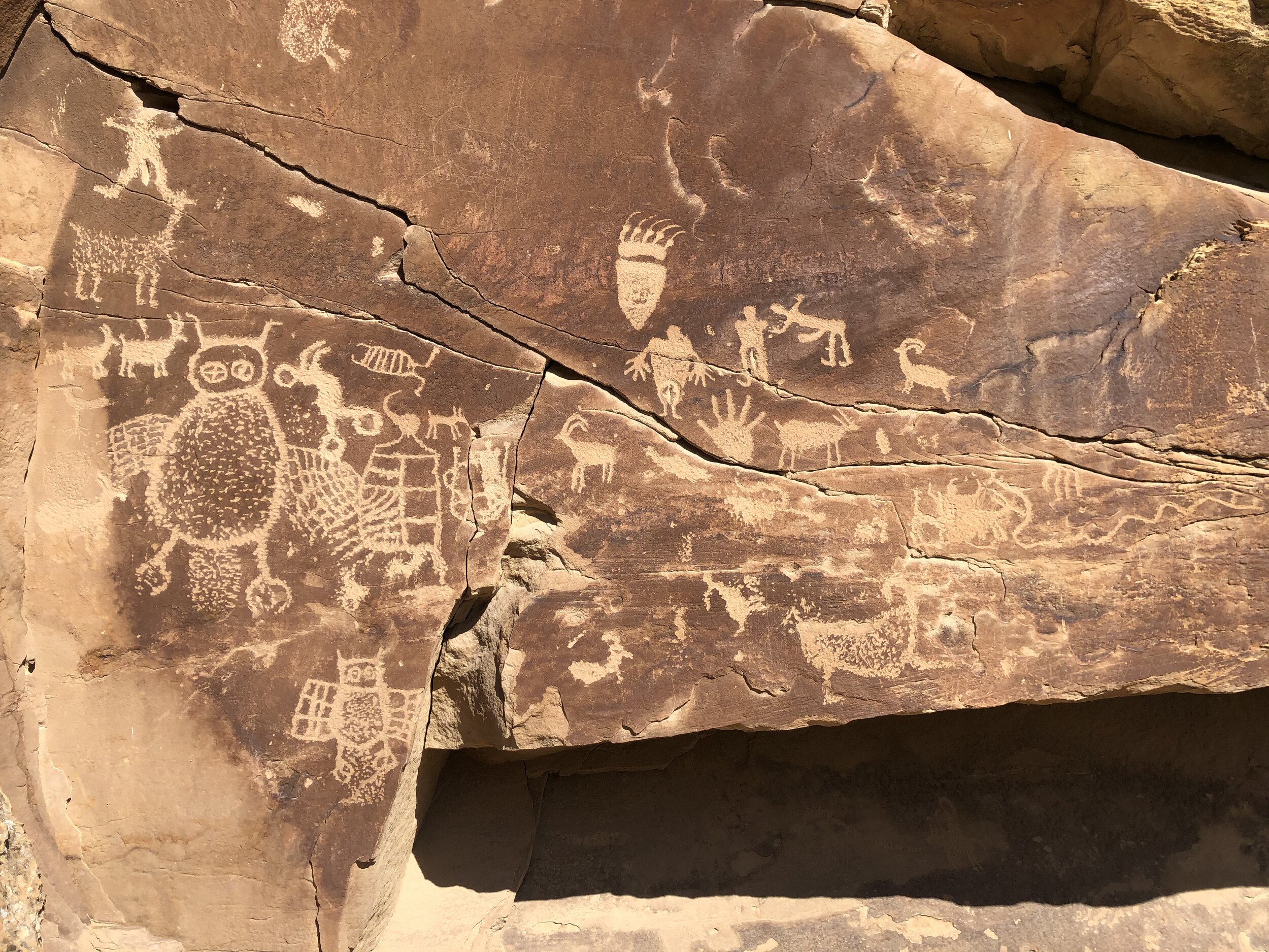
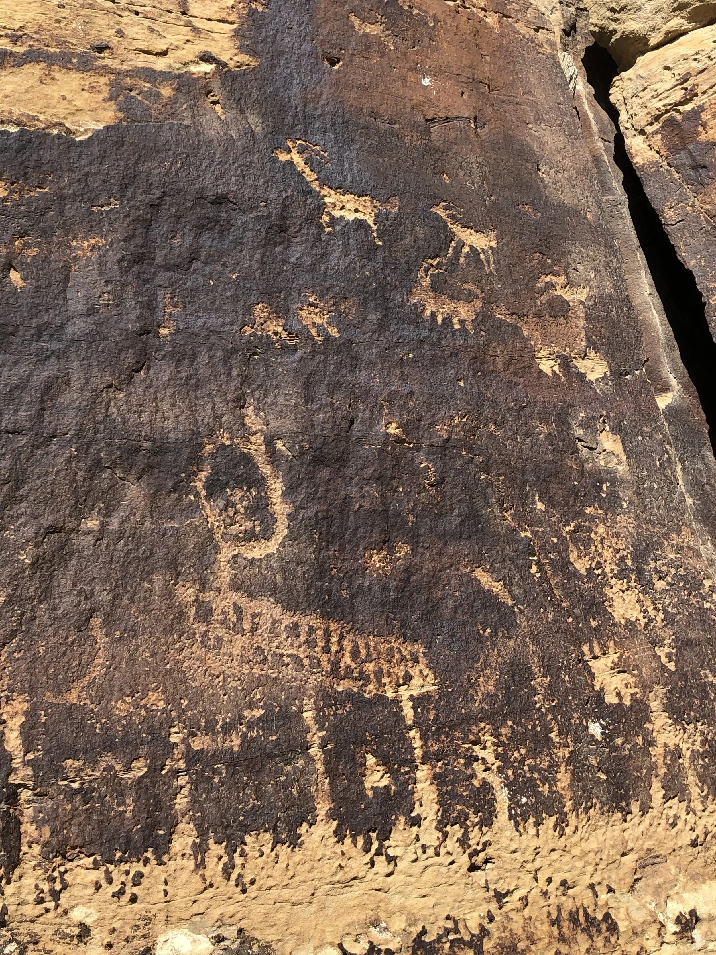
I had never seen such incredible petroglyphs. And to find them in a place I didn't even know about made them that much more special.

Before I knew it, I was crossing the border into colorful Colorado. Having lived there for a few years in the past, it's still "home" to me in many ways. This state makes me happy in so many ways.

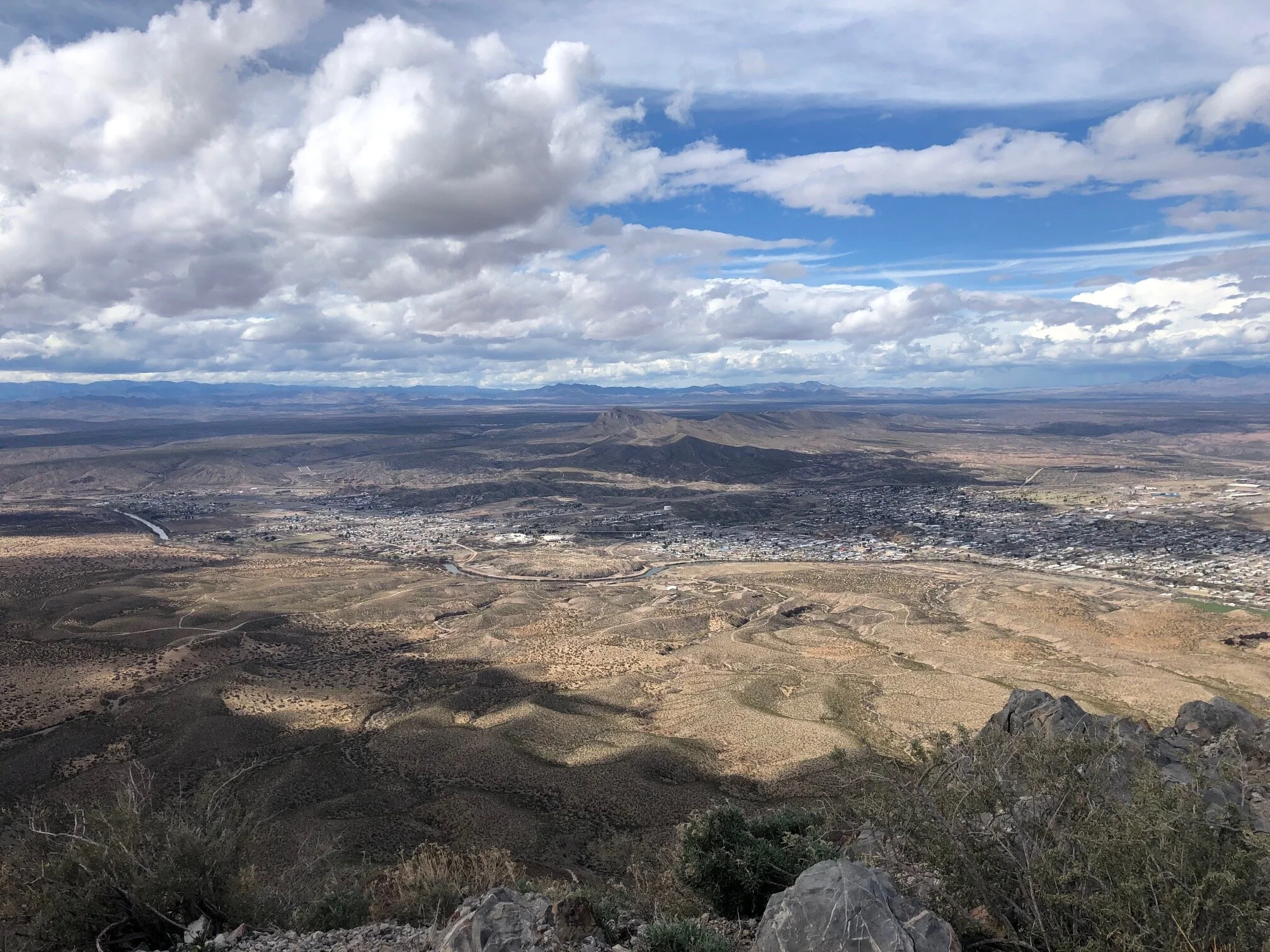
I found a free place to camp outside Montrose. This area was not the Colorado landscape I love, but it was close to the entrance to Black Canyon of the Gunnison National Park.

IMG_0110.jpg
IMG_1939.jpg
IMG_3782.jpg
IMG_3783.jpg
IMG_3784.jpg
IMG_3785.jpg
IMG_0110.jpg IMG_1939.jpg IMG_3782.jpg IMG_3783.jpg IMG_3784.jpg IMG_3785.jpg

The only thing I knew about this national park before visiting is that it's a canyon - that's it. Addie and I arrived at the South Rim entrance the next morning, heading first to the visitor center. The initial question I typically ask the rangers is, "What are the top things I should see?" The next question is always, "Where can I bring my dog?" Based on the ranger's answers to these questions, we headed out on the Rim Rock Trail. Adde was allowed!

The out and back three-mile trail provided fantastic views of the massive canyon.

IMG_7586.jpg
IMG_1555.jpg
IMG_5319.jpg
IMG_5976.jpg
IMG_9491.jpg

I felt good about taking a little hike with Addie. After, we drove the South Rim Road and stopped at some of the overlooks. There were many pull-offs, so we picked and chose based on what the ranger suggested.

IMG_5159.jpg
IMG_0046.jpg
IMG_0763.jpg
IMG_0844.jpg
IMG_2273.jpg
IMG_2590.jpg
IMG_2731.jpg
IMG_8635.jpg
IMG_4270.jpg
IMG_5128.jpg

The rim was one perspective of this park, but the bottom of the canyon was the other. We headed back towards the south entrance station and took a left onto East Portal Road. Vehicles longer than 22 feet were not permitted. The road was long, curvy, and steep, but it led us down the canyon to the Gunnison River. It was so peaceful and quiet down there.

IMG_0326.jpg
IMG_3990.jpg

I was looking forward to what awaited me in the Colorado mountains…mountain towns!

October 08, 2020 /Sarah Williams
Montrose, Black Canyon of the Gunnison, petroglyph, Utah, Colorado, Rocky Mountains, nine-mile canyon, rim rock trail, gunnison river
National Parks
Comment
Turtleback Mountain

Turtleback Mountain

#22: New Mexico: Part 2

May 28, 2020 by Sarah Williams in Along the Way

Although I had visited Santa Fe in the past, I didn’t remember it well. I wanted to check it out again while I was in the area.

The tricky part with Santa Fe was finding a viable place to camp. For some reason, this was challenging. I’ve been on the road long enough to know what types of places I prefer and what types of places I like to avoid. I prefer national parks, state parks, and national forests (and of course BLM/government land), which are typically tucked away in natural surroundings. These places also attract people who want to camp, as opposed to live. RV parks (for the most part), on the other hand, are often a different vibe. Although parks and national forests AND private RV parks can be hit or miss, many times private RV parks are filled with families, less active people and people residing for months at a time.

The type of campsite that I haven’t mentioned is the “alternative” campsite. What I mean by this is essentially a parking lot somewhere, usually of Walmart, Cracker Barrel, or other types of establishments. In my case, in Santa Fe, this meant a casino parking lot. Yes, that’s right. There were limited “natural” options in Santa Fe, and this casino allowed RV’rs to stay overnight (for free). The parking lot was HUGE, and it worked out perfectly.

IMG_7668.jpg
IMG_7059.jpg

I stayed at the Tesuque Casino for two nights, giving me a full day to explore Santa Fe. I drove my car, Airstream in tow, to a few of the areas of the city (I didn’t want to leave the Airstream in the casino parking lot unattended. I parked it on the street, took up two parking spots and simply paid the meter for both spots.). Art is a significant focus of the attractions in Santa Fe (including the Georgia O’Keeffe Museum and Meow Wolf). Unfortunately, my interest in select types of art is minimal, but I enjoyed the architecture and history. I walked around the plaza and saw the Cathedral Basilica of Saint Francis of Assisi. I had Addie with me, so I didn’t visit any galleries, but I was able to pop into a few shops (and enjoy an outside margarita at The Shed).

IMG_7067.jpg
IMG_7069.jpg
IMG_7073.jpg
IMG_7072.jpg
IMG_7071.jpg
IMG_7065.jpg
IMG_7074.jpg
60547850454__5F4D5B97-772B-425F-8B0C-61FC99E1FE35.JPG
CC6FA9F2-88F0-4912-835F-28895368B2F6.JPG
IMG_7067.jpg IMG_7069.jpg IMG_7073.jpg IMG_7072.jpg IMG_7071.jpg IMG_7065.jpg IMG_7074.jpg 60547850454__5F4D5B97-772B-425F-8B0C-61FC99E1FE35.JPG CC6FA9F2-88F0-4912-835F-28895368B2F6.JPG

I left early the next morning to make my way to a town called Truth or Consequences. On the route, was the Petroglyph National Monument, so I broke up the drive by making a trip there to hike and see the petroglyphs.

IMG_7083.jpg
IMG_7084.jpg
IMG_7085.jpg
IMG_7086.jpg
IMG_7087.jpg
IMG_7090.jpg
IMG_7091.jpg
IMG_7092.jpg
IMG_7095.jpg
IMG_7096.jpg
IMG_7098.jpg
IMG_7083.jpg IMG_7084.jpg IMG_7085.jpg IMG_7086.jpg IMG_7087.jpg IMG_7090.jpg IMG_7091.jpg IMG_7092.jpg IMG_7095.jpg IMG_7096.jpg IMG_7098.jpg

Truth or Consequences is an interesting place. At the very least, the town has an interesting name. I had reserved a campsite at Elephant Butte Lake State Park, which is probably a lot more bustling in the summer months. I arrived later in the day and made a plan to hike Turtleback Mountain the next day. After a quick coffee at Black Cat Books & Coffee, Addie and I set out to the trailhead.

Since the trailhead was unmarked, it was challenging to locate (I used AllTrails to find this hike). We met a friendly fellow hiker named Michael, who helped us find it, and we ended up hiking the entire trail with him (and his dog, Bella). This trail was only about 4.5 miles roundtrip, but an elevation gain of about 2,000 feet. It took us nearly 5 hours to complete. Michael and I chatted about many things as we hiked - work, relationships, life decisions, meditation - it was nice to have company and listen to engaging life stories from a stranger. Afterward, Addie and I were utterly exhausted and crashed back at the Airstream. Her poor little paw pads got blisters on them. Sadly, I think I may need to subject her to doggie boots....

IMG_7670.jpg
IMG_7101.jpg
IMG_7102.jpg
IMG_7110.jpg
IMG_7103.jpg
IMG_7105.jpg
IMG_7106.jpg
IMG_7107.jpg
IMG_7108.jpg
IMG_7112.jpg
IMG_7099.jpg
IMG_7670.jpg IMG_7101.jpg IMG_7102.jpg IMG_7110.jpg IMG_7103.jpg IMG_7105.jpg IMG_7106.jpg IMG_7107.jpg IMG_7108.jpg IMG_7112.jpg IMG_7099.jpg

The following morning I enjoyed coffee with a couple from Vermont who Michael and I had the pleasure of meeting while on our hike. They were also staying at Elephant Butte State Park. They have an interesting story: They live and work in Vermont for the spring and summer and travel in the southwest (mostly New Mexico) during the colder months. There is always an alternative way of living your life!

I hit the road after coffee and headed south to Silver City, NM. I wasn’t planning to, but my GPS took me through the Gila National Forest. That drive, although beautiful, was very annoying. I twisted and turned through switchbacks and curves, in the rain, towing the Airstream. If it were clear skies and I was in a sports car it would have been a different story…

Silver City is an old silver mining town currently noted for outdoor recreation, a mild climate (low humidity, four gentle seasons and 300+ days of sunshine a year), and historic downtown area. From there, I thought about visiting the Gila Cliff Dwellings, but that was a two-hour drive BACK through the Gila National Forest. I did not feel like getting back in the car the next morning (plus, no dogs allowed). Of course, I hemmed and hawed and ultimately decided not to go. Instead, with poor weather, I took a day to relax and briefly tour the historic downtown.

It was in Silver City when I noticed an existing leak in my Airstream had gotten much worse. I had water dripping in the trailer overnight and had no choice but to catch the dripping water in a bucket on the galley countertop.

A pot wasn’t large enough to sustain the dripping overnight…

A pot wasn’t large enough to sustain the dripping overnight…

ADDITIONALLY, my heat thermostat/panel was not activating. I had to get the trailer into the dealership and get these things fixed as soon as possible. I couldn’t keep traveling with these issues. All of this leads to post #16, when I took the Airstream to the dealership in Albuquerque for service.

May 28, 2020 /Sarah Williams
New Mexico, Santa Fe, Walmart, Georgia O'Keeffe, Meow Wolf, The Shed, Truth or Consequences, Petroglyph National Monument, petroglyph, Elephant Butte, Turtleback Mountain, AllTrails, Airstream, Hiking, hike, Gila National Forest, Silver City, Gila Cliff Dwellings, leak, Thermostate, Albuquerque
Along the Way
Comment

@lyfeintow